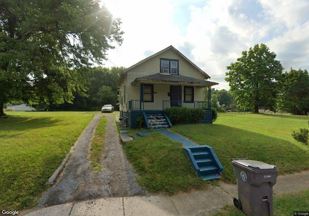
1519 Jacobs Rd Youngstown, OH 44505
McGuffey Heights NeighborhoodEstimated Value: $49,831 - $94,000
3
Beds
1
Bath
1,008
Sq Ft
$65/Sq Ft
Est. Value
About This Home
This home is located at 1519 Jacobs Rd, Youngstown, OH 44505 and is currently estimated at $65,958, approximately $65 per square foot. 1519 Jacobs Rd is a home located in Mahoning County with nearby schools including M.L. King Elementary School, Williamson Elementary School, and East High School.
Ownership History
Date
Name
Owned For
Owner Type
Purchase Details
Closed on
Jun 7, 2016
Bought by
Tiger Land Holdings Llc
Current Estimated Value
Home Financials for this Owner
Home Financials are based on the most recent Mortgage that was taken out on this home.
Interest Rate
3.66%
Create a Home Valuation Report for This Property
The Home Valuation Report is an in-depth analysis detailing your home's value as well as a comparison with similar homes in the area
Home Values in the Area
Average Home Value in this Area
Purchase History
| Date | Buyer | Sale Price | Title Company |
|---|---|---|---|
| Tiger Land Holdings Llc | -- | -- |
Source: Public Records
Mortgage History
| Date | Status | Borrower | Loan Amount |
|---|---|---|---|
| Closed | Tiger Land Holdings Llc | -- |
Source: Public Records
Tax History
| Year | Tax Paid | Tax Assessment Tax Assessment Total Assessment is a certain percentage of the fair market value that is determined by local assessors to be the total taxable value of land and additions on the property. | Land | Improvement |
|---|---|---|---|---|
| 2025 | $200 | $4,590 | $1,030 | $3,560 |
| 2024 | $227 | $4,590 | $1,030 | $3,560 |
| 2023 | $225 | $4,590 | $1,030 | $3,560 |
| 2022 | $122 | $1,800 | $1,000 | $800 |
| 2021 | $116 | $1,800 | $1,000 | $800 |
| 2020 | $117 | $1,800 | $1,000 | $800 |
| 2019 | $123 | $1,660 | $920 | $740 |
| 2018 | $124 | $1,660 | $920 | $740 |
| 2017 | $120 | $1,660 | $920 | $740 |
| 2016 | $120 | $1,820 | $920 | $900 |
| 2015 | $123 | $1,820 | $920 | $900 |
| 2014 | $117 | $1,820 | $920 | $900 |
| 2013 | $115 | $1,820 | $920 | $900 |
Source: Public Records
Map
Nearby Homes
- 1214 Brighton St
- 1720 Jacobs Rd
- 2849 McGuffey Rd
- 1251 Jacobs Rd
- 2051 Blair Ave
- 1003 Liberty Rd
- 2915 Megan Cir
- V/L Jacobs Rd
- 603 Liberty Rd
- 2526 Stocker Ave
- 3786 Choice Ct
- 206 Beachwood Dr
- 819 Lyden Ave
- 6359 Sittig Ave
- 3240 Oak Street Extension
- 585 Creekside Dr
- 3700 Liberty Ave
- 32 Maranatha Dr
- 36 Maranatha Dr
- 24 Maranatha Dr
- 1515 Jacobs Rd
- 1520 Jacobs Rd
- 1526 Jacobs Rd
- 1331 Jacobs Rd
- 1602 Jacobs Rd
- 1609 Jacobs Rd
- 1612 Jacobs Rd
- 1623 Jacobs Rd
- 1622 Jacobs Rd
- 2971 Edgar Ave
- 1320 Jacobs Rd
- 2974 Edgar Ave
- 3046 Edgar Ave
- 1628 Jacobs Rd
- 2972 Edgar Ave
- 2937 Northwood Ave
- 1303 Brighton St
- 1638 Jacobs Rd
- 3043 Northwood Ave
- 1330 Hanover St
Your Personal Tour Guide
Ask me questions while you tour the home.