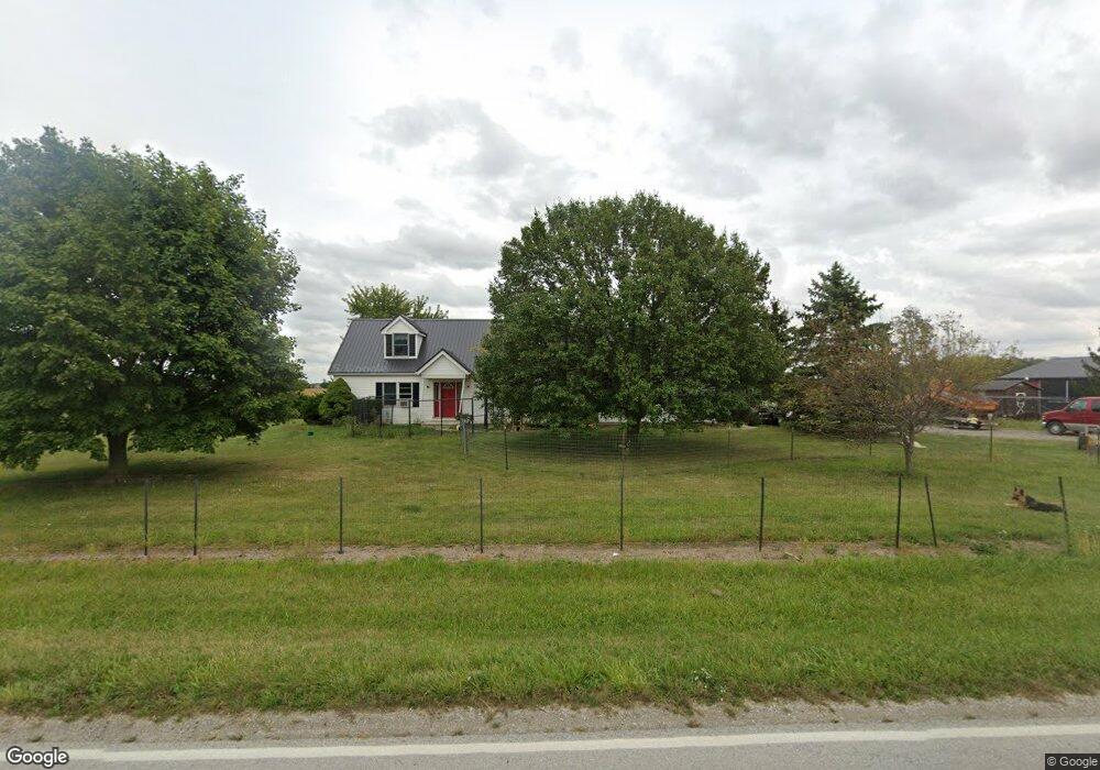
15198 Waynesfield Rd Waynesfield, OH 45896
Estimated Value: $312,000 - $486,000
3
Beds
3
Baths
2,268
Sq Ft
$175/Sq Ft
Est. Value
About This Home
This home is located at 15198 Waynesfield Rd, Waynesfield, OH 45896 and is currently estimated at $396,121, approximately $174 per square foot. 15198 Waynesfield Rd is a home located in Auglaize County with nearby schools including Waynesfield-Goshen Local Elementary School and Waynesfield-Goshen Local High School.
Ownership History
Date
Name
Owned For
Owner Type
Purchase Details
Closed on
Dec 10, 2019
Sold by
Grover Raymond R and Suever William
Bought by
Grover Cheryl L
Current Estimated Value
Purchase Details
Closed on
Mar 27, 2000
Sold by
Buffenbarger Timothy L
Bought by
Grover Raymond R
Purchase Details
Closed on
Apr 20, 1998
Sold by
Williamson David E
Bought by
Buffenbarger Timothy L
Purchase Details
Closed on
Aug 23, 1994
Sold by
Coder Alan L
Bought by
Williamson David E
Purchase Details
Closed on
Apr 8, 1992
Sold by
Coder Alan L
Bought by
Coder Alan L
Create a Home Valuation Report for This Property
The Home Valuation Report is an in-depth analysis detailing your home's value as well as a comparison with similar homes in the area
Home Values in the Area
Average Home Value in this Area
Purchase History
| Date | Buyer | Sale Price | Title Company |
|---|---|---|---|
| Grover Cheryl L | $91,133 | None Available | |
| Grover Raymond R | $153,000 | -- | |
| Buffenbarger Timothy L | $150,900 | -- | |
| Williamson David E | $10,000 | -- | |
| Coder Alan L | -- | -- |
Source: Public Records
Tax History Compared to Growth
Tax History
| Year | Tax Paid | Tax Assessment Tax Assessment Total Assessment is a certain percentage of the fair market value that is determined by local assessors to be the total taxable value of land and additions on the property. | Land | Improvement |
|---|---|---|---|---|
| 2024 | $5,839 | $94,540 | $10,250 | $84,290 |
| 2023 | $1,969 | $94,540 | $10,250 | $84,290 |
| 2022 | $3,202 | $79,640 | $9,310 | $70,330 |
| 2021 | $1,564 | $73,630 | $9,310 | $64,320 |
| 2020 | $2,956 | $73,634 | $9,314 | $64,320 |
| 2019 | $2,499 | $63,778 | $8,033 | $55,745 |
| 2018 | $2,520 | $63,778 | $8,033 | $55,745 |
| 2017 | $2,447 | $63,778 | $8,033 | $55,745 |
| 2016 | $2,115 | $56,729 | $7,648 | $49,081 |
| 2015 | $2,116 | $56,729 | $7,648 | $49,081 |
| 2014 | $2,119 | $56,729 | $7,648 | $49,081 |
| 2013 | $2,335 | $56,729 | $7,648 | $49,081 |
Source: Public Records
Map
Nearby Homes
- 25836 Ohio 67
- 202 W Mulberry St
- 105 Guthrie St
- 18544 Santa Fe Line Rd
- 22275 Buckland Holden Rd
- 20630 State Route 67
- 11352 N Township Road 88
- 12102 Shannon Dr Unit 89
- 12015 Holly Dr
- 11579 Cooper Ave
- 8150 Amherst Rd
- 11161 Macalpine Way
- 11385 Horseshoe Channel Dr
- 11546 Horseshoe Channel Dr
- 11526 Horseshoe Channel Dr
- 11638 Channel View Dr
- 5065 Amherst Rd
- 13501 Eagle Path
- 11524 Powhatan Path
- 11496 Powhatan Path
- 15118 Waynesfield Rd
- 24753 Middle Pike
- 25404 Middle Pike
- 15500 Waynesfield Rd
- 24598 Middle Pike
- 14703 Waynesfield Rd
- 15796 Waynesfield Rd
- 0 Waynesfield Rd
- 25729 Middle Pike
- 24258 Middle Pike
- 24239 Middle Pike
- 24552 Blank Pike Unit 1
- 15986 Waynesfield Rd
- 16108 Waynesfield Rd
- 16120 Waynesfield Rd
- 2772 Focht Rd