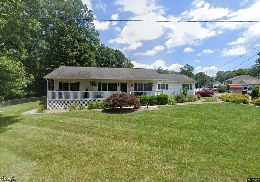
152 Ashley Rd Daniels, WV 25832
Estimated Value: $260,647 - $318,000
3
Beds
3
Baths
1,792
Sq Ft
$157/Sq Ft
Est. Value
About This Home
This home is located at 152 Ashley Rd, Daniels, WV 25832 and is currently estimated at $281,162, approximately $156 per square foot. 152 Ashley Rd is a home located in Raleigh County with nearby schools including Shady Spring Elementary School, Shady Spring Middle School, and Shady Spring High School.
Ownership History
Date
Name
Owned For
Owner Type
Purchase Details
Closed on
Oct 25, 2011
Sold by
Mullins Randy and Cooper Melvin
Bought by
Kirby Anna L and Lilly April L
Current Estimated Value
Home Financials for this Owner
Home Financials are based on the most recent Mortgage that was taken out on this home.
Original Mortgage
$69,000
Outstanding Balance
$47,187
Interest Rate
4.08%
Mortgage Type
Purchase Money Mortgage
Estimated Equity
$233,975
Purchase Details
Closed on
May 20, 2009
Sold by
Milam Julie M and Sperling Cynthia
Bought by
Krumholz Jessie
Purchase Details
Closed on
Oct 30, 2006
Sold by
Krumholz Karl and Krumholz Jessie
Bought by
Krumholz Jessie and Krumholz Karl
Purchase Details
Closed on
Feb 15, 2005
Sold by
Shrewsbury Henrietta
Bought by
Krumholz Jessie and Krumholz Karl
Create a Home Valuation Report for This Property
The Home Valuation Report is an in-depth analysis detailing your home's value as well as a comparison with similar homes in the area
Home Values in the Area
Average Home Value in this Area
Purchase History
| Date | Buyer | Sale Price | Title Company |
|---|---|---|---|
| Kirby Anna L | $159,000 | -- | |
| Krumholz Jessie | -- | -- | |
| Krumholz Jessie | -- | -- | |
| Krumholz Jessie | -- | -- |
Source: Public Records
Mortgage History
| Date | Status | Borrower | Loan Amount |
|---|---|---|---|
| Open | Krumholz Jessie | $69,000 |
Source: Public Records
Tax History Compared to Growth
Tax History
| Year | Tax Paid | Tax Assessment Tax Assessment Total Assessment is a certain percentage of the fair market value that is determined by local assessors to be the total taxable value of land and additions on the property. | Land | Improvement |
|---|---|---|---|---|
| 2024 | $956 | $99,540 | $12,000 | $87,540 |
| 2023 | $863 | $91,800 | $12,000 | $79,800 |
| 2022 | $863 | $91,800 | $12,000 | $79,800 |
| 2021 | $841 | $90,000 | $12,000 | $78,000 |
| 2020 | $855 | $90,720 | $12,720 | $78,000 |
| 2019 | $855 | $90,720 | $12,720 | $78,000 |
| 2018 | $898 | $94,320 | $12,000 | $82,320 |
| 2017 | $898 | $94,320 | $12,000 | $82,320 |
| 2016 | $913 | $94,320 | $12,000 | $82,320 |
| 2015 | $821 | $86,880 | $17,040 | $69,840 |
| 2014 | $882 | $91,860 | $17,040 | $74,820 |
Source: Public Records
Map
Nearby Homes
- 183 Mink Crossing
- 108 Ransom Dr
- 218 Pine Grove Cir
- 228 Hawksmoor Dr Unit 1
- 293 Hawksmoor Dr Unit 17
- 0 Fox Pen Way Unit 88474
- 103 Hawksmoor Dr Unit 1
- 174 Lilly St
- 458 Barnstaple Dr Unit 1
- 442 Barnstaple Dr Unit 3
- 425 Barnstaple Dr Unit 12
- 380 Barnstaple Dr Unit 2
- 571 Barnstaple Dr
- 133 Lilly St
- 153 Exmoor Ln Unit 3
- 465 Barnstaple Dr
- 238 Uplands Ln
- 218 Delta Road 30
- 204 Glen Planters Ln Unit 26
- 176 Glen Planters Ln Unit 29
- 105 Raccoon Ln
- 108 Old Antler Way
- 155 Ashley Rd
- 138 Ashley Rd
- 111 Raccoon Ln
- 169 Ashley Rd
- 101 Old Antler Way
- 107 Old Antler Way
- 134 Ashley Rd
- 134 Ashley Rd
- 110 Raccoon Ln
- 117 Raccoon Ln
- 112 Pearson Loop
- 114 Old Antler Way
- 116 Raccoon Ln
- 113 Pearson Loop
- 119 Old Antler Way
- 128 Ashley Rd
- 123 Ashley Rd
- 123 Ashley Rd