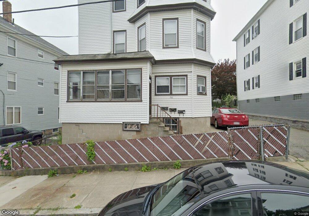
152 Blackstone St Fall River, MA 02721
Niagara NeighborhoodEstimated Value: $476,522 - $792,000
9
Beds
3
Baths
3,825
Sq Ft
$168/Sq Ft
Est. Value
About This Home
This home is located at 152 Blackstone St, Fall River, MA 02721 and is currently estimated at $641,631, approximately $167 per square foot. 152 Blackstone St is a home located in Bristol County with nearby schools including William S Greene, Matthew J. Kuss Middle School, and B M C Durfee High School.
Ownership History
Date
Name
Owned For
Owner Type
Purchase Details
Closed on
Dec 21, 2004
Sold by
Lemieux Constance M
Bought by
Moniz Billy Joe
Current Estimated Value
Home Financials for this Owner
Home Financials are based on the most recent Mortgage that was taken out on this home.
Original Mortgage
$207,200
Interest Rate
5.68%
Mortgage Type
Purchase Money Mortgage
Create a Home Valuation Report for This Property
The Home Valuation Report is an in-depth analysis detailing your home's value as well as a comparison with similar homes in the area
Home Values in the Area
Average Home Value in this Area
Purchase History
| Date | Buyer | Sale Price | Title Company |
|---|---|---|---|
| Moniz Billy Joe | $259,000 | -- |
Source: Public Records
Mortgage History
| Date | Status | Borrower | Loan Amount |
|---|---|---|---|
| Open | Moniz Billy Joe | $277,267 | |
| Closed | Moniz Billy Joe | $207,200 | |
| Closed | Moniz Billy Joe | $51,800 |
Source: Public Records
Tax History
| Year | Tax Paid | Tax Assessment Tax Assessment Total Assessment is a certain percentage of the fair market value that is determined by local assessors to be the total taxable value of land and additions on the property. | Land | Improvement |
|---|---|---|---|---|
| 2025 | $6,087 | $531,600 | $102,300 | $429,300 |
| 2024 | $5,786 | $503,600 | $95,500 | $408,100 |
| 2023 | $5,144 | $419,200 | $80,100 | $339,100 |
| 2022 | $4,546 | $360,200 | $76,300 | $283,900 |
| 2021 | $4,123 | $298,100 | $73,000 | $225,100 |
| 2020 | $3,666 | $253,700 | $70,600 | $183,100 |
| 2019 | $3,143 | $215,600 | $70,600 | $145,000 |
| 2018 | $2,917 | $199,500 | $74,800 | $124,700 |
| 2017 | $2,793 | $199,500 | $74,800 | $124,700 |
| 2016 | $2,903 | $213,000 | $91,500 | $121,500 |
| 2015 | $2,740 | $209,500 | $88,000 | $121,500 |
| 2014 | $2,907 | $231,100 | $97,700 | $133,400 |
Source: Public Records
Map
Nearby Homes
- 142 Blackstone St
- 162 Blackstone St
- 172 Blackstone St
- 157 Lonsdale St Unit 2W
- 157 Lonsdale St
- 155 Lonsdale St
- 161 Lonsdale St
- 145 Lonsdale St
- 145 Blackstone St
- 135 Lonsdale St
- 182 Blackstone St
- 182 Blackstone St Unit 2
- 182 Blackstone St Unit 1
- 182 Blackstone St Unit 3rd flr
- 122 Blackstone St
- 155 Blackstone St
- 133 Blackstone St
- 133 Blackstone St Unit 2
- 72 Dover St
- 165 Blackstone St
Your Personal Tour Guide
Ask me questions while you tour the home.