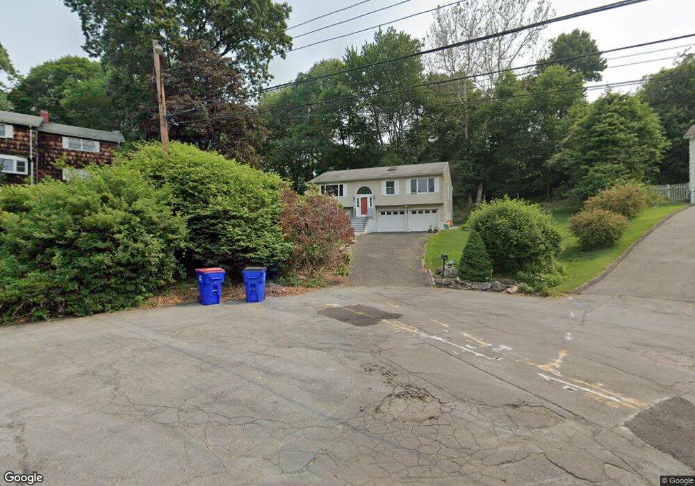
152 Carroll Rd Fairfield, CT 06824
University NeighborhoodEstimated Value: $797,000 - $981,731
3
Beds
4
Baths
1,232
Sq Ft
$735/Sq Ft
Est. Value
About This Home
This home is located at 152 Carroll Rd, Fairfield, CT 06824 and is currently estimated at $905,933, approximately $735 per square foot. 152 Carroll Rd is a home located in Fairfield County with nearby schools including Riverfield Elementary School, Roger Ludlowe Middle School, and Fairfield Ludlowe High School.
Ownership History
Date
Name
Owned For
Owner Type
Purchase Details
Closed on
Jul 16, 2004
Sold by
Lammerts Jan H
Bought by
Wanner Uwe and Wanner-Borchardt Wiebke
Current Estimated Value
Home Financials for this Owner
Home Financials are based on the most recent Mortgage that was taken out on this home.
Original Mortgage
$415,650
Interest Rate
6.25%
Create a Home Valuation Report for This Property
The Home Valuation Report is an in-depth analysis detailing your home's value as well as a comparison with similar homes in the area
Home Values in the Area
Average Home Value in this Area
Purchase History
| Date | Buyer | Sale Price | Title Company |
|---|---|---|---|
| Wanner Uwe | $528,000 | -- | |
| Wanner Uwe | $528,000 | -- |
Source: Public Records
Mortgage History
| Date | Status | Borrower | Loan Amount |
|---|---|---|---|
| Open | Wanner Uwe | $300,000 | |
| Closed | Wanner Uwe | $329,000 | |
| Closed | Wanner Uwe | $415,650 |
Source: Public Records
Tax History
| Year | Tax Paid | Tax Assessment Tax Assessment Total Assessment is a certain percentage of the fair market value that is determined by local assessors to be the total taxable value of land and additions on the property. | Land | Improvement |
|---|---|---|---|---|
| 2025 | $11,703 | $412,230 | $324,940 | $87,290 |
| 2024 | $11,501 | $412,230 | $324,940 | $87,290 |
| 2023 | $11,340 | $412,230 | $324,940 | $87,290 |
| 2022 | $11,229 | $412,230 | $324,940 | $87,290 |
| 2021 | $11,122 | $412,230 | $324,940 | $87,290 |
| 2020 | $11,269 | $420,630 | $321,580 | $99,050 |
| 2019 | $11,269 | $420,630 | $321,580 | $99,050 |
| 2018 | $11,088 | $420,630 | $321,580 | $99,050 |
| 2017 | $10,861 | $420,630 | $321,580 | $99,050 |
| 2016 | $10,705 | $420,630 | $321,580 | $99,050 |
| 2015 | $11,175 | $450,800 | $338,590 | $112,210 |
| 2014 | $11,000 | $450,800 | $338,590 | $112,210 |
Source: Public Records
Map
Nearby Homes
- 218 Lower Farm Rd
- 105 Charter Oak Rd
- 148 Millspaugh Dr
- 360 Duck Farm Rd
- 42 Robin Cir
- 196 Robin Ln
- 359 Reid St
- 1091 Round Hill Rd
- 1353 Mill Plain Rd
- 54 Ridgedale Rd
- 245 Reid St
- 115 Mayfair Rd
- 1478 Jennings Rd
- 68 Figlar Ave
- 341 Crestwood Rd
- 706 Judd St
- 210 Pansy Rd
- 12 Sugar Plum Ln
- 41 Pepperbush Ln
- 288 Melody Ln
- 154 Carroll Rd
- 150 Carroll Rd
- 148 Carroll Rd
- 144 Carroll Rd
- 127 Orchard Hill Ln
- 135 Orchard Hill Ln
- 156 Carroll Rd
- 89 Ross Hill Rd
- 105 Orchard Hill Ln
- 97 Ross Hill Rd
- 149 Orchard Hill Ln
- 118 Carroll Rd
- 141 Carroll Rd
- 176 Carroll Rd
- 77 Ross Hill Rd
- 95 Orchard Hill Ln
- 104 Carroll Rd
- 165 Orchard Hill Ln
- 137 Ross Hill Rd
- 172 Orchard Hill Ln
Your Personal Tour Guide
Ask me questions while you tour the home.