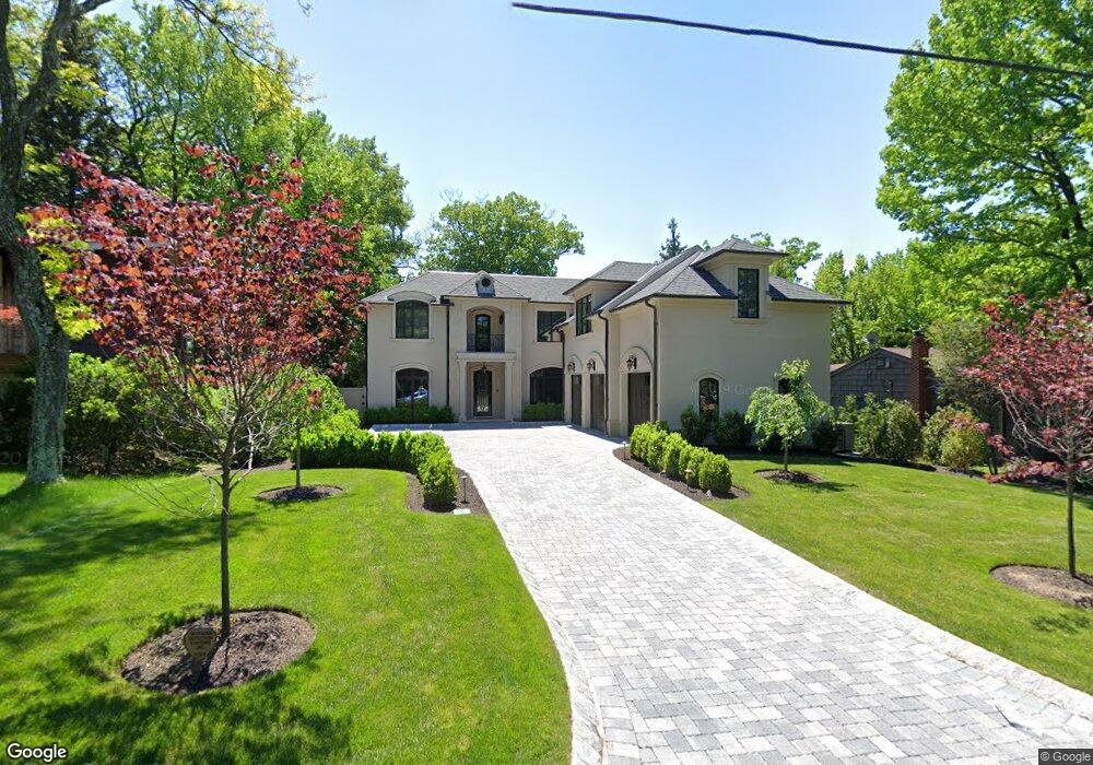
152 Chestnut St Englewood Cliffs, NJ 07632
Estimated Value: $3,005,000 - $3,211,531
5
Beds
7
Baths
5,680
Sq Ft
$548/Sq Ft
Est. Value
About This Home
This home is located at 152 Chestnut St, Englewood Cliffs, NJ 07632 and is currently estimated at $3,112,633, approximately $547 per square foot. 152 Chestnut St is a home located in Bergen County with nearby schools including North Cliff Elementary School, Upper School Elementary School, and Dwight-Englewood School.
Ownership History
Date
Name
Owned For
Owner Type
Purchase Details
Closed on
Feb 21, 2020
Sold by
Zwirn Jeffrey and Zwirn Debra
Bought by
Akhtar Affan and Syed Humaira
Current Estimated Value
Home Financials for this Owner
Home Financials are based on the most recent Mortgage that was taken out on this home.
Original Mortgage
$1,450,000
Outstanding Balance
$1,283,873
Interest Rate
3.6%
Mortgage Type
New Conventional
Estimated Equity
$1,828,760
Purchase Details
Closed on
Oct 1, 2014
Sold by
Distaulo John Paul
Bought by
Zwirn Jeffrey and Zwirn Debra
Purchase Details
Closed on
Apr 14, 2014
Sold by
Gezdir Ayda
Bought by
Distaulo John Paul
Purchase Details
Closed on
Oct 23, 2009
Sold by
Nedurian Harry
Bought by
Gezdir Ayda
Create a Home Valuation Report for This Property
The Home Valuation Report is an in-depth analysis detailing your home's value as well as a comparison with similar homes in the area
Home Values in the Area
Average Home Value in this Area
Purchase History
| Date | Buyer | Sale Price | Title Company |
|---|---|---|---|
| Akhtar Affan | $2,100,000 | Westcor Land Title Ins Co | |
| Zwirn Jeffrey | $1,050,000 | Stewart Title | |
| Distaulo John Paul | $930,000 | -- | |
| Gezdir Ayda | $705,000 | -- |
Source: Public Records
Mortgage History
| Date | Status | Borrower | Loan Amount |
|---|---|---|---|
| Open | Akhtar Affan | $1,450,000 |
Source: Public Records
Tax History Compared to Growth
Tax History
| Year | Tax Paid | Tax Assessment Tax Assessment Total Assessment is a certain percentage of the fair market value that is determined by local assessors to be the total taxable value of land and additions on the property. | Land | Improvement |
|---|---|---|---|---|
| 2025 | $30,608 | $2,650,000 | $1,006,000 | $1,644,000 |
| 2024 | $33,618 | $2,650,000 | $1,006,000 | $1,644,000 |
| 2023 | $33,088 | $2,946,400 | $1,006,000 | $1,940,400 |
| 2022 | $33,088 | $2,946,400 | $1,006,000 | $1,940,400 |
| 2021 | $25,434 | $2,946,400 | $1,006,000 | $1,940,400 |
| 2020 | $33,913 | $2,946,400 | $1,006,000 | $1,940,400 |
| 2019 | $31,851 | $2,946,400 | $1,006,000 | $1,940,400 |
| 2018 | $30,731 | $2,946,400 | $1,006,000 | $1,940,400 |
| 2017 | $10,040 | $1,006,000 | $1,006,000 | $0 |
| 2016 | $11,198 | $1,143,800 | $1,006,000 | $137,800 |
| 2015 | $10,637 | $1,143,800 | $1,006,000 | $137,800 |
| 2014 | $9,951 | $1,143,800 | $1,006,000 | $137,800 |
Source: Public Records
Map
Nearby Homes
- 30 Reiner Place
- 2 Maple St
- 645 Summit St
- 148 Demarest Ave
- 577 Floyd St
- 244 Fairview Ave
- 45 Marjorie Terrace
- 48 Cambridge Place
- 231 N Woodland St
- 519 E Palisade Ave
- 2 Connor Dr
- 12 Kira Ln
- 14 Allison Dr
- 48 S Woodland St
- 277 Walnut St
- 14 Roberts Rd
- 294 Oakwood Rd
- 298 Booth Ave
- 379 Mauro Rd
- 320 Mountain Rd
- 150 Chestnut St
- 156 Chestnut St
- 146 Chestnut St
- 160 Chestnut St
- 149 Pershing Rd
- 137 Chestnut St
- 171 Pershing Rd
- 594 Summit St
- 147 Pershing Rd
- 6 Cambridge Place
- 133 Chestnut St
- 175 Pershing Rd
- 5 Cambridge Place
- 606 Summit St
- 162 Pershing Rd
- 164 Pershing Rd
- 172 Chestnut St
- 158 Pershing Rd
- 6 Maple St
- 10 Cambridge Place