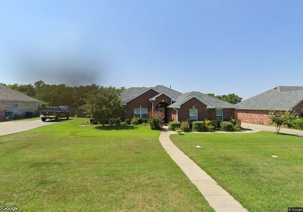
152 Chrissa Dr Pottsboro, TX 75076
Estimated Value: $349,409 - $386,000
3
Beds
2
Baths
1,808
Sq Ft
$203/Sq Ft
Est. Value
About This Home
This home is located at 152 Chrissa Dr, Pottsboro, TX 75076 and is currently estimated at $367,705, approximately $203 per square foot. 152 Chrissa Dr is a home located in Grayson County with nearby schools including Pottsboro Elementary School, Pottsboro Middle School, and Pottsboro High School.
Ownership History
Date
Name
Owned For
Owner Type
Purchase Details
Closed on
Jul 7, 2010
Sold by
Hsbc Bank Usa National Association
Bought by
Greer William J and Greer Helen
Current Estimated Value
Home Financials for this Owner
Home Financials are based on the most recent Mortgage that was taken out on this home.
Original Mortgage
$125,154
Outstanding Balance
$83,291
Interest Rate
4.75%
Mortgage Type
FHA
Estimated Equity
$284,414
Purchase Details
Closed on
Mar 2, 2010
Sold by
Allen Westin and Allen Heidi M
Bought by
Hsbc Bank Usa National Association
Purchase Details
Closed on
Mar 21, 2006
Sold by
Hidalgo Jim
Bought by
Allen Westin and Allen Heidi M
Home Financials for this Owner
Home Financials are based on the most recent Mortgage that was taken out on this home.
Original Mortgage
$130,400
Interest Rate
8.9%
Mortgage Type
New Conventional
Create a Home Valuation Report for This Property
The Home Valuation Report is an in-depth analysis detailing your home's value as well as a comparison with similar homes in the area
Home Values in the Area
Average Home Value in this Area
Purchase History
| Date | Buyer | Sale Price | Title Company |
|---|---|---|---|
| Greer William J | -- | Red River Title Co | |
| Hsbc Bank Usa National Association | $130,500 | None Available | |
| Allen Westin | -- | Security Title |
Source: Public Records
Mortgage History
| Date | Status | Borrower | Loan Amount |
|---|---|---|---|
| Open | Greer William J | $125,154 | |
| Previous Owner | Allen Westin | $130,400 |
Source: Public Records
Tax History Compared to Growth
Tax History
| Year | Tax Paid | Tax Assessment Tax Assessment Total Assessment is a certain percentage of the fair market value that is determined by local assessors to be the total taxable value of land and additions on the property. | Land | Improvement |
|---|---|---|---|---|
| 2025 | $1,308 | $358,425 | -- | -- |
| 2024 | $6,288 | $325,841 | $0 | $0 |
| 2023 | $1,308 | $296,219 | $0 | $0 |
| 2022 | $5,706 | $269,290 | $0 | $0 |
| 2021 | $5,430 | $244,809 | $23,494 | $221,315 |
| 2020 | $5,400 | $235,602 | $23,494 | $212,108 |
| 2019 | $5,675 | $237,726 | $23,494 | $214,232 |
| 2018 | $5,207 | $214,993 | $23,494 | $191,499 |
| 2017 | $4,907 | $200,181 | $23,494 | $176,687 |
| 2016 | $4,478 | $184,372 | $22,446 | $161,926 |
| 2015 | $2,167 | $167,717 | $22,446 | $145,271 |
| 2014 | $2,284 | $164,440 | $22,446 | $141,994 |
Source: Public Records
Map
Nearby Homes
- 209 Chrissa Dr
- 137 Pearce Dr
- TBD Pearce Dr
- 111 Prairie Meadow Ln
- 101 Rock Hill Rd
- 113 Rock Hill Rd
- 113 Ginger Dr
- 107 Fountain Meadows
- 106 Cardinal Ln
- 118 Texoma Meadows
- 106 Kristy Ct
- 105 Park Ln
- TBD Cardinal Ln
- Lot 14 Lauren Ln
- 110 E Fm 120
- 206 S Magnolia St
- 412 Main St
- 408 Front St
- 105 E William St
- 200 Clement Ct