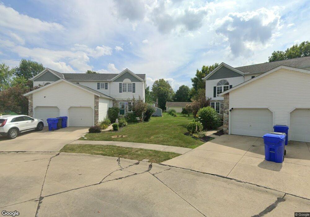
152 Harvest Ct Unit 14 Lagrange, OH 44050
Estimated Value: $196,000 - $258,000
3
Beds
2
Baths
1,456
Sq Ft
$153/Sq Ft
Est. Value
About This Home
This home is located at 152 Harvest Ct Unit 14, Lagrange, OH 44050 and is currently estimated at $222,538, approximately $152 per square foot. 152 Harvest Ct Unit 14 is a home located in Lorain County with nearby schools including Keystone Elementary School, Keystone Middle School, and Keystone High School.
Ownership History
Date
Name
Owned For
Owner Type
Purchase Details
Closed on
May 7, 2009
Sold by
Crock Real Estate Investments Iv Llc
Bought by
Cather Daniel A and Zezlina Cather Kathy J
Current Estimated Value
Home Financials for this Owner
Home Financials are based on the most recent Mortgage that was taken out on this home.
Original Mortgage
$93,100
Outstanding Balance
$58,759
Interest Rate
4.83%
Mortgage Type
Purchase Money Mortgage
Estimated Equity
$163,779
Purchase Details
Closed on
Aug 23, 2008
Sold by
Stace Development Co
Bought by
Crock Real Estate Investments Iv Llc
Create a Home Valuation Report for This Property
The Home Valuation Report is an in-depth analysis detailing your home's value as well as a comparison with similar homes in the area
Home Values in the Area
Average Home Value in this Area
Purchase History
| Date | Buyer | Sale Price | Title Company |
|---|---|---|---|
| Cather Daniel A | $98,000 | Pvf Title | |
| Crock Real Estate Investments Iv Llc | -- | Pvf Title |
Source: Public Records
Mortgage History
| Date | Status | Borrower | Loan Amount |
|---|---|---|---|
| Open | Cather Daniel A | $93,100 |
Source: Public Records
Tax History Compared to Growth
Tax History
| Year | Tax Paid | Tax Assessment Tax Assessment Total Assessment is a certain percentage of the fair market value that is determined by local assessors to be the total taxable value of land and additions on the property. | Land | Improvement |
|---|---|---|---|---|
| 2024 | $2,554 | $60,263 | $8,750 | $51,513 |
| 2023 | $2,564 | $50,526 | $8,043 | $42,483 |
| 2022 | $2,547 | $50,526 | $8,043 | $42,483 |
| 2021 | $2,548 | $50,526 | $8,043 | $42,483 |
| 2020 | $2,488 | $43,970 | $7,000 | $36,970 |
| 2019 | $2,474 | $43,970 | $7,000 | $36,970 |
| 2018 | $2,388 | $43,970 | $7,000 | $36,970 |
| 2017 | $1,927 | $33,210 | $5,250 | $27,960 |
| 2016 | $1,914 | $33,210 | $5,250 | $27,960 |
| 2015 | $1,911 | $33,210 | $5,250 | $27,960 |
| 2014 | $1,686 | $33,210 | $5,250 | $27,960 |
| 2013 | $1,636 | $33,210 | $5,250 | $27,960 |
Source: Public Records
Map
Nearby Homes
- 128 Harvest Ct
- 171 Keywood Blvd
- 433 N Center St
- 516 Appomattox Ct
- 548 William St
- 756 N Center St
- 607 Rundle St
- 40725 Biggs Rd
- 630 Rundle St
- 829 Robinson Dr
- 831 Robinson Dr
- 822 Robinson Dr
- 194 Railroad St
- 808 Buckingham Dr
- 800 Buckingham Dr
- 110 Railroad St
- 0 Dill Ct Unit 5072837
- 41635 Parsons Rd
- 40175 Banks Rd
- 40185 Banks Rd
- 150 Harvest Ct Unit 13
- 154 Harvest Ct
- 148 Harvest Ct
- 156 Harvest Ct
- 146 Harvest Ct
- 158 Harvest Ct
- 143 Loperwood Ln
- 160 Harvest Ct
- 144 Harvest Ct
- 147 Loperwood Ln
- 139 Loperwood Ln
- 142 Harvest Ct
- 151 Loperwood Ln
- 135 Loperwood Ln
- 155 Loperwood Ln
- 131 Loperwood Ln
- 136 Harvest Ct
- 159 Loperwood Ln
- 134 Harvest Ct
- 127 Loperwood Ln