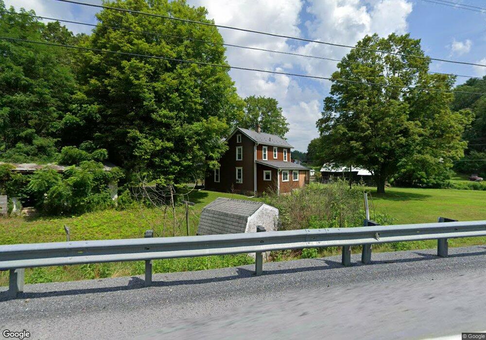
152 Hoover Rd Robertsdale, PA 16674
Estimated Value: $76,000 - $120,000
--
Bed
--
Bath
1,432
Sq Ft
$74/Sq Ft
Est. Value
About This Home
This home is located at 152 Hoover Rd, Robertsdale, PA 16674 and is currently estimated at $106,116, approximately $74 per square foot. 152 Hoover Rd is a home located in Fulton County with nearby schools including Forbes Road Elementary School and Forbes Road Junior/Senior High School.
Ownership History
Date
Name
Owned For
Owner Type
Purchase Details
Closed on
Sep 2, 2021
Sold by
Woodward Kevin D and Woodward Adaria M
Bought by
Ciampa White Valerie A
Current Estimated Value
Home Financials for this Owner
Home Financials are based on the most recent Mortgage that was taken out on this home.
Original Mortgage
$76,000
Outstanding Balance
$63,998
Interest Rate
2.8%
Mortgage Type
Future Advance Clause Open End Mortgage
Estimated Equity
$42,118
Purchase Details
Closed on
May 8, 2020
Sold by
Bayview Loan Servicing Llc
Bought by
Woodward Kevin
Purchase Details
Closed on
Sep 20, 2019
Sold by
Bickel Larry D and Bickel Shannon N
Bought by
Bayview Loan Servicing Llc
Purchase Details
Closed on
Apr 11, 2018
Sold by
Bickel Larry D and Bickel Shannon N
Bought by
Department Of Transportation
Purchase Details
Closed on
Jun 18, 1997
Sold by
Bickel Larry D and Bickel Shannon N
Bought by
Bickel Larry D and Bickel Shannon N
Create a Home Valuation Report for This Property
The Home Valuation Report is an in-depth analysis detailing your home's value as well as a comparison with similar homes in the area
Home Values in the Area
Average Home Value in this Area
Purchase History
| Date | Buyer | Sale Price | Title Company |
|---|---|---|---|
| Ciampa White Valerie A | $95,000 | None Available | |
| Woodward Kevin | $13,800 | Timios Inc | |
| Bayview Loan Servicing Llc | $93,553 | Nations Title Agency | |
| Department Of Transportation | -- | None Available | |
| Bickel Larry D | $55,000 | -- |
Source: Public Records
Mortgage History
| Date | Status | Borrower | Loan Amount |
|---|---|---|---|
| Open | Ciampa White Valerie A | $76,000 |
Source: Public Records
Tax History Compared to Growth
Tax History
| Year | Tax Paid | Tax Assessment Tax Assessment Total Assessment is a certain percentage of the fair market value that is determined by local assessors to be the total taxable value of land and additions on the property. | Land | Improvement |
|---|---|---|---|---|
| 2025 | $1,261 | $25,360 | $6,660 | $18,700 |
| 2024 | $1,261 | $25,360 | $6,660 | $18,700 |
| 2023 | $1,211 | $25,360 | $6,660 | $18,700 |
| 2022 | $1,211 | $25,360 | $6,660 | $18,700 |
| 2021 | $1,211 | $25,360 | $6,660 | $18,700 |
| 2020 | $1,211 | $25,360 | $6,660 | $18,700 |
| 2019 | $1,211 | $25,360 | $6,660 | $18,700 |
| 2018 | $1,214 | $25,360 | $6,660 | $18,700 |
| 2017 | $1,214 | $25,430 | $6,730 | $18,700 |
| 2016 | -- | $25,430 | $6,730 | $18,700 |
| 2015 | -- | $25,430 | $6,730 | $18,700 |
| 2014 | -- | $25,430 | $6,730 | $18,700 |
Source: Public Records
Map
Nearby Homes
- 2082 Waterfall Rd
- 198-200 Hickory St
- 00 Scellini St
- 282 North St
- Scellini St
- 537 Scellini St
- TRACT 4: 13.5+/- ACR Coles Valley Rd
- TRACT 3: 13.5+/- ACR Coles Valley Rd
- TRACT 2: 30+/- ACRES Coles Valley Rd
- TRACT 1: 65+/- ACRES Coles Valley Rd
- 7505 Mountain View Dr
- 22015 Waterfall Rd
- 855 W Tannery Rd
- 00 Cooks Rd
- 738 W Tannery Rd
- 1814 Iron Bridge Rd
- 3422 N Clear Ridge Rd
- 19906 Coles Valley Rd
- 0 Eagle Foundry Rd
- 0 Cooks Rd