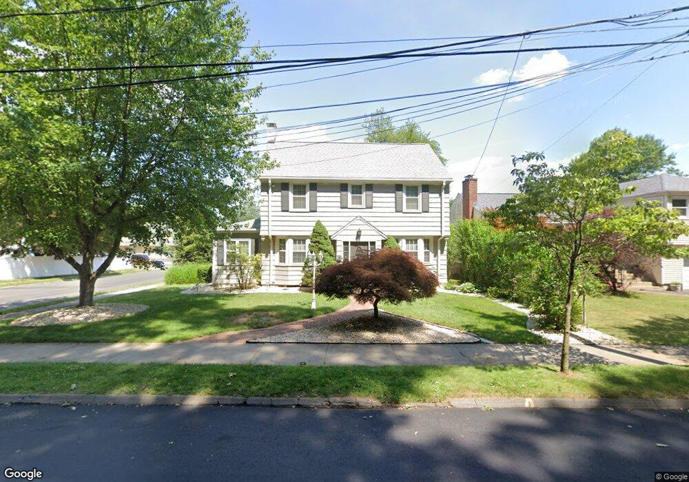
152 Hubbard Rd Hartford, CT 06114
South End NeighborhoodEstimated Value: $300,000 - $336,000
3
Beds
2
Baths
1,771
Sq Ft
$177/Sq Ft
Est. Value
About This Home
This home is located at 152 Hubbard Rd, Hartford, CT 06114 and is currently estimated at $314,034, approximately $177 per square foot. 152 Hubbard Rd is a home located in Hartford County with nearby schools including Dr. James H Naylor/Ccsu Leadership Academy, Asian Studies School At Dwight/Belizzi School, and M. D. Fox School.
Ownership History
Date
Name
Owned For
Owner Type
Purchase Details
Closed on
Apr 18, 2000
Sold by
Mcalpine Roy
Bought by
Jessamy Arthur and Jessamy Yvette
Current Estimated Value
Home Financials for this Owner
Home Financials are based on the most recent Mortgage that was taken out on this home.
Original Mortgage
$133,800
Interest Rate
8.26%
Mortgage Type
Purchase Money Mortgage
Purchase Details
Closed on
Aug 23, 1995
Sold by
Sinopoli Vincent and Sinopoli Carmel
Bought by
Mcalpine Roy
Home Financials for this Owner
Home Financials are based on the most recent Mortgage that was taken out on this home.
Original Mortgage
$92,700
Interest Rate
7.32%
Mortgage Type
Purchase Money Mortgage
Purchase Details
Closed on
Oct 27, 1989
Sold by
Weber Paul L
Bought by
Sinopoli Vincent M
Create a Home Valuation Report for This Property
The Home Valuation Report is an in-depth analysis detailing your home's value as well as a comparison with similar homes in the area
Home Values in the Area
Average Home Value in this Area
Purchase History
| Date | Buyer | Sale Price | Title Company |
|---|---|---|---|
| Jessamy Arthur | $135,000 | -- | |
| Mcalpine Roy | $103,000 | -- | |
| Sinopoli Vincent M | $70,000 | -- |
Source: Public Records
Mortgage History
| Date | Status | Borrower | Loan Amount |
|---|---|---|---|
| Open | Sinopoli Vincent M | $160,000 | |
| Closed | Sinopoli Vincent M | $157,000 | |
| Closed | Sinopoli Vincent M | $133,800 | |
| Previous Owner | Sinopoli Vincent M | $92,700 |
Source: Public Records
Tax History Compared to Growth
Tax History
| Year | Tax Paid | Tax Assessment Tax Assessment Total Assessment is a certain percentage of the fair market value that is determined by local assessors to be the total taxable value of land and additions on the property. | Land | Improvement |
|---|---|---|---|---|
| 2024 | $5,316 | $77,102 | $12,716 | $64,386 |
| 2023 | $5,316 | $77,102 | $12,716 | $64,386 |
| 2022 | $5,316 | $77,102 | $12,716 | $64,386 |
| 2021 | $4,137 | $55,685 | $16,730 | $38,955 |
| 2020 | $4,137 | $55,685 | $16,730 | $38,955 |
| 2019 | $4,137 | $55,685 | $16,730 | $38,955 |
| 2018 | $3,997 | $53,808 | $16,166 | $37,642 |
| 2016 | $3,881 | $52,245 | $15,397 | $36,848 |
| 2015 | $3,697 | $49,763 | $14,665 | $35,098 |
| 2014 | $3,606 | $48,546 | $14,306 | $34,240 |
Source: Public Records
Map
Nearby Homes
- 166 George St
- 5 Wolcott Hill Rd
- 308 Brown St
- 244 Brown St
- 390 Fairfield Ave
- 159 Gilman St
- 71 Hanmer St
- 47 Bolton St
- 51 Hanmer St
- 18 Mclean St Unit 20
- 90 Salem St
- 839 Wethersfield Ave
- 63 Standish St Unit 65
- 183 Preston St Unit 185
- 218 Grandview Terrace Unit 220
- 147 Preston St Unit 1
- 152 Otis St
- 1320 Berlin Turnpike Unit 118
- 1320 Berlin Turnpike Unit 625
- 35 Clifford St
- 156 Hubbard Rd
- 160 Hubbard Rd
- 144 Hubbard Rd
- 419 Campfield Ave
- 423 Campfield Ave
- 164 Hubbard Rd
- 427 Campfield Ave
- 140 Hubbard Rd
- 409 Campfield Ave
- 431 Campfield Ave
- 168 Hubbard Rd
- 136 Hubbard Rd
- 435 Campfield Ave
- 172 Hubbard Rd
- 401 Campfield Ave
- 132 Hubbard Rd
- 437 Campfield Ave Unit 439
- 397 Campfield Ave
- 128 Hubbard Rd
- 420 Campfield Ave