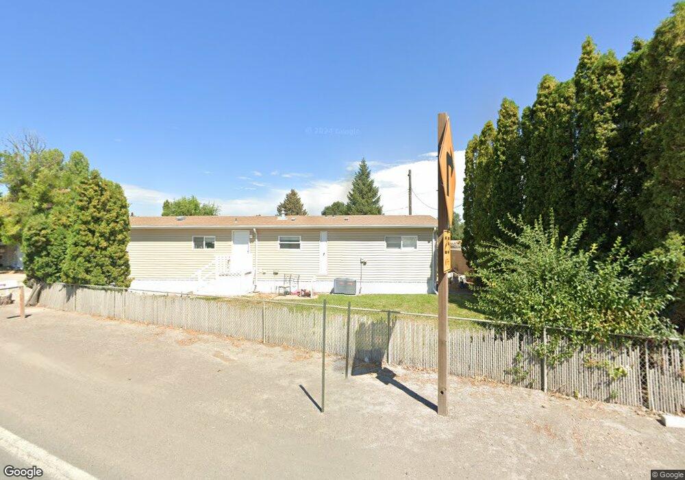
152 Hwy 30 1-7 Kimberly, ID 83341
Estimated Value: $275,000 - $999,823
1
Bed
12
Baths
780
Sq Ft
$603/Sq Ft
Est. Value
About This Home
This home is located at 152 Hwy 30 1-7, Kimberly, ID 83341 and is currently estimated at $470,706, approximately $603 per square foot. 152 Hwy 30 1-7 is a home located in Twin Falls County with nearby schools including Kimberly Elementary School, STRICKER ELEMENTARY SCHOOL, and Kimberly Middle School.
Ownership History
Date
Name
Owned For
Owner Type
Purchase Details
Closed on
Dec 13, 2021
Sold by
Barsness Daniel R and Barsness Carol J
Bought by
Lynch Land Development Llc
Current Estimated Value
Home Financials for this Owner
Home Financials are based on the most recent Mortgage that was taken out on this home.
Original Mortgage
$185,882
Outstanding Balance
$170,564
Interest Rate
3.09%
Mortgage Type
Commercial
Estimated Equity
$300,142
Create a Home Valuation Report for This Property
The Home Valuation Report is an in-depth analysis detailing your home's value as well as a comparison with similar homes in the area
Home Values in the Area
Average Home Value in this Area
Purchase History
| Date | Buyer | Sale Price | Title Company |
|---|---|---|---|
| Lynch Land Development Llc | -- | Titleone Burley |
Source: Public Records
Mortgage History
| Date | Status | Borrower | Loan Amount |
|---|---|---|---|
| Open | Lynch Land Development Llc | $185,882 |
Source: Public Records
Tax History Compared to Growth
Tax History
| Year | Tax Paid | Tax Assessment Tax Assessment Total Assessment is a certain percentage of the fair market value that is determined by local assessors to be the total taxable value of land and additions on the property. | Land | Improvement |
|---|---|---|---|---|
| 2025 | $2,470 | $232,111 | $112,861 | $119,250 |
| 2024 | $2,470 | $232,111 | $112,861 | $119,250 |
| 2023 | $2,659 | $246,031 | $112,861 | $133,170 |
| 2022 | $3,023 | $247,821 | $112,861 | $134,960 |
| 2021 | $3,749 | $224,470 | $111,810 | $112,660 |
| 2020 | $3,301 | $194,490 | $111,810 | $82,680 |
| 2019 | $2,979 | $162,203 | $87,043 | $75,160 |
| 2018 | $3,123 | $163,253 | $87,043 | $76,210 |
| 2017 | $3,041 | $154,423 | $87,043 | $67,380 |
| 2016 | $2,997 | $146,343 | $0 | $0 |
| 2015 | $3,011 | $146,343 | $87,043 | $59,300 |
| 2012 | -- | $142,926 | $0 | $0 |
Source: Public Records
Map
Nearby Homes
- 152 U S 30
- 4028 3500 E
- 325 Center St E
- 510 Center St E
- 1041 Lupine Ln
- 1141 Sunset Ln
- 345 Center St W
- 715 Center St E Unit 22
- 305 Lucille St
- 414 Main St S
- 309 Tamarac St
- 337 Lincoln St
- 910 Blueridge Dr
- 815 Emerald Dr N
- 209 Brentwood Dr
- 840 Cottonridge Way
- 600 Redwood Ln
- 277 Maxine Ln
- 702 Lake St
- 214 Maxine Ln
- 152 Highway 30
- 151 U S Highway 30
- 151 U S Hwy 30
- 151 U S Hwy 30
- 151 U S 30
- 110 Highway 30
- 217 Taylor St E
- 151 Taylor St E
- 137 Taylor St E
- 133 Taylor St E
- 533 Main St N
- 324 Highway 30
- 324 U S 30
- 543 Main St N
- 148 Taylor St E
- 607 Main St N
- 222 Taylor St E
- 325 Chestnut St N
- 549 & 607 Main St N
- 226 Taylor St E