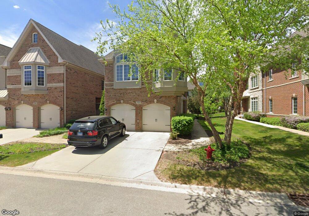
152 Paxton Rd Unit 57 Bloomingdale, IL 60108
Estimated Value: $543,431 - $620,000
3
Beds
3
Baths
2,500
Sq Ft
$231/Sq Ft
Est. Value
About This Home
This home is located at 152 Paxton Rd Unit 57, Bloomingdale, IL 60108 and is currently estimated at $577,608, approximately $231 per square foot. 152 Paxton Rd Unit 57 is a home located in DuPage County with nearby schools including Cloverdale Elementary School, Stratford Middle School, and Glenbard North High School.
Ownership History
Date
Name
Owned For
Owner Type
Purchase Details
Closed on
Oct 27, 2016
Sold by
Toll Il Iii Lp
Bought by
Trocchio Philip A and Trocchio Roseanne
Current Estimated Value
Home Financials for this Owner
Home Financials are based on the most recent Mortgage that was taken out on this home.
Original Mortgage
$337,810
Interest Rate
3.25%
Mortgage Type
FHA
Create a Home Valuation Report for This Property
The Home Valuation Report is an in-depth analysis detailing your home's value as well as a comparison with similar homes in the area
Home Values in the Area
Average Home Value in this Area
Purchase History
| Date | Buyer | Sale Price | Title Company |
|---|---|---|---|
| Trocchio Philip A | $415,000 | First American Title Company |
Source: Public Records
Mortgage History
| Date | Status | Borrower | Loan Amount |
|---|---|---|---|
| Previous Owner | Trocchio Philip A | $337,810 |
Source: Public Records
Tax History Compared to Growth
Tax History
| Year | Tax Paid | Tax Assessment Tax Assessment Total Assessment is a certain percentage of the fair market value that is determined by local assessors to be the total taxable value of land and additions on the property. | Land | Improvement |
|---|---|---|---|---|
| 2024 | $10,660 | $141,860 | $35,965 | $105,895 |
| 2023 | $10,016 | $129,730 | $32,890 | $96,840 |
| 2022 | $12,076 | $156,570 | $21,600 | $134,970 |
| 2021 | $12,525 | $148,760 | $20,520 | $128,240 |
| 2020 | $12,400 | $145,130 | $20,020 | $125,110 |
| 2019 | $11,885 | $139,470 | $19,240 | $120,230 |
| 2018 | $11,619 | $135,830 | $18,740 | $117,090 |
| 2017 | $11,504 | $126,660 | $17,370 | $109,290 |
| 2016 | $12,681 | $135,460 | $18,580 | $116,880 |
| 2015 | $12,434 | $126,410 | $17,340 | $109,070 |
| 2014 | $12,633 | $126,410 | $17,340 | $109,070 |
| 2013 | $12,701 | $130,730 | $17,930 | $112,800 |
Source: Public Records
Map
Nearby Homes
- 169 Waverly Ct
- 164 Springdale Ln
- 117 Oneida Ct
- 313 Collin Cir
- 306 Orchard Ln
- 286 Lorraine Cir
- 127 Glengarry Dr Unit 307
- 122 Glengarry Dr Unit G15-16
- 208 Glengarry Dr Unit 304
- 209 Glengarry Dr Unit 302
- 239 Stonington Dr
- 241 Stonington Dr
- 24W459 Lawrence Ave
- 101 Donmor Dr
- 000 Gary Ave
- 134 Country Club Dr
- 123 W Confidential St
- 6N041 Keeney Rd
- 6N160 Garden Ave
- 475 W Army Trail Rd
- 152 Paxton Rd
- 154 Paxton Rd Unit 53
- 154 Paxton Rd Unit 58
- 154 Paxton Rd
- 156 Paxton Rd Unit 59
- 156 Paxton Rd
- 150 Paxton Rd Unit 56
- 148 Paxton Rd Unit 55
- 158 Paxton Rd Unit 60
- 158 Paxton Rd
- 149 Roundtree Ct
- 149 Roundtree Ct Unit 46
- 146 Paxton Rd Unit 54
- 147 Roundtree Ct
- 155 Paxton Rd
- 144 Paxton Rd
- 151 Paxton Rd
- 108 Paxton Rd
- 157 Paxton Rd
- 149 Paxton Rd