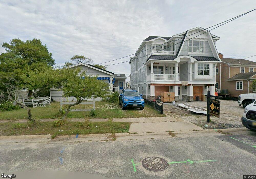
152 Pershing Blvd Lavallette, NJ 08735
Estimated Value: $3,180,000
6
Beds
6
Baths
--
Sq Ft
6,098
Sq Ft Lot
About This Home
This home is located at 152 Pershing Blvd, Lavallette, NJ 08735 and is currently estimated at $3,180,000. 152 Pershing Blvd is a home located in Ocean County with nearby schools including Lavallette Elementary School.
Ownership History
Date
Name
Owned For
Owner Type
Purchase Details
Closed on
Nov 7, 2025
Sold by
M G C Development Llc
Bought by
152 Pershing Blvd Llc
Current Estimated Value
Purchase Details
Closed on
Dec 18, 2024
Sold by
Beaver Timothy M and Beaver Warissara P
Bought by
Mgc Development Llc
Purchase Details
Closed on
Apr 28, 2014
Sold by
Beaver Timothy M
Bought by
Beaver Timothy M and Beaver Warissara P
Purchase Details
Closed on
Jun 10, 2006
Sold by
Beaver Timothy M
Bought by
Beaver Timothy M
Create a Home Valuation Report for This Property
The Home Valuation Report is an in-depth analysis detailing your home's value as well as a comparison with similar homes in the area
Home Values in the Area
Average Home Value in this Area
Purchase History
| Date | Buyer | Sale Price | Title Company |
|---|---|---|---|
| 152 Pershing Blvd Llc | -- | Fidelity National Title Insura | |
| Mgc Development Llc | $1,025,000 | Fidelity National Title | |
| Beaver Timothy M | -- | None Available | |
| Beaver Timothy M | -- | None Available | |
| Beaver Timothy M | -- | None Available |
Source: Public Records
Map
Nearby Homes
- 153 Pershing Blvd
- 151 Pershing Blvd
- 108 Dickman Dr
- 47 Pershing Blvd
- 2060 Route 35 S Unit 3
- 1919 Bay Blvd Unit C13
- 1919 Bay Blvd Unit A11
- 1919 Bay Blvd Unit B37
- 1919 Bay Blvd Unit B29
- 2052 Baltimore Ave
- 116 Newark Ave
- 1922 Bay Blvd
- 209 1st Ave
- 1920 Bay Blvd
- 2033 Route 35 Unit 3
- 113 New Brunswick Ave
- 1807 Grand Central Ave Unit 2
- 2030 Route 35 N Unit C
- 21 Jersey City Ave
- 2000 New Jersey 35
- 150 Pershing Blvd
- 154 Pershing Blvd
- 244 Newark Ave
- 148 Pershing Blvd
- 246 Newark Ave
- 156 Pershing Blvd
- 248 Newark Ave
- 158 Pershing Blvd
- 146 Pershing Blvd
- 238 Newark Ave
- 30 Bullard Dr
- 236 Newark Ave
- 25 Sturgis Rd
- 21 Sturgis Rd
- 155 Pershing Blvd
- 23 Sturgis Rd
- 32 Bullard Dr
- 157 Pershing Blvd
- 22 Bullard Dr
- 149 Pershing Blvd
Your Personal Tour Guide
Ask me questions while you tour the home.