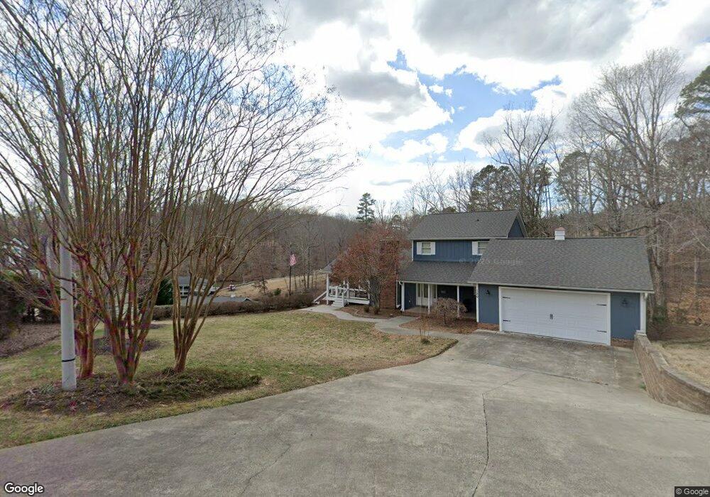
152 Rock Point Dr Semora, NC 27343
Estimated Value: $919,000 - $1,654,606
5
Beds
6
Baths
3,291
Sq Ft
$380/Sq Ft
Est. Value
About This Home
This home is located at 152 Rock Point Dr, Semora, NC 27343 and is currently estimated at $1,249,902, approximately $379 per square foot. 152 Rock Point Dr is a home with nearby schools including Person High School.
Ownership History
Date
Name
Owned For
Owner Type
Purchase Details
Closed on
Sep 8, 2014
Sold by
Pearman Larry W and Pearman Susan W
Bought by
Addis Daniel M and Kim Namhee
Current Estimated Value
Purchase Details
Closed on
Dec 10, 2013
Sold by
Mangum Nancy Pass
Bought by
Addis Daniel M and Kim Namhee
Home Financials for this Owner
Home Financials are based on the most recent Mortgage that was taken out on this home.
Original Mortgage
$41,250
Interest Rate
4.16%
Mortgage Type
New Conventional
Create a Home Valuation Report for This Property
The Home Valuation Report is an in-depth analysis detailing your home's value as well as a comparison with similar homes in the area
Home Values in the Area
Average Home Value in this Area
Purchase History
| Date | Buyer | Sale Price | Title Company |
|---|---|---|---|
| Addis Daniel M | $92,000 | None Available | |
| Addis Daniel M | $55,000 | None Available |
Source: Public Records
Mortgage History
| Date | Status | Borrower | Loan Amount |
|---|---|---|---|
| Previous Owner | Addis Daniel M | $41,250 |
Source: Public Records
Tax History Compared to Growth
Tax History
| Year | Tax Paid | Tax Assessment Tax Assessment Total Assessment is a certain percentage of the fair market value that is determined by local assessors to be the total taxable value of land and additions on the property. | Land | Improvement |
|---|---|---|---|---|
| 2025 | $9,174 | $1,604,681 | $0 | $0 |
| 2024 | $9,174 | $1,154,673 | $0 | $0 |
| 2023 | $9,117 | $1,154,673 | $0 | $0 |
| 2022 | $0 | $1,154,673 | $0 | $0 |
| 2021 | $0 | $726,438 | $0 | $0 |
| 2020 | $2,310 | $279,959 | $0 | $0 |
| 2019 | $2,354 | $279,959 | $0 | $0 |
| 2018 | $2,227 | $279,959 | $0 | $0 |
| 2017 | $0 | $219,321 | $0 | $0 |
| 2016 | $1,764 | $219,321 | $0 | $0 |
| 2015 | $468 | $150,584 | $0 | $0 |
| 2014 | $468 | $66,226 | $0 | $0 |
Source: Public Records
Map
Nearby Homes
- 0 Rock Pointe Dr Unit 10091076
- 454 Southpoint Trail
- 232 Hardy Hollow Rd
- Tbd Quail Roost Dr
- Lot 54 Pinesborough Estates Rd
- 600 Fox Lair Trail
- 195 Lynn Smith Rd
- 173 Lawrence Barker Rd
- 734 Crystal Forest Dr
- 976 Estate Rd
- Lot 7 Lynn Smith Rd
- 214 Crystal Bay Ln
- 197 Barefoot Landing Ln
- Lot D Swallowtail Dr
- 276 Beech Dr
- 28 Greenway Dr
- 36 Red Bud Ln
- 528 Beech Dr
- 19 Whitetail Ln
- 4.5 Acres off Kelly Brewer Rd
- 120 Rock Point Dr
- Tbd Rock Pointe Dr
- 0 Rock Pointe Dr Unit 10009126
- 0 Rock Pointe Dr Unit 1642006
- Lot #1 Rock Pointe Dr
- 0 Rock Pointe Dr Unit B TR1803546
- 0 Rock Pointe Dr Unit 1 1642006
- 0 Rock Pointe Dr Unit B
- 0 Rock Point Dr Unit 1795460
- 000 Rock Pointe Dr
- 000 Rock Pointe Dr Unit B
- 0 Rock Point Dr Unit 1 TR1795460
- 294 Rock Point Dr
- 294 Rock Pointe Dr
- 175 Rock Pointe Dr
- 209 Rock Pointe Dr
- 209 Rock Point Dr
- 301 Rock Point Dr
- 255 Rock Pointe Dr
- 255 Rock Point Dr