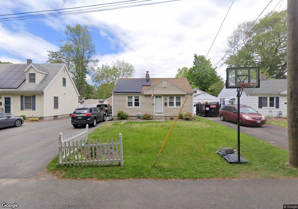
152 Rollins St Springfield, MA 01109
Pine Point NeighborhoodEstimated Value: $214,000 - $239,000
2
Beds
1
Bath
720
Sq Ft
$316/Sq Ft
Est. Value
About This Home
This home is located at 152 Rollins St, Springfield, MA 01109 and is currently estimated at $227,553, approximately $316 per square foot. 152 Rollins St is a home located in Hampden County with nearby schools including Thomas M Balliet Elementary School, John F. Kennedy Academy, and Springfield Central High School.
Ownership History
Date
Name
Owned For
Owner Type
Purchase Details
Closed on
Apr 12, 2021
Sold by
Kelley Mary
Bought by
Dias Steven B
Current Estimated Value
Home Financials for this Owner
Home Financials are based on the most recent Mortgage that was taken out on this home.
Original Mortgage
$138,400
Outstanding Balance
$124,757
Interest Rate
2.9%
Mortgage Type
Purchase Money Mortgage
Estimated Equity
$102,796
Purchase Details
Closed on
Oct 24, 2016
Sold by
Connaughton Jeffrey
Bought by
Kelley Mary
Home Financials for this Owner
Home Financials are based on the most recent Mortgage that was taken out on this home.
Original Mortgage
$109,610
Interest Rate
3.44%
Mortgage Type
New Conventional
Purchase Details
Closed on
Jan 31, 2007
Sold by
Deutsche Bank Natl T C
Bought by
Connaughton Jeffrey R
Home Financials for this Owner
Home Financials are based on the most recent Mortgage that was taken out on this home.
Original Mortgage
$76,650
Interest Rate
6.16%
Mortgage Type
Purchase Money Mortgage
Purchase Details
Closed on
Sep 6, 2006
Sold by
Linsford Donna M
Bought by
Deutsche Bank Natl T C
Purchase Details
Closed on
Dec 20, 2002
Sold by
Withers John R
Bought by
Lunsford Donna M
Home Financials for this Owner
Home Financials are based on the most recent Mortgage that was taken out on this home.
Original Mortgage
$72,200
Interest Rate
6.16%
Mortgage Type
Purchase Money Mortgage
Purchase Details
Closed on
Jun 24, 1991
Sold by
Lessard Thomas J
Bought by
Withers John R
Home Financials for this Owner
Home Financials are based on the most recent Mortgage that was taken out on this home.
Original Mortgage
$79,926
Interest Rate
9.37%
Mortgage Type
Purchase Money Mortgage
Purchase Details
Closed on
Apr 6, 1990
Sold by
Lessard Paul D
Bought by
Rossi John M
Purchase Details
Closed on
Dec 13, 1989
Sold by
Lessard Pual D
Bought by
Lessard Thomas J
Purchase Details
Closed on
Aug 1, 1989
Sold by
Crothers James M
Bought by
Lessard Paul D
Create a Home Valuation Report for This Property
The Home Valuation Report is an in-depth analysis detailing your home's value as well as a comparison with similar homes in the area
Home Values in the Area
Average Home Value in this Area
Purchase History
| Date | Buyer | Sale Price | Title Company |
|---|---|---|---|
| Dias Steven B | $173,000 | None Available | |
| Kelley Mary | $113,000 | -- | |
| Connaughton Jeffrey R | $80,685 | -- | |
| Deutsche Bank Natl T C | $103,468 | -- | |
| Lunsford Donna M | $76,000 | -- | |
| Withers John R | $78,800 | -- | |
| Rossi John M | $25,000 | -- | |
| Lessard Thomas J | $85,000 | -- | |
| Lessard Paul D | $95,000 | -- |
Source: Public Records
Mortgage History
| Date | Status | Borrower | Loan Amount |
|---|---|---|---|
| Open | Dias Steven B | $138,400 | |
| Previous Owner | Kelley Mary | $109,610 | |
| Previous Owner | Lessard Paul D | $75,300 | |
| Previous Owner | Connaughton Jeffrey R | $76,650 | |
| Previous Owner | Lunsford Donna M | $72,200 | |
| Previous Owner | Lessard Paul D | $76,025 | |
| Previous Owner | Lessard Paul D | $79,926 |
Source: Public Records
Tax History
| Year | Tax Paid | Tax Assessment Tax Assessment Total Assessment is a certain percentage of the fair market value that is determined by local assessors to be the total taxable value of land and additions on the property. | Land | Improvement |
|---|---|---|---|---|
| 2025 | $2,749 | $175,300 | $37,400 | $137,900 |
| 2024 | $2,692 | $167,600 | $37,400 | $130,200 |
| 2023 | $2,803 | $164,400 | $33,100 | $131,300 |
| 2022 | $3,190 | $169,500 | $30,900 | $138,600 |
| 2021 | $2,984 | $157,900 | $28,100 | $129,800 |
| 2020 | $2,951 | $151,100 | $28,100 | $123,000 |
| 2019 | $2,442 | $124,100 | $29,100 | $95,000 |
| 2018 | $2,284 | $117,900 | $29,100 | $88,800 |
| 2017 | $2,284 | $116,200 | $32,000 | $84,200 |
| 2016 | $1,919 | $97,600 | $32,000 | $65,600 |
| 2015 | $1,979 | $100,600 | $32,000 | $68,600 |
Source: Public Records
Map
Nearby Homes
- 158 Rollins St
- 148 Rollins St
- 162 Rollins St
- 142 Rollins St
- 138 Rollins St
- 30 Elizabeth St
- 465 Berkshire Ave
- 457 Berkshire Ave
- 24 Elizabeth St
- 495 Berkshire Ave
- 35 Elizabeth St
- 29 Elizabeth St
- 25 Elizabeth St
- 501 Berkshire Ave
- 19 Elizabeth St
- 470 Berkshire Ave
- 462 Berkshire Ave
- 476 Berkshire Ave
- 456 Berkshire Ave
- 482 Berkshire Ave
Your Personal Tour Guide
Ask me questions while you tour the home.