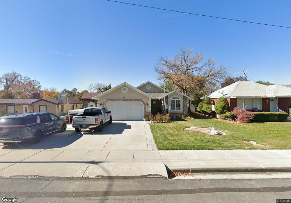
152 S 100 W Springville, UT 84663
Estimated Value: $521,000 - $583,000
4
Beds
2
Baths
3,360
Sq Ft
$165/Sq Ft
Est. Value
About This Home
This home is located at 152 S 100 W, Springville, UT 84663 and is currently estimated at $555,045, approximately $165 per square foot. 152 S 100 W is a home located in Utah County with nearby schools including Westside Elementary School, Springville Junior High School, and Springville High School.
Ownership History
Date
Name
Owned For
Owner Type
Purchase Details
Closed on
Nov 7, 2000
Sold by
Rymer Russell A and Rymer Cherrie L
Bought by
Fox David R and Fox Laurel A
Current Estimated Value
Home Financials for this Owner
Home Financials are based on the most recent Mortgage that was taken out on this home.
Original Mortgage
$175,000
Outstanding Balance
$64,484
Interest Rate
7.88%
Estimated Equity
$490,561
Create a Home Valuation Report for This Property
The Home Valuation Report is an in-depth analysis detailing your home's value as well as a comparison with similar homes in the area
Home Values in the Area
Average Home Value in this Area
Purchase History
| Date | Buyer | Sale Price | Title Company |
|---|---|---|---|
| Fox David R | -- | Century Title |
Source: Public Records
Mortgage History
| Date | Status | Borrower | Loan Amount |
|---|---|---|---|
| Open | Fox David R | $175,000 |
Source: Public Records
Tax History Compared to Growth
Tax History
| Year | Tax Paid | Tax Assessment Tax Assessment Total Assessment is a certain percentage of the fair market value that is determined by local assessors to be the total taxable value of land and additions on the property. | Land | Improvement |
|---|---|---|---|---|
| 2025 | $2,655 | $537,000 | $131,500 | $405,500 |
| 2024 | $2,655 | $271,975 | $0 | $0 |
| 2023 | $2,555 | $262,020 | $0 | $0 |
| 2022 | $2,567 | $258,500 | $0 | $0 |
| 2021 | $2,306 | $361,500 | $98,300 | $263,200 |
| 2020 | $2,138 | $324,900 | $81,900 | $243,000 |
| 2019 | $2,075 | $321,100 | $78,100 | $243,000 |
| 2018 | $1,909 | $281,800 | $70,500 | $211,300 |
| 2017 | $1,912 | $149,875 | $0 | $0 |
| 2016 | $1,749 | $134,420 | $0 | $0 |
| 2015 | $1,553 | $122,045 | $0 | $0 |
| 2014 | $1,505 | $117,535 | $0 | $0 |
Source: Public Records
Map
Nearby Homes
- 1768 W 300 S Unit D
- 311 W Center St
- 111 E Center St
- 293 S 450 W Unit B
- 12 N 450 W
- 550 S 400 W
- 64 W 600 S Unit C205
- 145 W 400 N
- 67 W 600 S Unit B204
- 618 S 100 W Unit 302
- 675 S 100 W Unit A305
- 375 N 100 E
- 393 E Center St
- 670 S Main St Unit 1-4
- 532 W 300 S Unit B
- 544 W 300 S Unit C
- 511 S 300 E Unit 2
- 224 S 550 W Unit B-2
- 156 N 600 W
- 337 E 600 S