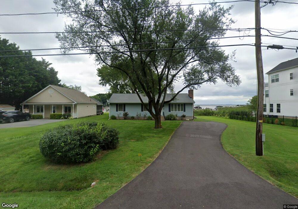
152 Somerset Rd Stevensville, MD 21666
Romancoke NeighborhoodEstimated Value: $540,337 - $795,000
--
Bed
2
Baths
1,456
Sq Ft
$444/Sq Ft
Est. Value
About This Home
This home is located at 152 Somerset Rd, Stevensville, MD 21666 and is currently estimated at $645,834, approximately $443 per square foot. 152 Somerset Rd is a home located in Queen Anne's County with nearby schools including Matapeake Elementary School, Matapeake Middle School, and Kent Island High School.
Ownership History
Date
Name
Owned For
Owner Type
Purchase Details
Closed on
Jun 12, 2018
Sold by
Kecman Fern Marie and Kecman Daniel
Bought by
Kecman Daniel and Kecman Fern Marie
Current Estimated Value
Purchase Details
Closed on
Aug 10, 1984
Sold by
Chesgreen Elmer C and Chesgreen Mary C
Bought by
Kecman Daniel
Home Financials for this Owner
Home Financials are based on the most recent Mortgage that was taken out on this home.
Original Mortgage
$70,000
Interest Rate
14.54%
Create a Home Valuation Report for This Property
The Home Valuation Report is an in-depth analysis detailing your home's value as well as a comparison with similar homes in the area
Home Values in the Area
Average Home Value in this Area
Purchase History
| Date | Buyer | Sale Price | Title Company |
|---|---|---|---|
| Kecman Daniel | -- | None Available | |
| Kecman Daniel | -- | None Available | |
| Kecman Daniel | $100,000 | -- |
Source: Public Records
Mortgage History
| Date | Status | Borrower | Loan Amount |
|---|---|---|---|
| Closed | Kecman Daniel | $70,000 |
Source: Public Records
Tax History Compared to Growth
Tax History
| Year | Tax Paid | Tax Assessment Tax Assessment Total Assessment is a certain percentage of the fair market value that is determined by local assessors to be the total taxable value of land and additions on the property. | Land | Improvement |
|---|---|---|---|---|
| 2025 | $4,979 | $528,533 | $0 | $0 |
| 2024 | $4,842 | $513,967 | $0 | $0 |
| 2023 | $4,704 | $499,400 | $361,700 | $137,700 |
| 2022 | $4,586 | $486,800 | $0 | $0 |
| 2021 | $4,548 | $474,200 | $0 | $0 |
| 2020 | $4,487 | $461,600 | $331,700 | $129,900 |
| 2019 | $4,421 | $454,700 | $0 | $0 |
| 2018 | $4,355 | $447,800 | $0 | $0 |
| 2017 | $4,289 | $440,900 | $0 | $0 |
| 2016 | -- | $440,900 | $0 | $0 |
| 2015 | $6,422 | $440,900 | $0 | $0 |
| 2014 | $6,422 | $498,900 | $0 | $0 |
Source: Public Records
Map
Nearby Homes
- 300 Talbot Rd
- 224 Wicomico Rd
- 116 Talbot Rd
- 122 S Carolina Rd
- 101 Oak St
- 122 Mallard Dr
- 116 Mallard Dr
- 8905 Romancoke Rd
- 9401 Romancoke Rd
- Lot 1 - E/Kent Point Romancoke
- 321 Oregon Rd
- 306 N Lake Rd
- 123 Long Point Rd
- 118 N Lake Dr
- 114 N Lake Dr
- 203 Olive Branch Rd
- 210 Pennick Dr
- Lot 8 Ackerman Dr
- 208 Long Point Rd
- 214 Pennick Dr
- 154 Somerset Rd
- 150 Somerset Rd
- 0 Somerset Rd Unit 1000212998
- 160 Somerset Rd
- 146 Somerset Rd
- 205 Somerset Rd
- 201 Somerset Rd
- 207 Somerset Rd
- 142 Somerset Rd
- 209 Somerset Rd
- 137 Somerset Rd
- 164 Somerset Rd
- Lot 1 Somerset Rd
- 215 Somerset Rd
- 131 Somerset Rd
- 219 Somerset Rd
- 170 Somerset Rd
- 210 Somerset Rd
- 134 Somerset Rd
- 200 Somerset Rd