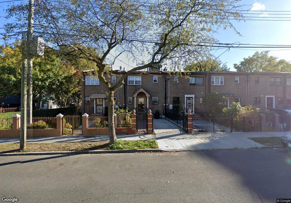
152 Sutter Ave Brooklyn, NY 11212
Brownsville NeighborhoodEstimated Value: $500,658 - $641,000
Studio
--
Bath
1,116
Sq Ft
$528/Sq Ft
Est. Value
About This Home
This home is located at 152 Sutter Ave, Brooklyn, NY 11212 and is currently estimated at $589,415, approximately $528 per square foot. 152 Sutter Ave is a home located in Kings County with nearby schools including P.S. 156 Waverly, P.S. 165 Ida Posner, and P.S. 150 - Christopher.
Ownership History
Date
Name
Owned For
Owner Type
Purchase Details
Closed on
Dec 19, 2022
Sold by
Camile Lightbody Trustee
Bought by
Camile Lightbody Trustee and Dt New Asset Trust Made As Of August 24,
Current Estimated Value
Purchase Details
Closed on
Dec 7, 2021
Sold by
Thompson Daphne
Bought by
Camile Lightbody As Trustee and Natalie Brown, As Trustee
Purchase Details
Closed on
Feb 2, 2018
Sold by
Thompson Daphne and Thompson Keith
Bought by
Thompson Daphne
Create a Home Valuation Report for This Property
The Home Valuation Report is an in-depth analysis detailing your home's value as well as a comparison with similar homes in the area
Home Values in the Area
Average Home Value in this Area
Purchase History
| Date | Buyer | Sale Price | Title Company |
|---|---|---|---|
| Camile Lightbody Trustee | -- | -- | |
| Camile Lightbody As Trustee | -- | -- | |
| Thompson Daphne | -- | -- |
Source: Public Records
Tax History
| Year | Tax Paid | Tax Assessment Tax Assessment Total Assessment is a certain percentage of the fair market value that is determined by local assessors to be the total taxable value of land and additions on the property. | Land | Improvement |
|---|---|---|---|---|
| 2025 | $4,078 | $28,980 | $14,040 | $14,940 |
| 2024 | $4,078 | $33,240 | $14,040 | $19,200 |
| 2023 | $4,124 | $30,960 | $14,040 | $16,920 |
| 2022 | $4,022 | $29,220 | $14,040 | $15,180 |
| 2021 | $4,000 | $31,200 | $14,040 | $17,160 |
| 2019 | $3,540 | $23,940 | $14,040 | $9,900 |
| 2018 | $3,449 | $16,920 | $10,474 | $6,446 |
| 2017 | $3,422 | $16,789 | $9,996 | $6,793 |
| 2016 | $3,166 | $15,839 | $10,712 | $5,127 |
| 2015 | $1,910 | $14,943 | $9,400 | $5,543 |
| 2014 | $1,910 | $14,100 | $8,841 | $5,259 |
Source: Public Records
Map
Nearby Homes
- 589 Saratoga Ave
- 121 Legion St
- 637 Saratoga Ave
- 124 Herzl St
- 96 Herzl St
- 675 Saratoga Ave
- 45 Legion St
- 1887 Strauss St Unit HOUSE
- 687 Saratoga Ave
- 2041 Strauss St
- 31 Tapscott St
- 1585 Pitkin Ave
- 2087 Union St
- 267 Legion St
- 244 Grafton St
- 195 Chester St
- 1830 Sterling Place
- 330 Herzl St
- 548 Rockaway Ave
- 315 Legion St
- 150 Sutter Ave
- 154 Sutter Ave
- 148 Sutter Ave
- 146 Sutter Ave
- 1968 Strauss St
- 144 Sutter Ave
- 142 Sutter Ave
- 1972 Strauss St
- 140 Sutter Ave
- 156 Sutter Ave
- 1974 Strauss St
- 138 Sutter Ave
- 615 Saratoga Ave
- 1948 Strauss St
- 158 Sutter Ave
- 617 Saratoga Ave
- 1978 Strauss St
- 136 Sutter Ave
- 136 Sutter Ave Unit Building
- 619 Saratoga Ave
Your Personal Tour Guide
Ask me questions while you tour the home.