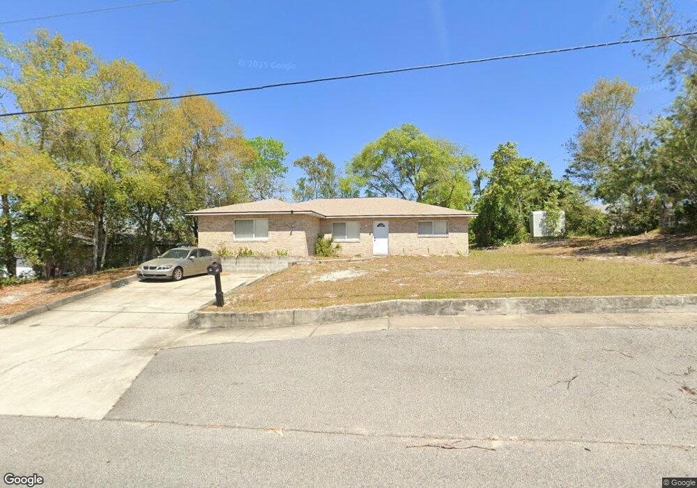
1520 5th St Daytona Beach, FL 32117
Neighborhood K NeighborhoodEstimated Value: $271,000 - $317,000
3
Beds
2
Baths
1,930
Sq Ft
$149/Sq Ft
Est. Value
About This Home
This home is located at 1520 5th St, Daytona Beach, FL 32117 and is currently estimated at $288,473, approximately $149 per square foot. 1520 5th St is a home located in Volusia County with nearby schools including Westside Elementary School, David C. Hinson Sr. Middle School, and Mainland High School.
Ownership History
Date
Name
Owned For
Owner Type
Purchase Details
Closed on
Feb 8, 1994
Sold by
Lewis Michael L and Lewis Janice L
Bought by
Reed Clifford and Reed Vera Jean
Current Estimated Value
Home Financials for this Owner
Home Financials are based on the most recent Mortgage that was taken out on this home.
Original Mortgage
$68,340
Interest Rate
7.17%
Mortgage Type
VA
Purchase Details
Closed on
Nov 23, 1993
Sold by
M M & J Const Inc
Bought by
Lewis Michael L and Lewis Janice L
Home Financials for this Owner
Home Financials are based on the most recent Mortgage that was taken out on this home.
Original Mortgage
$48,000
Interest Rate
6.81%
Purchase Details
Closed on
Dec 15, 1988
Bought by
Reed Clifford and Vera Jean
Purchase Details
Closed on
May 15, 1973
Bought by
Reed Clifford and Vera Jean
Create a Home Valuation Report for This Property
The Home Valuation Report is an in-depth analysis detailing your home's value as well as a comparison with similar homes in the area
Home Values in the Area
Average Home Value in this Area
Purchase History
| Date | Buyer | Sale Price | Title Company |
|---|---|---|---|
| Reed Clifford | $67,000 | -- | |
| Lewis Michael L | -- | -- | |
| Reed Clifford | $7,500 | -- | |
| Reed Clifford | $3,300 | -- |
Source: Public Records
Mortgage History
| Date | Status | Borrower | Loan Amount |
|---|---|---|---|
| Closed | Reed Clifford | $68,340 | |
| Previous Owner | Lewis Michael L | $48,000 |
Source: Public Records
Tax History Compared to Growth
Tax History
| Year | Tax Paid | Tax Assessment Tax Assessment Total Assessment is a certain percentage of the fair market value that is determined by local assessors to be the total taxable value of land and additions on the property. | Land | Improvement |
|---|---|---|---|---|
| 2025 | $3,435 | $241,334 | $30,000 | $211,334 |
| 2024 | $3,435 | $241,985 | $30,000 | $211,985 |
| 2023 | $3,435 | $239,164 | $30,000 | $209,164 |
| 2022 | $3,105 | $206,544 | $30,000 | $176,544 |
| 2021 | $2,842 | $160,132 | $20,000 | $140,132 |
| 2020 | $2,585 | $145,054 | $16,500 | $128,554 |
| 2019 | $2,377 | $129,907 | $16,500 | $113,407 |
| 2018 | $2,263 | $122,184 | $17,500 | $104,684 |
| 2017 | $2,092 | $103,328 | $13,000 | $90,328 |
| 2016 | $1,983 | $92,025 | $0 | $0 |
| 2015 | -- | $79,783 | $0 | $0 |
| 2014 | -- | $86,454 | $0 | $0 |
Source: Public Records
Map
Nearby Homes
- 1033 Cadillac Dr
- 1136 Lakewood Park Dr
- 1015 Cadillac Dr
- 1026 Imperial Dr
- 1113 Berkshire Rd
- 160 Big Ben Dr
- 1122 Lewis Dr
- 1325 Laurel Dr
- 1340 Continental Dr
- 1119 Edith Dr
- 116 Big Ben Dr
- 888 W Coquina Dr
- 882 W Coquina Dr
- 1605 N Patrick Cir
- 929 Derbyshire Rd
- 104 Heathrow Dr
- 1412 Continental Dr
- 952 Essex Rd
- 0 Derbyshire Rd
- 10th Derbyshire Rd
- 1217 Sunset Cir
- 1223 Sunset Cir
- 1200 Cadillac Dr
- 1208 Cadillac Dr
- 1065 Thunderbird Dr
- 1032 Cadillac Dr
- 1227 Sunset Cir
- 1220 Cadillac Dr
- 1066 Thunderbird Dr Unit 32117
- 1061 Thunderbird Dr Unit 32117
- 1218 Sunset Cir
- 1030 Cadillac Dr
- 1201 Cadillac Dr
- 1209 Sunset Cir
- 1231 Sunset Cir
- 1062 Thunderbird Dr
- 1209 Cadillac Dr
- 1057 Thunderbird Dr
- 1035 Cadillac Dr
- 1527 5th St