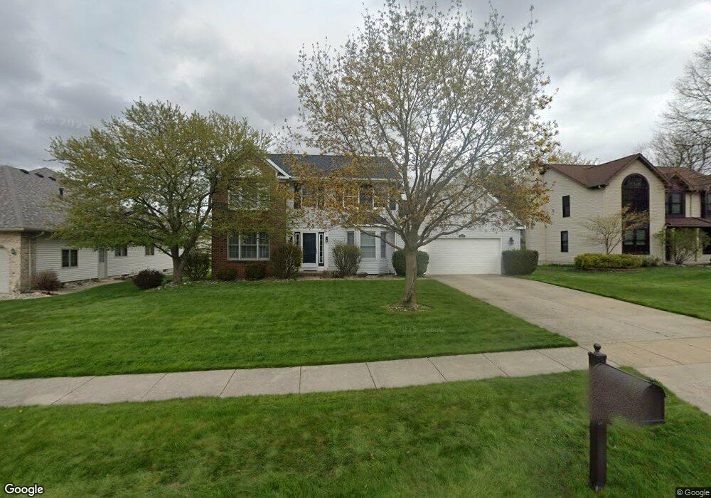
1520 Alan Ln Lansing, MI 48917
Estimated Value: $344,358 - $379,000
4
Beds
3
Baths
2,289
Sq Ft
$158/Sq Ft
Est. Value
About This Home
This home is located at 1520 Alan Ln, Lansing, MI 48917 and is currently estimated at $361,840, approximately $158 per square foot. 1520 Alan Ln is a home located in Eaton County with nearby schools including Willow Ridge Elementary School, Leon W. Hayes Middle School, and Grand Ledge High School.
Ownership History
Date
Name
Owned For
Owner Type
Purchase Details
Closed on
Sep 29, 2005
Sold by
Stover Michael J and Stover Crystal R
Bought by
Stover Michael J and Stover Crystal R
Current Estimated Value
Home Financials for this Owner
Home Financials are based on the most recent Mortgage that was taken out on this home.
Original Mortgage
$200,000
Interest Rate
5.88%
Mortgage Type
New Conventional
Create a Home Valuation Report for This Property
The Home Valuation Report is an in-depth analysis detailing your home's value as well as a comparison with similar homes in the area
Home Values in the Area
Average Home Value in this Area
Purchase History
| Date | Buyer | Sale Price | Title Company |
|---|---|---|---|
| Stover Michael J | -- | Affidavit Title |
Source: Public Records
Mortgage History
| Date | Status | Borrower | Loan Amount |
|---|---|---|---|
| Closed | Stover Michael J | $200,000 |
Source: Public Records
Tax History Compared to Growth
Tax History
| Year | Tax Paid | Tax Assessment Tax Assessment Total Assessment is a certain percentage of the fair market value that is determined by local assessors to be the total taxable value of land and additions on the property. | Land | Improvement |
|---|---|---|---|---|
| 2025 | $4,795 | $149,700 | $0 | $0 |
| 2024 | $2,340 | $140,900 | $0 | $0 |
| 2023 | $2,180 | $131,400 | $0 | $0 |
| 2022 | $4,102 | $122,200 | $0 | $0 |
| 2021 | $3,925 | $118,300 | $0 | $0 |
| 2020 | $3,852 | $111,500 | $0 | $0 |
| 2019 | $3,786 | $108,509 | $0 | $0 |
| 2018 | $3,557 | $108,100 | $0 | $0 |
| 2017 | $3,483 | $102,200 | $0 | $0 |
| 2016 | -- | $98,200 | $0 | $0 |
| 2015 | -- | $93,200 | $0 | $0 |
| 2014 | -- | $89,300 | $0 | $0 |
| 2013 | -- | $87,900 | $0 | $0 |
Source: Public Records
Map
Nearby Homes
- 5910 Cabrena Dr
- 6512 Spring Tree Ln Unit 14
- 6333 Larocque Cir
- 6542 Brook Trail
- 6361 Larocque Cir
- 6606 Windsong Way
- 6725 French Creek Dr
- 1108 Summergreen Ln Unit 103
- 1527 Lindy Dr
- 5754 River Ridge Dr
- 1120 Rolling Green Ln
- 1516 Elmwood Rd
- 2212 Holiday Ln
- 5201 Greenbriar Rd
- 1205 Woodmeadow Unit 201
- 1031 Mall Dr E
- 4915 Canyon Trail
- 1106 S Ridge Rd
- 1744 Willow Creek Dr Unit 60
- 1738 Willow Creek Dr Unit 63
- 1514 Alan Ln
- 1526 Alan Ln
- 1521 Smokedrift Ln
- 1515 Smokedrift Ln
- 6034 Stoney Point Dr
- 1527 Smokedrift Ln
- 1517 Alan Ln
- 1511 Alan Ln
- 1505 Smokedrift Ln
- 1525 Alan Ln
- 6040 Stoney Point Dr
- 1610 Alan Ln
- 1533 Smokedrift Ln
- 1603 Alan Ln
- 1410 Alan Ln
- 1514 Smokedrift Ln
- 1415 Smokedrift Ln
- 1609 Alan Ln
- 1620 Alan Ln
- 1504 Smokedrift Ln