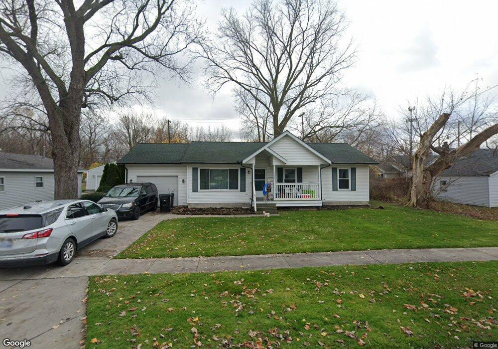
1520 Bancroft St Port Huron, MI 48060
Estimated Value: $148,000 - $159,325
3
Beds
1
Bath
1,066
Sq Ft
$142/Sq Ft
Est. Value
About This Home
This home is located at 1520 Bancroft St, Port Huron, MI 48060 and is currently estimated at $151,831, approximately $142 per square foot. 1520 Bancroft St is a home located in St. Clair County with nearby schools including Woodrow Wilson Elementary School, Central Middle School, and Port Huron High School.
Create a Home Valuation Report for This Property
The Home Valuation Report is an in-depth analysis detailing your home's value as well as a comparison with similar homes in the area
Home Values in the Area
Average Home Value in this Area
Tax History Compared to Growth
Tax History
| Year | Tax Paid | Tax Assessment Tax Assessment Total Assessment is a certain percentage of the fair market value that is determined by local assessors to be the total taxable value of land and additions on the property. | Land | Improvement |
|---|---|---|---|---|
| 2025 | $2,081 | $73,900 | $0 | $0 |
| 2024 | $1,762 | $71,300 | $0 | $0 |
| 2023 | $1,665 | $67,900 | $0 | $0 |
| 2022 | $1,739 | $62,800 | $0 | $0 |
| 2021 | $1,650 | $56,700 | $0 | $0 |
| 2020 | $1,669 | $50,900 | $50,900 | $0 |
| 2019 | $1,639 | $36,300 | $0 | $0 |
| 2018 | $1,603 | $36,300 | $0 | $0 |
| 2017 | $1,432 | $34,200 | $0 | $0 |
| 2016 | $1,223 | $34,200 | $0 | $0 |
| 2015 | $1,276 | $34,000 | $34,000 | $0 |
| 2014 | $1,276 | $35,600 | $35,600 | $0 |
| 2013 | -- | $39,200 | $0 | $0 |
Source: Public Records
Map
Nearby Homes
- 1624 15th St
- 1322 Division St
- 1325 Division St
- 1610 16th St
- 1917 Minnie St
- 1309 Division St
- 1815 Griswold St
- 1127 Minnie St
- 1426 18th St
- 1112 Minnie St
- 1425 18th St
- 1831 11th St
- 1424 19th St
- 1413 14th St
- 1132 Griswold St
- 2203 VL Railroad St
- 2200 VL Railroad St
- 1207 White St
- 1811 23rd St
- 2023 23rd St