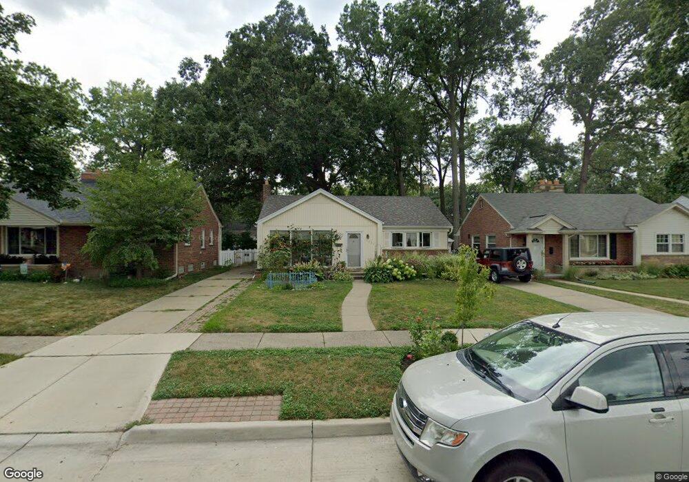
1520 Birchcrest Dr Dearborn, MI 48124
Snow Woods NeighborhoodEstimated Value: $235,000 - $287,000
3
Beds
2
Baths
1,023
Sq Ft
$257/Sq Ft
Est. Value
About This Home
This home is located at 1520 Birchcrest Dr, Dearborn, MI 48124 and is currently estimated at $262,671, approximately $256 per square foot. 1520 Birchcrest Dr is a home located in Wayne County with nearby schools including Snow Elementary School, Stout Middle School, and Edsel Ford High School.
Ownership History
Date
Name
Owned For
Owner Type
Purchase Details
Closed on
Feb 2, 2023
Sold by
Boyk Robert M
Bought by
Boyk Robert M and Taylor Shannon Lindsay
Current Estimated Value
Purchase Details
Closed on
Mar 30, 2010
Sold by
Dfcu Financial Federal Cu
Bought by
Boyk Robert M
Purchase Details
Closed on
Mar 4, 2009
Sold by
Vroom Michael C
Bought by
Dfcu Financial Federal Credit Union
Purchase Details
Closed on
Aug 10, 2007
Sold by
Vroom Marilyn F
Bought by
Vroom Michael C
Purchase Details
Closed on
Jan 26, 1998
Sold by
Vroom Vroom C C and Vroom Winifred
Create a Home Valuation Report for This Property
The Home Valuation Report is an in-depth analysis detailing your home's value as well as a comparison with similar homes in the area
Home Values in the Area
Average Home Value in this Area
Purchase History
| Date | Buyer | Sale Price | Title Company |
|---|---|---|---|
| Boyk Robert M | -- | -- | |
| Boyk Robert M | $72,000 | Interstate Title Inc | |
| Dfcu Financial Federal Credit Union | $116,729 | None Available | |
| Vroom Michael C | -- | None Available | |
| -- | -- | -- |
Source: Public Records
Tax History Compared to Growth
Tax History
| Year | Tax Paid | Tax Assessment Tax Assessment Total Assessment is a certain percentage of the fair market value that is determined by local assessors to be the total taxable value of land and additions on the property. | Land | Improvement |
|---|---|---|---|---|
| 2025 | $2,355 | $116,000 | $0 | $0 |
| 2024 | $2,355 | $103,200 | $0 | $0 |
| 2023 | $2,229 | $87,900 | $0 | $0 |
| 2022 | $2,508 | $76,000 | $0 | $0 |
| 2021 | $2,914 | $70,800 | $0 | $0 |
| 2019 | $2,885 | $60,400 | $0 | $0 |
| 2018 | $2,443 | $55,800 | $0 | $0 |
| 2017 | $701 | $53,300 | $0 | $0 |
| 2016 | $2,286 | $52,800 | $0 | $0 |
| 2015 | $4,320 | $47,400 | $0 | $0 |
| 2013 | $4,185 | $41,850 | $0 | $0 |
| 2011 | -- | $49,250 | $0 | $0 |
Source: Public Records
Map
Nearby Homes
- 1400 Sherwood Ct
- 1562 Hollywood St
- 1111 Linden St
- 2004 Chestnut St
- 1026 Linden St
- 1906 Venice St
- 3117 Willow St
- 3139 Chestnut St
- 3165 Linden St
- 3313 Hollywood St
- 3309 Dallas St
- 3507 Raymond Ave
- 2053 Edgewood St
- 3135 Byrd St
- 2038 Detroit St
- 16958 Cambridge Ave
- 1881 Woodside St
- 1910 Woodside St
- 1961 Pelham St
- 17452 Cicotte Ave
- 1510 Birchcrest Dr
- 1530 Birchcrest Dr
- 1500 Birchcrest Dr
- 1540 Birchcrest Dr
- 1523 Sherwood Ct
- 1513 Sherwood Ct
- 1533 Sherwood Ct
- 1464 Birchcrest Dr
- 1505 Sherwood Ct
- 1543 Sherwood Ct
- 1517 Birchcrest Dr
- 1527 Birchcrest Dr
- 1497 Sherwood Ct
- 1507 Birchcrest Dr
- 1553 Sherwood Ct
- 1454 Birchcrest Dr
- 1560 Birchcrest Dr
- 1539 Birchcrest Dr
- 1473 Birchcrest Dr
- 1549 Birchcrest Dr