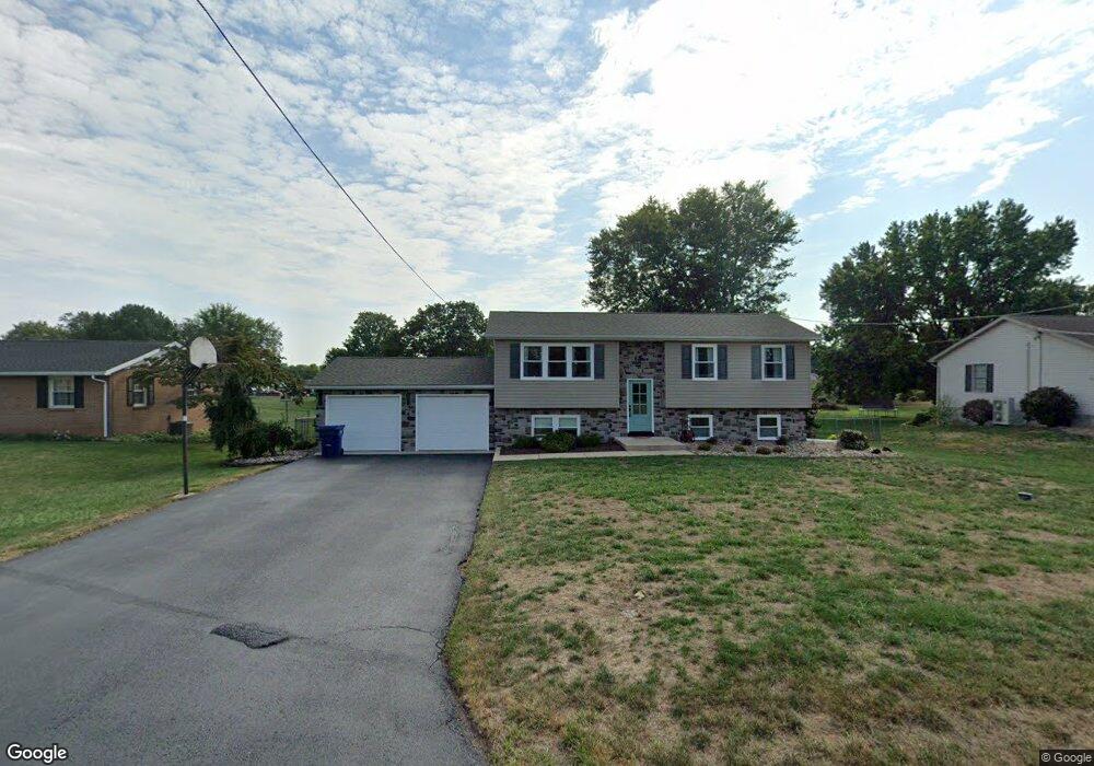
1520 Brenda Dr Greencastle, PA 17225
Estimated Value: $329,000 - $441,906
4
Beds
2
Baths
2,504
Sq Ft
$146/Sq Ft
Est. Value
About This Home
This home is located at 1520 Brenda Dr, Greencastle, PA 17225 and is currently estimated at $366,477, approximately $146 per square foot. 1520 Brenda Dr is a home located in Franklin County with nearby schools including Greencastle-Antrim Primary School, Greencastle-Antrim Elementary School, and Greencastle-Antrim Middle School.
Ownership History
Date
Name
Owned For
Owner Type
Purchase Details
Closed on
Dec 21, 2012
Sold by
Miller Rondey A and Miller Heidi L
Bought by
Miller Rodney A and Miller Heidi L
Current Estimated Value
Home Financials for this Owner
Home Financials are based on the most recent Mortgage that was taken out on this home.
Original Mortgage
$220,391
Outstanding Balance
$155,400
Interest Rate
3.75%
Mortgage Type
FHA
Estimated Equity
$211,077
Purchase Details
Closed on
Mar 6, 2009
Sold by
Reaves James P and Reaves Lorayne I M
Bought by
Miller Rodney A and Will Heidi L
Home Financials for this Owner
Home Financials are based on the most recent Mortgage that was taken out on this home.
Original Mortgage
$230,644
Interest Rate
5.14%
Mortgage Type
FHA
Create a Home Valuation Report for This Property
The Home Valuation Report is an in-depth analysis detailing your home's value as well as a comparison with similar homes in the area
Home Values in the Area
Average Home Value in this Area
Purchase History
| Date | Buyer | Sale Price | Title Company |
|---|---|---|---|
| Miller Rodney A | -- | None Available | |
| Miller Rodney A | $234,900 | None Available |
Source: Public Records
Mortgage History
| Date | Status | Borrower | Loan Amount |
|---|---|---|---|
| Open | Miller Rodney A | $220,391 | |
| Closed | Miller Rodney A | $230,644 |
Source: Public Records
Tax History Compared to Growth
Tax History
| Year | Tax Paid | Tax Assessment Tax Assessment Total Assessment is a certain percentage of the fair market value that is determined by local assessors to be the total taxable value of land and additions on the property. | Land | Improvement |
|---|---|---|---|---|
| 2025 | $4,122 | $24,640 | $1,300 | $23,340 |
| 2024 | $3,740 | $24,640 | $1,300 | $23,340 |
| 2023 | $3,696 | $24,640 | $1,300 | $23,340 |
| 2022 | $3,696 | $24,640 | $1,300 | $23,340 |
| 2021 | $3,624 | $24,640 | $1,300 | $23,340 |
| 2020 | $3,529 | $24,640 | $1,300 | $23,340 |
| 2019 | $3,449 | $24,640 | $1,300 | $23,340 |
| 2018 | $3,412 | $24,640 | $1,300 | $23,340 |
| 2017 | $3,326 | $24,640 | $1,300 | $23,340 |
| 2016 | $706 | $24,640 | $1,300 | $23,340 |
| 2015 | $658 | $24,640 | $1,300 | $23,340 |
| 2014 | $658 | $24,640 | $1,300 | $23,340 |
Source: Public Records
Map
Nearby Homes
- 11765 Melrose Ave
- 20 Helens Dr
- 12976 Daybreak Ln
- 10135 Jasper Dr
- 707 Shook Ct W
- 12689 Williamsport Pike
- 281 Toms Ln
- 763 Joy Dr
- 10937 Grant Shook Rd
- 10925 Grant Shook Rd
- 1223 E Pebblebrook Dr
- 11498 Nicole Dr
- 2428 Pikeside Dr
- 0 Molly Pitcher Hwy Unit PAFL178468
- 0 Molly Pitcher Hwy Unit PAFL2030380
- 480 S Carlisle St
- 375 Carolle St
- 642 Milnor Rd
- 34.77 Acres Red Oak Estate S
- 775 Lohman Ave
- 1540 Brenda Dr
- 1521 Brenda Dr
- 1560 Brenda Dr
- 1470 Brenda Dr
- 1481 Brenda Dr
- 1561 Brenda Dr
- 1451 Brenda Dr
- 1620 Brenda Dr
- 12249 Nancy Ave
- 1621 Brenda Dr
- 12064 Randy Dr
- 1401 Brenda Dr
- 1360 Brenda Dr
- 12277 Nancy Ave
- 1254 Preston Ln
- 1685 Brenda Dr
- 12248 Nancy Ave
- 12120 Randy Dr
- 1361 Brenda Dr
- 1246 Preston Ln