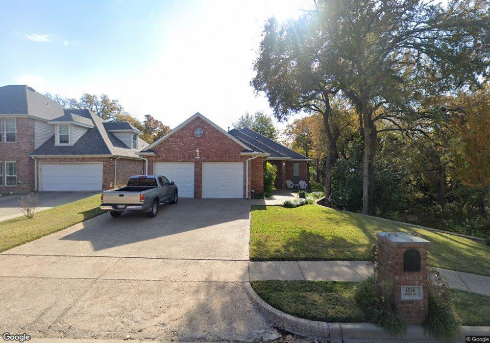
1520 Briar Dr Bedford, TX 76022
Estimated Value: $418,000 - $433,000
4
Beds
2
Baths
2,310
Sq Ft
$184/Sq Ft
Est. Value
About This Home
This home is located at 1520 Briar Dr, Bedford, TX 76022 and is currently estimated at $424,675, approximately $183 per square foot. 1520 Briar Dr is a home located in Tarrant County with nearby schools including Stonegate Elementary School, Central J High School, and L.D. Bell High School.
Ownership History
Date
Name
Owned For
Owner Type
Purchase Details
Closed on
Jun 6, 2007
Sold by
Roosevelt J Kean
Bought by
Roosevelt Ii J Kean and Roosevelt Carol Foltz
Current Estimated Value
Purchase Details
Closed on
Sep 27, 1999
Sold by
Young Waymon R and Young Janice
Bought by
Roosevelt Ii J Kean
Home Financials for this Owner
Home Financials are based on the most recent Mortgage that was taken out on this home.
Original Mortgage
$115,000
Outstanding Balance
$35,227
Interest Rate
8.02%
Estimated Equity
$389,448
Create a Home Valuation Report for This Property
The Home Valuation Report is an in-depth analysis detailing your home's value as well as a comparison with similar homes in the area
Home Values in the Area
Average Home Value in this Area
Purchase History
| Date | Buyer | Sale Price | Title Company |
|---|---|---|---|
| Roosevelt Ii J Kean | -- | None Available | |
| Roosevelt Ii J Kean | -- | Stewart Title |
Source: Public Records
Mortgage History
| Date | Status | Borrower | Loan Amount |
|---|---|---|---|
| Open | Roosevelt Ii J Kean | $115,000 |
Source: Public Records
Tax History Compared to Growth
Tax History
| Year | Tax Paid | Tax Assessment Tax Assessment Total Assessment is a certain percentage of the fair market value that is determined by local assessors to be the total taxable value of land and additions on the property. | Land | Improvement |
|---|---|---|---|---|
| 2025 | $2,021 | $380,000 | $71,250 | $308,750 |
| 2024 | $2,021 | $394,599 | $71,250 | $323,349 |
| 2023 | $7,001 | $365,000 | $52,250 | $312,750 |
| 2022 | $7,260 | $364,038 | $52,250 | $311,788 |
| 2021 | $7,118 | $334,374 | $52,250 | $282,124 |
| 2020 | $6,531 | $274,709 | $52,250 | $222,459 |
| 2019 | $6,705 | $276,344 | $52,250 | $224,094 |
| 2018 | $3,613 | $250,889 | $33,250 | $217,639 |
| 2017 | $6,449 | $269,283 | $35,000 | $234,283 |
| 2016 | $5,863 | $242,341 | $35,000 | $207,341 |
| 2015 | $3,675 | $230,431 | $35,000 | $195,431 |
| 2014 | $3,675 | $215,800 | $28,000 | $187,800 |
Source: Public Records
Map
Nearby Homes
- 1509 Shirley Way
- 1204 Edgecliff Dr
- 1213 Briar Dr
- 1701 Winchester Way
- 1004 Overhill Dr
- 1031 Boston Blvd
- 921 Overhill Dr
- 909 Overhill Dr
- 604 Donna Ln
- 1416 Wade Dr
- 1613 Trinity Ct
- 1108 Wade Dr
- 933 Charleston Ct
- 2025 Schumac Ln
- 1604 Richmond Dr
- 952 Charleston Dr
- 933 Wade Dr
- 501 Merrill Dr
- 2201 Greendale Ct
- 6 Park Ln