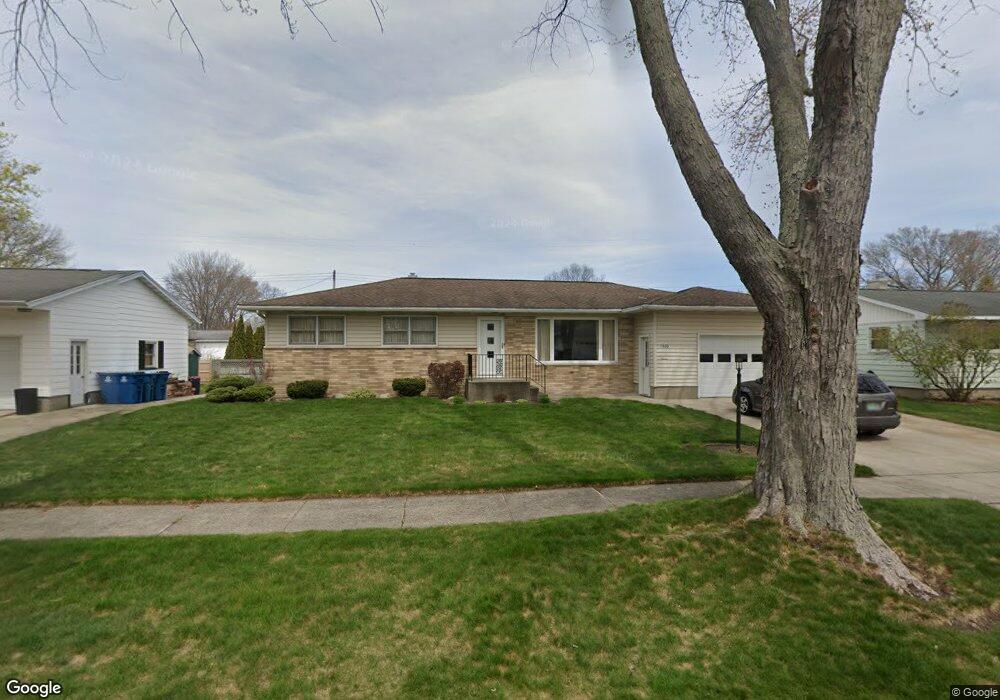
1520 Cornell Rd Muskegon, MI 49441
Roosevelt Park NeighborhoodEstimated Value: $254,000 - $277,000
4
Beds
1
Bath
1,424
Sq Ft
$187/Sq Ft
Est. Value
About This Home
This home is located at 1520 Cornell Rd, Muskegon, MI 49441 and is currently estimated at $265,785, approximately $186 per square foot. 1520 Cornell Rd is a home located in Muskegon County with nearby schools including Mona Shores High School, West Shore Lutheran School, and St. Francis De Sales Elementary School.
Ownership History
Date
Name
Owned For
Owner Type
Purchase Details
Closed on
Aug 31, 2009
Sold by
Paparella David L
Bought by
Paparella David L and David L Paparella Trust
Current Estimated Value
Home Financials for this Owner
Home Financials are based on the most recent Mortgage that was taken out on this home.
Original Mortgage
$81,000
Interest Rate
5.27%
Mortgage Type
New Conventional
Purchase Details
Closed on
May 24, 2007
Sold by
Paparella David L
Bought by
Paparella David L and The David L Paparella Trust
Home Financials for this Owner
Home Financials are based on the most recent Mortgage that was taken out on this home.
Original Mortgage
$78,430
Interest Rate
6.21%
Mortgage Type
Unknown
Purchase Details
Closed on
May 10, 2007
Sold by
Paparella Aura
Bought by
Paparella David L
Home Financials for this Owner
Home Financials are based on the most recent Mortgage that was taken out on this home.
Original Mortgage
$78,430
Interest Rate
6.21%
Mortgage Type
Unknown
Create a Home Valuation Report for This Property
The Home Valuation Report is an in-depth analysis detailing your home's value as well as a comparison with similar homes in the area
Home Values in the Area
Average Home Value in this Area
Purchase History
| Date | Buyer | Sale Price | Title Company |
|---|---|---|---|
| Paparella David L | -- | Safe Title Inc | |
| Paparella David L | -- | Safe Title Inc | |
| Paparella David L | -- | None Available | |
| Paparella David L | -- | Harbor Title |
Source: Public Records
Mortgage History
| Date | Status | Borrower | Loan Amount |
|---|---|---|---|
| Closed | Paparella David L | $81,000 | |
| Closed | Paparella David L | $78,430 |
Source: Public Records
Tax History Compared to Growth
Tax History
| Year | Tax Paid | Tax Assessment Tax Assessment Total Assessment is a certain percentage of the fair market value that is determined by local assessors to be the total taxable value of land and additions on the property. | Land | Improvement |
|---|---|---|---|---|
| 2025 | $2,513 | $122,800 | $0 | $0 |
| 2024 | $964 | $111,700 | $0 | $0 |
| 2023 | $922 | $101,300 | $0 | $0 |
| 2022 | $2,291 | $78,300 | $0 | $0 |
| 2021 | $2,182 | $70,800 | $0 | $0 |
| 2020 | $2,157 | $68,200 | $0 | $0 |
| 2019 | $2,117 | $62,300 | $0 | $0 |
| 2018 | $2,068 | $54,500 | $0 | $0 |
| 2017 | $2,020 | $53,100 | $0 | $0 |
| 2016 | $767 | $46,900 | $0 | $0 |
| 2015 | -- | $40,500 | $0 | $0 |
| 2014 | -- | $45,200 | $0 | $0 |
| 2013 | -- | $42,600 | $0 | $0 |
Source: Public Records
Map
Nearby Homes
- 1521 Cornell Rd
- 2881 Cornell Ct
- 1377 Princeton Rd
- 1582 Haverhill Rd
- 1752 Bonneville Dr
- 1480 Marlboro Rd
- 1448 Marlboro Rd
- 1564 Montague Ave
- 2552 Wickham Dr
- 1405 Winchester Dr
- 1705 Montague Ave
- 1543 Randolph Ave
- 1729 Winchester Dr
- 1555 Beardsley Ave
- 3059 Coolidge Rd
- 3246 Royal Oak Rd
- 1733 Woodside Rd
- 1059 W Summit Ave
- 1408 Lexington Ave
- 1936 W Sherman Blvd
- 1510 Cornell Rd
- 1530 Cornell Rd
- 1525 Garrison Rd
- 1513 Garrison Rd
- 1498 Cornell Rd
- 1540 Cornell Rd
- 1537 Garrison Rd
- 1509 Cornell Rd
- 1533 Cornell Rd
- 1552 Cornell Rd
- 1488 Cornell Rd
- 1497 Cornell Rd
- 1543 Cornell Rd
- 1489 Garrison Rd
- 1549 Garrison Rd
- 1487 Cornell Rd
- 1562 Cornell Rd
- 1522 W Summit Ave
- 1476 Cornell Rd
- 1555 Cornell Rd