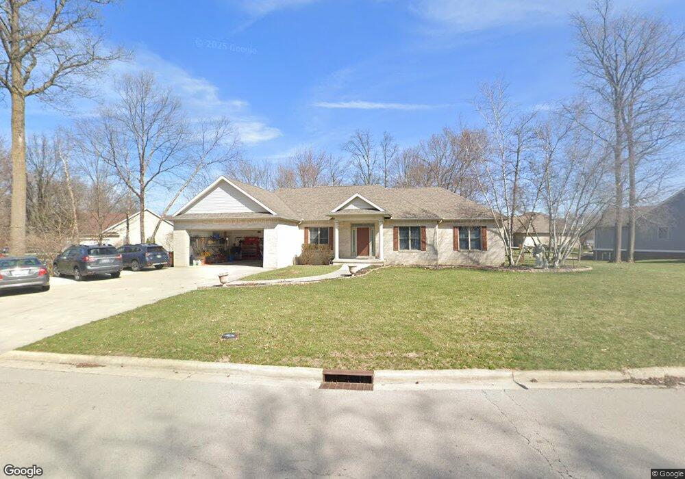
1520 Forest Trail Dr Findlay, OH 45840
Estimated Value: $444,669 - $473,000
3
Beds
2
Baths
2,162
Sq Ft
$212/Sq Ft
Est. Value
About This Home
This home is located at 1520 Forest Trail Dr, Findlay, OH 45840 and is currently estimated at $457,917, approximately $211 per square foot. 1520 Forest Trail Dr is a home located in Hancock County with nearby schools including Van Buren Elementary School, Van Buren Middle School, and Van Buren High School.
Ownership History
Date
Name
Owned For
Owner Type
Purchase Details
Closed on
Jun 29, 2012
Sold by
Wetzel Gerald A and Wetzel Jamee W
Bought by
Thomas Kimberly M
Current Estimated Value
Home Financials for this Owner
Home Financials are based on the most recent Mortgage that was taken out on this home.
Original Mortgage
$199,000
Outstanding Balance
$138,403
Interest Rate
3.83%
Mortgage Type
New Conventional
Estimated Equity
$319,514
Create a Home Valuation Report for This Property
The Home Valuation Report is an in-depth analysis detailing your home's value as well as a comparison with similar homes in the area
Home Values in the Area
Average Home Value in this Area
Purchase History
| Date | Buyer | Sale Price | Title Company |
|---|---|---|---|
| Thomas Kimberly M | $235,900 | Mid Amercian Title Agency In |
Source: Public Records
Mortgage History
| Date | Status | Borrower | Loan Amount |
|---|---|---|---|
| Open | Thomas Kimberly M | $199,000 |
Source: Public Records
Tax History Compared to Growth
Tax History
| Year | Tax Paid | Tax Assessment Tax Assessment Total Assessment is a certain percentage of the fair market value that is determined by local assessors to be the total taxable value of land and additions on the property. | Land | Improvement |
|---|---|---|---|---|
| 2024 | $3,684 | $116,020 | $19,960 | $96,060 |
| 2023 | $3,666 | $116,020 | $19,960 | $96,060 |
| 2022 | $3,667 | $116,020 | $19,960 | $96,060 |
| 2021 | $3,455 | $103,000 | $18,640 | $84,360 |
| 2020 | $3,279 | $97,970 | $18,640 | $79,330 |
| 2019 | $3,392 | $97,970 | $18,640 | $79,330 |
| 2018 | $2,989 | $85,190 | $16,210 | $68,980 |
| 2017 | $2,999 | $85,190 | $16,210 | $68,980 |
| 2016 | $2,915 | $85,190 | $16,210 | $68,980 |
| 2015 | $3,024 | $86,560 | $16,210 | $70,350 |
| 2014 | $3,036 | $86,560 | $16,210 | $70,350 |
| 2012 | $3,297 | $86,560 | $16,210 | $70,350 |
Source: Public Records
Map
Nearby Homes
- 0 Bushwillow Dr Or Rock Candy Rd Unit Lot 157
- 0 Bearcat Way Or Rock Candy Rd Unit Lot 167
- 0 Rock Candy Rd Or Bushwillow Dr Unit Lot 173
- 0 Rock Candy Rd Unit Lot 159
- 0 Rock Candy Rd Unit Lot 170
- 0 Rock Candy Rd Unit Lot 172 206819
- 0 Rock Candy Rd Unit Lot 162
- 0 Rock Candy Rd Unit Lot 171
- 0 Rock Candy Rd Unit Lot 168
- 1405 Cypress Lake
- 3106 Saddlebrook
- 3018 Gleneagle Dr
- 0 Allen Township 142
- 1310 Muirfield Dr
- 6535 Silver Lake Dr
- 0 County Road 95 Unit 6097574
- 0 Township Highway 99
- 12325 Township Highway 99
- 933 Laurel Ln
- 3300 Crosshill Dr
- 3605 Forest Trail Dr
- 1500 Forest Trail Dr
- 3610 Turnberry Dr
- 1515 Forest Trail Dr
- 1505 Forest Trail Dr
- 1470 Hollow Tree Dr
- 3516 Chagrin Valley
- 3510 Turnberry Dr
- 3517 Chagrin Valley
- 3615 Turnberry Dr
- 3515 Turnberry Dr
- 3630 Turnberry Dr
- 3705 Forest Trail Dr
- 1462 Hollow Tree Dr
- 3500 Turnberry Dr
- 3511 Chagrin Valley
- 0 Hollow Tree Dr Unit 97075
- 0 Hollow Tree Dr Unit 97076
- 0 Hollow Tree Dr Unit H111180
- 0 Hollow Tree Dr Unit H112116