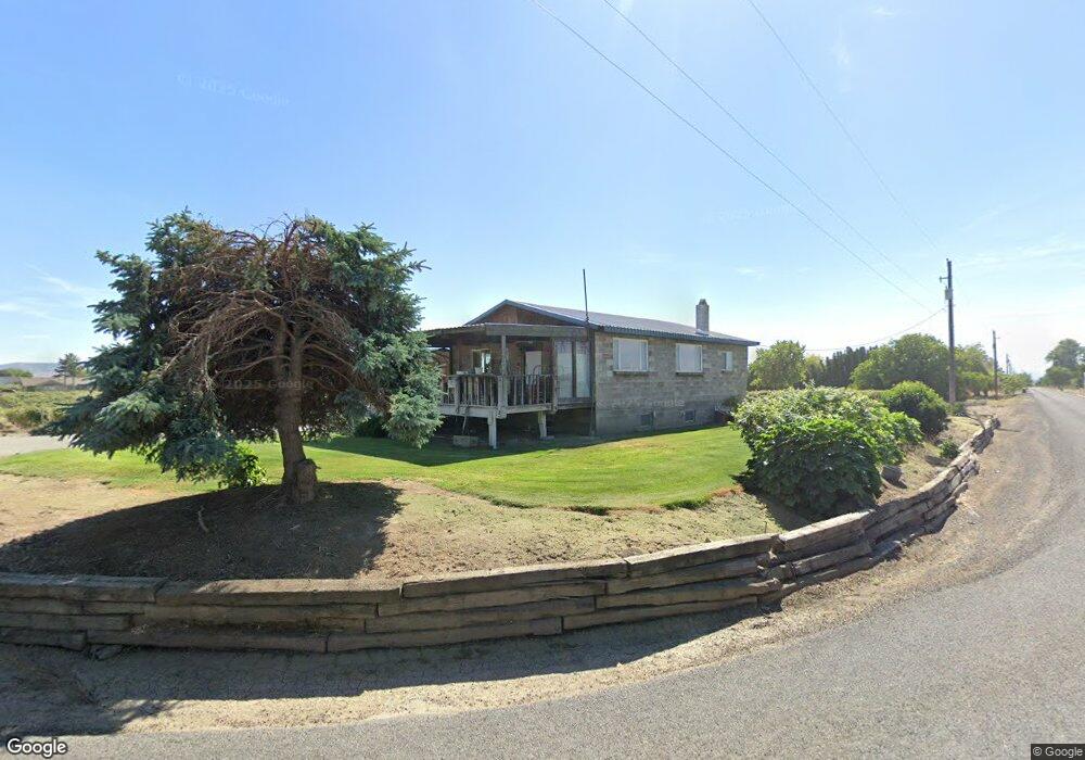
1520 Olmstead Rd Grandview, WA 98930
Estimated Value: $329,510 - $827,000
2
Beds
1
Bath
1,120
Sq Ft
$408/Sq Ft
Est. Value
About This Home
This home is located at 1520 Olmstead Rd, Grandview, WA 98930 and is currently estimated at $457,128, approximately $408 per square foot. 1520 Olmstead Rd is a home located in Yakima County with nearby schools including Grandview High School and Grandview Seventh-day Adventist School.
Ownership History
Date
Name
Owned For
Owner Type
Purchase Details
Closed on
Sep 27, 2006
Sold by
Danson Mary L and Gillis Mary L
Bought by
Danson Bradley M and Danson Mary L
Current Estimated Value
Home Financials for this Owner
Home Financials are based on the most recent Mortgage that was taken out on this home.
Original Mortgage
$109,208
Interest Rate
6.53%
Mortgage Type
FHA
Purchase Details
Closed on
Jul 20, 2006
Sold by
Bertsch Michael R and Bertsch Stella M
Bought by
Danson Mary L and Gillis Mary L
Create a Home Valuation Report for This Property
The Home Valuation Report is an in-depth analysis detailing your home's value as well as a comparison with similar homes in the area
Home Values in the Area
Average Home Value in this Area
Purchase History
| Date | Buyer | Sale Price | Title Company |
|---|---|---|---|
| Danson Bradley M | -- | Pacific Alliance Title Co | |
| Danson Mary L | -- | Pacific Alliance Title Co |
Source: Public Records
Mortgage History
| Date | Status | Borrower | Loan Amount |
|---|---|---|---|
| Previous Owner | Danson Bradley M | $109,208 |
Source: Public Records
Tax History Compared to Growth
Tax History
| Year | Tax Paid | Tax Assessment Tax Assessment Total Assessment is a certain percentage of the fair market value that is determined by local assessors to be the total taxable value of land and additions on the property. | Land | Improvement |
|---|---|---|---|---|
| 2025 | $2,514 | $255,500 | $62,300 | $193,200 |
| 2023 | $2,743 | $235,200 | $57,400 | $177,800 |
| 2022 | $359 | $213,700 | $56,000 | $157,700 |
| 2021 | $362 | $194,800 | $53,800 | $141,000 |
| 2019 | $1,658 | $124,000 | $49,300 | $74,700 |
| 2018 | $1,712 | $115,300 | $46,600 | $68,700 |
| 2017 | $1,501 | $112,200 | $46,600 | $65,600 |
| 2016 | $1,930 | $111,300 | $46,600 | $64,700 |
| 2015 | $1,930 | $115,600 | $46,600 | $69,000 |
| 2014 | $1,930 | $119,250 | $40,550 | $78,700 |
| 2013 | $1,930 | $119,250 | $40,550 | $78,700 |
Source: Public Records
Map
Nearby Homes
- 1921 Olmstead Rd
- TBD Wilson Hwy
- 0 Wilson Hwy
- 104 Luli St
- 108 Luli St
- 100 Luli St
- 0 Olmstead Rd
- 402 Amberly Ave
- TBD Apricot Rd
- NKA Puterbaugh Rd
- NKA Apricot Rd
- 608 Vineyard St Unit (Phase 2 Lot 15) Spe
- 602 Vineyard St
- 608 Vineyard St
- 602 Vineyard St Unit (Phase 2 Lot 12) Spe
- 610 Vineyard St
- 604 Vineyard St Unit (Phase 2 Lot 13) Spe
- 604 Vineyard St
- 606 Vineyard St Unit (Phase 2 Lot 14) Spe
- 610 Vineyard St Unit (Phase 2 Lot 16) Spe
- 1440 Olmstead Rd
- 1400 Olmstead Rd
- 1631 Olmstead Rd
- 1620 Olmstead Rd Unit HOME
- 1370 Olmstead Rd
- 1361 Olmstead Rd
- 1681 Olmstead Rd
- 1330 Olmstead Rd
- 1171 Olmstead Rd
- 1131 Olmstead Rd
- 850 Un-Assigned Rd
- 1071 Olmstead Rd
- 1101 Olmstead Rd
- 1025 Olmstead Rd
- 1539 N County Line Rd
- 131 Hanks Rd
- 151 Hanks Rd
- 991 Olmstead Rd
- 2040 Olmstead Rd
- 2050 Olmstead Rd