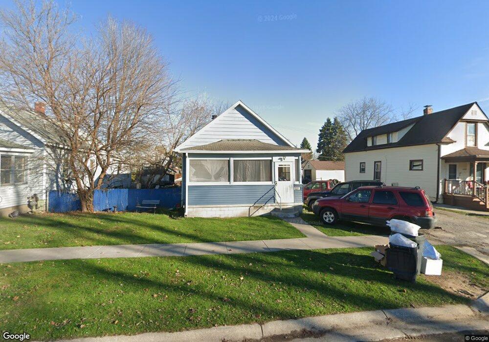
1520 Poplar St Port Huron, MI 48060
Estimated Value: $108,000 - $141,000
3
Beds
1
Bath
1,008
Sq Ft
$123/Sq Ft
Est. Value
About This Home
This home is located at 1520 Poplar St, Port Huron, MI 48060 and is currently estimated at $123,612, approximately $122 per square foot. 1520 Poplar St is a home located in St. Clair County with nearby schools including H.D. Crull Elementary School, Holland Woods Middle School, and Port Huron Northern High School.
Ownership History
Date
Name
Owned For
Owner Type
Purchase Details
Closed on
Apr 21, 2009
Sold by
Secretary Of Housing & Urban Development
Bought by
Teresinho Manuel
Current Estimated Value
Purchase Details
Closed on
Nov 10, 2008
Sold by
Chase Home Finance Llc
Bought by
The Secretary Of Housing And Urban Devel
Purchase Details
Closed on
May 8, 2008
Sold by
Lovely Leroy
Bought by
Chase Home Finance Llc
Create a Home Valuation Report for This Property
The Home Valuation Report is an in-depth analysis detailing your home's value as well as a comparison with similar homes in the area
Home Values in the Area
Average Home Value in this Area
Purchase History
| Date | Buyer | Sale Price | Title Company |
|---|---|---|---|
| Teresinho Manuel | $11,500 | None Available | |
| The Secretary Of Housing And Urban Devel | -- | None Available | |
| Chase Home Finance Llc | $34,030 | None Available |
Source: Public Records
Tax History Compared to Growth
Tax History
| Year | Tax Paid | Tax Assessment Tax Assessment Total Assessment is a certain percentage of the fair market value that is determined by local assessors to be the total taxable value of land and additions on the property. | Land | Improvement |
|---|---|---|---|---|
| 2025 | $2,298 | $44,700 | $0 | $0 |
| 2024 | $2,015 | $41,400 | $0 | $0 |
| 2023 | $1,908 | $36,700 | $0 | $0 |
| 2022 | $1,913 | $31,600 | $0 | $0 |
| 2021 | $1,791 | $29,100 | $0 | $0 |
| 2020 | $1,074 | $27,000 | $27,000 | $0 |
| 2019 | $1,055 | $18,700 | $0 | $0 |
| 2018 | $1,099 | $18,700 | $0 | $0 |
| 2017 | $948 | $17,600 | $0 | $0 |
| 2016 | $881 | $17,600 | $0 | $0 |
| 2015 | $866 | $16,000 | $16,000 | $0 |
| 2014 | $866 | $15,200 | $15,200 | $0 |
| 2013 | -- | $15,200 | $0 | $0 |
Source: Public Records
Map
Nearby Homes
- 1433 Poplar St
- 1417 Kearney St
- 1620 McBrady St
- 1649 Whipple St
- 1733 Whipple St
- 917 Saint Clair St
- 1002 Erie St
- 1907 Riverside Dr
- 711 Stanton St
- 1819 Riverside Dr
- 1321 Nelson St
- 2400 Stone St Unit 2414
- 805 Pine Grove Ave
- 0000 Campau Ave
- 2419 Cherry St
- 1203 Varney St
- 443 11th St
- 29 Taylor St
- 1116 Hancock St
- 1109 Wells St