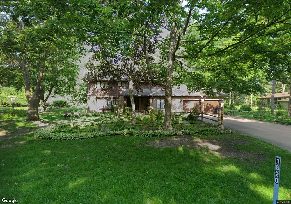
1520 S Circle Ln Palatine, IL 60067
Creekside NeighborhoodEstimated Value: $649,698 - $682,000
4
Beds
3
Baths
3,000
Sq Ft
$223/Sq Ft
Est. Value
About This Home
This home is located at 1520 S Circle Ln, Palatine, IL 60067 and is currently estimated at $668,425, approximately $222 per square foot. 1520 S Circle Ln is a home located in Cook County with nearby schools including Central Road Elementary School, Plum Grove Jr High School, and William Fremd High School.
Ownership History
Date
Name
Owned For
Owner Type
Purchase Details
Closed on
Jul 25, 2014
Sold by
Meyer Dale W
Bought by
Meyer Dale W and Dale W Meyer Revocable Trust
Current Estimated Value
Purchase Details
Closed on
Mar 21, 2007
Sold by
Meyer Dale W and Meyer Roberta I
Bought by
Meyer Dale W and Meyer Roberta I
Create a Home Valuation Report for This Property
The Home Valuation Report is an in-depth analysis detailing your home's value as well as a comparison with similar homes in the area
Home Values in the Area
Average Home Value in this Area
Purchase History
| Date | Buyer | Sale Price | Title Company |
|---|---|---|---|
| Meyer Dale W | -- | None Available | |
| Meyer Dale W | -- | None Available |
Source: Public Records
Tax History Compared to Growth
Tax History
| Year | Tax Paid | Tax Assessment Tax Assessment Total Assessment is a certain percentage of the fair market value that is determined by local assessors to be the total taxable value of land and additions on the property. | Land | Improvement |
|---|---|---|---|---|
| 2024 | $9,869 | $44,000 | $11,208 | $32,792 |
| 2023 | $9,809 | $44,000 | $11,208 | $32,792 |
| 2022 | $9,809 | $44,000 | $11,208 | $32,792 |
| 2021 | $10,537 | $39,262 | $7,132 | $32,130 |
| 2020 | $11,459 | $41,801 | $7,132 | $34,669 |
| 2019 | $11,425 | $46,706 | $7,132 | $39,574 |
| 2018 | $11,526 | $44,173 | $6,622 | $37,551 |
| 2017 | $9,914 | $44,173 | $6,622 | $37,551 |
| 2016 | $10,362 | $44,173 | $6,622 | $37,551 |
| 2015 | $11,772 | $43,901 | $6,113 | $37,788 |
| 2014 | $11,353 | $43,901 | $6,113 | $37,788 |
| 2013 | $10,726 | $43,901 | $6,113 | $37,788 |
Source: Public Records
Map
Nearby Homes
- 302 E Shady Dr
- 2650 Brookwood Way Dr Unit 108
- 2600 Brookwood Way Dr Unit 316
- 2600 Brookwood Way Dr Unit 305
- 2600 Brookwood Unit 314
- 4 Eton on Oxford
- 4301 Euclid Ave
- 4704 Euclid Ave Unit 1B
- 1808 Plum Grove Rd Unit 1B
- 2401 Rohlwing Rd
- 208 Brookdale Ln
- 4795 Woodcliff Ln
- 112 Ironwood Ct
- 3400 Wellington Ct Unit 306
- 32 W Fern Ct Unit 116B
- 36 W Fern Ct Unit 117B
- 3255 Kirchoff Rd Unit 306
- 3265 Kirchoff Rd Unit 223
- 216 Still Water Ct Unit 91
- 3 E Orchard Ln
- 1534 S Circle Ln Unit 2
- 1506 S Circle Ln
- 1501 S Circle Ln
- 1531 S California Ave
- 1537 S Circle Ln
- 2640 California Ave
- 2460 Chapman Ct
- 242 E Tall Trees Ln
- 2470 Chapman Ct
- 1545 S Circle Ln
- 226 E Tall Trees Ln
- 1549 S California Ave
- 262 E Shady Dr
- 305 E Shady Dr Unit 2
- 2450 Chapman Ct
- 282 E Tall Trees Ln
- 208 E Tall Trees Ln
- 284 E Shady Dr
- 2461 Chapman Ct
- 4451 Williamsburg Ct