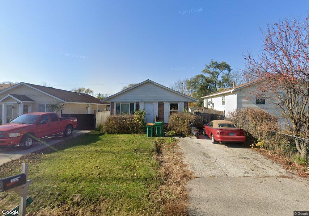
1520 Turnbull Dr Round Lake Beach, IL 60073
Estimated Value: $175,000 - $208,742
3
Beds
1
Bath
975
Sq Ft
$201/Sq Ft
Est. Value
About This Home
This home is located at 1520 Turnbull Dr, Round Lake Beach, IL 60073 and is currently estimated at $196,436, approximately $201 per square foot. 1520 Turnbull Dr is a home located in Lake County with nearby schools including Raymond Ellis Elementary School, Round Lake Middle School, and Round Lake High School.
Ownership History
Date
Name
Owned For
Owner Type
Purchase Details
Closed on
Sep 24, 1993
Sold by
Anderson James and Anderson Patricia
Bought by
Phillips Arthur J and Phillips Doreen
Current Estimated Value
Home Financials for this Owner
Home Financials are based on the most recent Mortgage that was taken out on this home.
Original Mortgage
$41,000
Interest Rate
7.22%
Create a Home Valuation Report for This Property
The Home Valuation Report is an in-depth analysis detailing your home's value as well as a comparison with similar homes in the area
Home Values in the Area
Average Home Value in this Area
Purchase History
| Date | Buyer | Sale Price | Title Company |
|---|---|---|---|
| Phillips Arthur J | $54,000 | Imperial Land Title Inc |
Source: Public Records
Mortgage History
| Date | Status | Borrower | Loan Amount |
|---|---|---|---|
| Closed | Phillips Arthur J | $41,000 |
Source: Public Records
Tax History Compared to Growth
Tax History
| Year | Tax Paid | Tax Assessment Tax Assessment Total Assessment is a certain percentage of the fair market value that is determined by local assessors to be the total taxable value of land and additions on the property. | Land | Improvement |
|---|---|---|---|---|
| 2024 | $3,564 | $51,051 | $8,985 | $42,066 |
| 2023 | $3,564 | $44,622 | $7,853 | $36,769 |
| 2022 | $3,553 | $41,753 | $6,901 | $34,852 |
| 2021 | $3,772 | $40,132 | $6,633 | $33,499 |
| 2020 | $3,386 | $36,297 | $6,312 | $29,985 |
| 2019 | $3,276 | $34,824 | $6,056 | $28,768 |
| 2018 | $3,183 | $30,060 | $5,807 | $24,253 |
| 2017 | $3,029 | $28,275 | $5,462 | $22,813 |
| 2016 | $2,872 | $26,101 | $5,042 | $21,059 |
| 2015 | $2,754 | $23,845 | $4,606 | $19,239 |
| 2014 | $3,306 | $28,113 | $4,358 | $23,755 |
| 2012 | $3,328 | $29,360 | $4,551 | $24,809 |
Source: Public Records
Map
Nearby Homes
- 1506 Brentwood Dr
- 1503 Cherokee Dr
- 1615 Cherokee Dr
- 1315 Cherokee Dr
- 630 Morningside Dr
- 933 Tomahawk Trail
- 1724 Lotus Dr
- 908 Flintwood Ct
- 1813 Tomahawk Trail
- 24513 W Stub Ave
- 1110 N Fairfield Rd
- 24536 W Stub Ave
- 1610 Goldenrod Terrace
- 24530 W Lake Shore Dr
- 1221 N Fairfield Rd
- 1401 Meadowbrook Dr
- 930 N Fairfield Rd
- 24576 W Norelius Ave
- 1410 Juneway Terrace
- 1248 N Red Oak Cir Unit 2
- 1518 Turnbull Dr
- 831 Golfview Dr
- 1516 Turnbull Dr
- 1514 Turnbull Dr
- 1517 Brentwood Dr
- 1521 Brentwood Dr
- 1515 Brentwood Dr
- 832 Golfview Dr
- 1519 Turnbull Dr
- 1513 Brentwood Dr
- 1521 Turnbull Dr
- 1517 Turnbull Dr
- 1512 Turnbull Dr
- 1515 Turnbull Dr
- 1525 Brentwood Dr
- 1511 Brentwood Dr
- 1513 Turnbull Dr
- 1525 Turnbull Dr
- 1527 Brentwood Dr