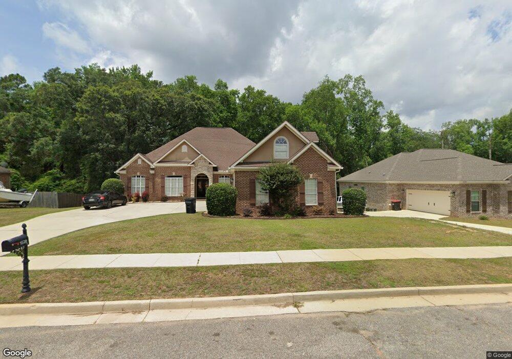
1520 Vassar Ct Mobile, AL 36695
Warwick NeighborhoodEstimated Value: $383,029 - $433,000
11
Beds
3
Baths
3,380
Sq Ft
$123/Sq Ft
Est. Value
About This Home
This home is located at 1520 Vassar Ct, Mobile, AL 36695 and is currently estimated at $415,507, approximately $122 per square foot. 1520 Vassar Ct is a home located in Mobile County with nearby schools including Elsie Collier Elementary School, Bernice J Causey Middle School, and Baker High School.
Ownership History
Date
Name
Owned For
Owner Type
Purchase Details
Closed on
Jul 2, 2007
Sold by
Springfield Llc
Bought by
Sanderson Edward P and Sanderson Courtney P
Current Estimated Value
Home Financials for this Owner
Home Financials are based on the most recent Mortgage that was taken out on this home.
Original Mortgage
$254,400
Outstanding Balance
$155,670
Interest Rate
6.37%
Mortgage Type
Construction
Estimated Equity
$259,837
Create a Home Valuation Report for This Property
The Home Valuation Report is an in-depth analysis detailing your home's value as well as a comparison with similar homes in the area
Home Values in the Area
Average Home Value in this Area
Purchase History
We collect this data history from publicly available records. To have your information removed, we recommend requesting removal directly through your county’s website.
| Date | Buyer | Sale Price | Title Company |
|---|---|---|---|
| Sanderson Edward P | $40,500 | Slt |
Source: Public Records
Mortgage History
We collect this data history from publicly available records. To have your information removed, we recommend requesting removal directly through your county’s website.
| Date | Status | Borrower | Loan Amount |
|---|---|---|---|
| Open | Sanderson Edward P | $254,400 |
Source: Public Records
Tax History
| Year | Tax Paid | Tax Assessment Tax Assessment Total Assessment is a certain percentage of the fair market value that is determined by local assessors to be the total taxable value of land and additions on the property. | Land | Improvement |
|---|---|---|---|---|
| 2025 | $1,817 | $38,830 | $4,200 | $34,630 |
| 2024 | $1,817 | $37,960 | $4,200 | $33,760 |
| 2023 | $1,612 | $34,610 | $4,900 | $29,710 |
| 2022 | $1,433 | $30,920 | $4,260 | $26,660 |
| 2021 | $1,306 | $28,300 | $3,800 | $24,500 |
| 2020 | $1,319 | $28,580 | $3,800 | $24,780 |
| 2019 | $1,275 | $27,660 | $0 | $0 |
| 2018 | $1,295 | $28,080 | $0 | $0 |
| 2017 | $1,315 | $28,500 | $0 | $0 |
| 2016 | $1,469 | $31,660 | $0 | $0 |
| 2013 | $1,296 | $27,860 | $0 | $0 |
Source: Public Records
Map
Nearby Homes
- 8898 Augusta Ct
- 0 Twelve Oaks Dr Unit 7776397
- 0 Twelve Oaks Dr Unit 30
- 8859 Aiken Way
- 1609 Woodberry Dr
- 8601 Grelot Rd
- 8577 the Pines of Dawes Dr
- 8565 the Pines of Dawes Dr
- 8555 the Pines of Dawes Dr
- 1371 Rosefield Dr E
- 0 Air Terminal Dr Unit 7717451
- 3943 Ohara Dr
- 9029 Crain Ave
- 9002 Amelia Dr
- 8391 Jeff Hamilton Road Extension
- 8391 Jeff Hamilton Road Extension
- 9056 Redberry Dr
- 8405 Calgary Dr
- 8440 Kendall Ct N
- 1871 Harrington Way
- 1510 Vassar Ct Unit 14
- 1510 Vassar Ct
- 1530 Vassar Ct
- 1550 Vassar Ct
- 1500 Vassar Ct Unit 13
- 1550 Vassar Ct Unit 18
- 0 Vassar Ct Unit 7110166
- 0 Vassar Ct Unit 14 0517595
- 0 Vassar Ct Unit 517483
- 0 Vassar Ct Unit 12 0517418
- 0 Vassar Ct Unit 12 0227574
- 0 Vassar Ct Unit 19 0245229
- 0 Vassar Ct Unit 20 0245083
- 0 Vassar Ct
- 1540 Vassar Ct
- 1529 Vassar Ct
- 1509 Vassar Ct
- 1539 Vassar Ct
- 1499 Vassar Ct
- 1549 Vassar Ct
Your Personal Tour Guide
Ask me questions while you tour the home.