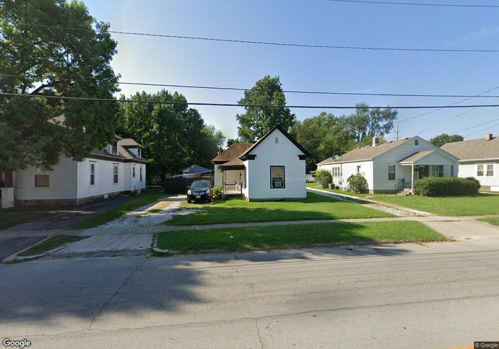
1520 W Atlantic St Springfield, MO 65803
Woodland Heights NeighborhoodEstimated Value: $55,000 - $119,000
2
Beds
1
Bath
700
Sq Ft
$132/Sq Ft
Est. Value
About This Home
This home is located at 1520 W Atlantic St, Springfield, MO 65803 and is currently estimated at $92,057, approximately $131 per square foot. 1520 W Atlantic St is a home located in Greene County with nearby schools including Bowerman Elementary School, Reed Academy, and Hillcrest High School.
Ownership History
Date
Name
Owned For
Owner Type
Purchase Details
Closed on
Mar 1, 2024
Sold by
Taylor Richard D and Taylor Rebecca A
Bought by
Schartel Shawn
Current Estimated Value
Purchase Details
Closed on
Feb 20, 2024
Sold by
Ashlock Kenneth R
Bought by
Richard D Taylor And Rebecca A Taylor Revocab and Taylor
Purchase Details
Closed on
Sep 19, 2003
Sold by
Smith Laura
Bought by
Taylor Richard and Taylor Rebecca
Create a Home Valuation Report for This Property
The Home Valuation Report is an in-depth analysis detailing your home's value as well as a comparison with similar homes in the area
Home Values in the Area
Average Home Value in this Area
Purchase History
| Date | Buyer | Sale Price | Title Company |
|---|---|---|---|
| Schartel Shawn | -- | Hickory County Title | |
| Schartel Shawn | -- | Hickory County Title | |
| Richard D Taylor And Rebecca A Taylor Revocab | $34,000 | Hickory County Title | |
| Taylor Richard | -- | Lincoln Evans Title Co Inc |
Source: Public Records
Tax History Compared to Growth
Tax History
| Year | Tax Paid | Tax Assessment Tax Assessment Total Assessment is a certain percentage of the fair market value that is determined by local assessors to be the total taxable value of land and additions on the property. | Land | Improvement |
|---|---|---|---|---|
| 2025 | $306 | $7,890 | $3,800 | $4,090 |
| 2024 | $306 | $5,710 | $2,190 | $3,520 |
| 2023 | $305 | $5,710 | $2,190 | $3,520 |
| 2022 | $312 | $5,710 | $2,190 | $3,520 |
| 2021 | $312 | $5,710 | $2,190 | $3,520 |
| 2020 | $326 | $5,710 | $2,190 | $3,520 |
| 2019 | $317 | $5,710 | $2,190 | $3,520 |
| 2018 | $303 | $5,460 | $2,190 | $3,270 |
| 2017 | $300 | $5,460 | $2,190 | $3,270 |
| 2016 | $299 | $5,460 | $2,190 | $3,270 |
| 2015 | $297 | $5,460 | $2,190 | $3,270 |
| 2014 | $286 | $5,230 | $2,190 | $3,040 |
Source: Public Records
Map
Nearby Homes
- 1516 W Lee St
- 1630 W Atlantic St
- 1700 W Atlantic St
- 1720 W Florida St
- 2122 N Newton Ave
- 1210 W Atlantic St
- 1710 W High St
- 1207 W Florida St
- 1925 W Atlantic St
- 2219 N Nettleton Ave
- 1201 W Chase St
- 2228 N Farmer Ave
- 1944 W Thoman St
- 1956 W Atlantic St
- 2130 N Elizabeth Ave
- 2074 N Albertha Ave
- 2234 N Fay Ave
- 2010 W Atlantic St
- 2042 N Marion Ave
- 2100 W Lee St
- 1526 W Atlantic St
- 1516 W Atlantic St
- 1512 W Atlantic St
- 1532 W Atlantic St
- 1536 W Atlantic St
- 1506 W Atlantic St
- 1521 W Thoman St
- 1515 W Thoman St
- 1527 W Thoman St
- 1511 W Thoman St
- 1531 W Thoman St
- 1521 W Atlantic St
- 1535 W Thoman St
- 1507 W Thoman St
- 1533 W Atlantic St
- 1501 W Thoman St
- 1430 W Atlantic St
- 1426 W Atlantic St
- 1603 W Thoman St
- 1520 W Thoman St