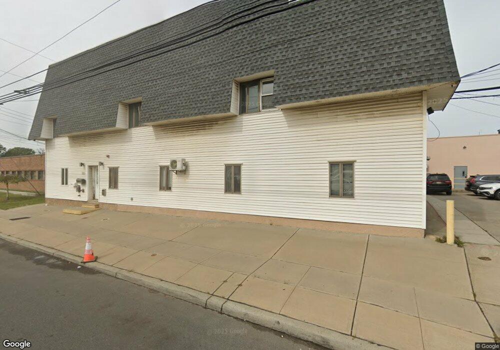
1520 W Elizabeth Ave Linden, NJ 07036
--
Bed
--
Bath
13,472
Sq Ft
1.06
Acres
About This Home
This home is located at 1520 W Elizabeth Ave, Linden, NJ 07036. 1520 W Elizabeth Ave is a home located in Union County with nearby schools including School No. 8, Myles J. McManus Middle School, and Linden High School.
Ownership History
Date
Name
Owned For
Owner Type
Purchase Details
Closed on
Feb 14, 2017
Sold by
1512 West Elizabeth Ave Llc
Bought by
Rainbow Terminal Llc
Home Financials for this Owner
Home Financials are based on the most recent Mortgage that was taken out on this home.
Original Mortgage
$1,800,000
Outstanding Balance
$1,485,715
Interest Rate
4.09%
Mortgage Type
Commercial
Purchase Details
Closed on
Dec 8, 2009
Sold by
The Lubrizol Corporation
Bought by
1512 West Elizabeth Avenue Llc
Create a Home Valuation Report for This Property
The Home Valuation Report is an in-depth analysis detailing your home's value as well as a comparison with similar homes in the area
Home Values in the Area
Average Home Value in this Area
Purchase History
| Date | Buyer | Sale Price | Title Company |
|---|---|---|---|
| Rainbow Terminal Llc | $2,150,000 | Title Agency Of New Jersey I | |
| 1512 West Elizabeth Avenue Llc | $750,000 | None Available |
Source: Public Records
Mortgage History
| Date | Status | Borrower | Loan Amount |
|---|---|---|---|
| Open | Rainbow Terminal Llc | $1,800,000 |
Source: Public Records
Tax History Compared to Growth
Tax History
| Year | Tax Paid | Tax Assessment Tax Assessment Total Assessment is a certain percentage of the fair market value that is determined by local assessors to be the total taxable value of land and additions on the property. | Land | Improvement |
|---|---|---|---|---|
| 2025 | $23,628 | $336,000 | $212,000 | $124,000 |
| 2024 | $20,146 | $336,000 | $212,000 | $124,000 |
| 2023 | $20,146 | $292,900 | $212,000 | $80,900 |
| 2022 | $20,251 | $292,900 | $212,000 | $80,900 |
| 2021 | $20,354 | $292,900 | $212,000 | $80,900 |
| 2020 | $20,245 | $292,900 | $212,000 | $80,900 |
| 2019 | $20,178 | $292,900 | $212,000 | $80,900 |
| 2018 | $20,172 | $292,900 | $212,000 | $80,900 |
| 2017 | $16,164 | $239,900 | $159,000 | $80,900 |
| 2016 | $15,656 | $239,900 | $159,000 | $80,900 |
| 2015 | $15,059 | $239,900 | $159,000 | $80,900 |
| 2014 | $14,766 | $239,900 | $159,000 | $80,900 |
Source: Public Records
Map
Nearby Homes
- 214 Bradford Ave
- 1811 W Price St
- 211 Bradford Ave
- 392 Lower Alden Dr
- 374 Raleigh Rd
- 312 Amon Terrace
- 1019 W Henry St
- 244 W Scott Ave Unit 2
- 2012 Price St
- 349 Miltonia St
- 2184 Evans St Unit 1
- 272 Egolf Dr
- 420 Miltonia St
- 707 Erudo St
- 746 N Stiles St
- 324 Dewitt St
- 2000 Whittier St
- 651 W Lincoln Ave
- 606 Knopf St
- 706 Lindegar St
- 1512 W Elizabeth Ave Unit 2A
- 1512 W Elizabeth Ave Unit 2B
- 1512 W Elizabeth Ave
- 1529 W Elizabeth Ave
- 127 Marion Ave
- 151 Marion Ave
- 191 Marion Ave
- 140 Lexington Ave
- 150 Lexington Ave
- 160 Lexington Ave
- 125 Lexington Ave
- 201 Lexington Ave
- 205 Lexington Ave
- 110 Bradford Ave
- 225 Marion Ave
- 225 Marion Ave Unit 2
- 225 Marion Ave Unit 1
- 114 Bradford Ave
- 230 Marion Ave Unit 230
- 120 Bradford Ave