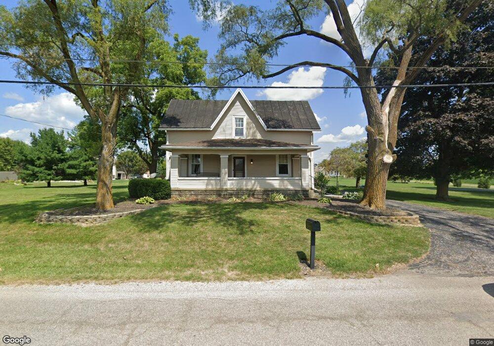
1520 W Southern Ave Bucyrus, OH 44820
Estimated Value: $199,000 - $448,000
4
Beds
2
Baths
2,726
Sq Ft
$110/Sq Ft
Est. Value
About This Home
This home is located at 1520 W Southern Ave, Bucyrus, OH 44820 and is currently estimated at $298,836, approximately $109 per square foot. 1520 W Southern Ave is a home located in Crawford County with nearby schools including Wynford Elementary School, Wynford High School, and Wayside Christian School.
Ownership History
Date
Name
Owned For
Owner Type
Purchase Details
Closed on
Oct 28, 2011
Sold by
Stitzlein Michael P and Stitzlein Lidna G
Bought by
Stump Jennifer
Current Estimated Value
Home Financials for this Owner
Home Financials are based on the most recent Mortgage that was taken out on this home.
Original Mortgage
$150,510
Outstanding Balance
$102,633
Interest Rate
4.02%
Mortgage Type
New Conventional
Estimated Equity
$196,203
Create a Home Valuation Report for This Property
The Home Valuation Report is an in-depth analysis detailing your home's value as well as a comparison with similar homes in the area
Home Values in the Area
Average Home Value in this Area
Purchase History
| Date | Buyer | Sale Price | Title Company |
|---|---|---|---|
| Stump Jennifer | $147,500 | None Available |
Source: Public Records
Mortgage History
| Date | Status | Borrower | Loan Amount |
|---|---|---|---|
| Open | Stump Jennifer | $150,510 |
Source: Public Records
Tax History Compared to Growth
Tax History
| Year | Tax Paid | Tax Assessment Tax Assessment Total Assessment is a certain percentage of the fair market value that is determined by local assessors to be the total taxable value of land and additions on the property. | Land | Improvement |
|---|---|---|---|---|
| 2024 | $2,099 | $47,770 | $11,380 | $36,390 |
| 2023 | $2,099 | $35,380 | $9,510 | $25,870 |
| 2022 | $1,839 | $35,380 | $9,510 | $25,870 |
| 2021 | $1,835 | $35,380 | $9,510 | $25,870 |
| 2020 | $1,612 | $29,460 | $9,510 | $19,950 |
| 2019 | $1,648 | $29,460 | $9,510 | $19,950 |
| 2018 | $1,640 | $29,460 | $9,510 | $19,950 |
| 2017 | $1,886 | $32,710 | $9,510 | $23,200 |
| 2016 | $1,828 | $32,710 | $9,510 | $23,200 |
| 2015 | $1,802 | $32,710 | $9,510 | $23,200 |
| 2014 | $1,793 | $32,710 | $9,510 | $23,200 |
| 2013 | $1,793 | $32,710 | $9,510 | $23,200 |
Source: Public Records
Map
Nearby Homes
- 130 Brentwood St
- 275 Brentwood St
- 1112 Hillcrest Dr
- 1149 Farmview Dr
- 2440 Wyandot Rd
- 1123 Hillcrest Dr
- 1145 Lynne Ave
- 0 Lynne Ave
- 1315 Lynne Ave
- 1555 Rosedale Ave
- 2273 Kerstetter Rd
- 452 Pleasant Ln
- 325 W Liberty St
- 900 S Spring St
- 1211 S Sandusky Ave
- 1021 S Sandusky Ave
- 317 S Spring St
- 316 W Warren St
- 885 W Perry St
- 708 S Sandusky Ave
- 205 Brentwood St
- 211 Brentwood St
- 1530 W Southern Ave
- 1400 Fairmeadow Dr
- 1101 Hillcrest Dr
- 1101 Hillcrest Dr
- 215 Brentwood St
- 200 Brentwood St
- 1103 Hillcrest Dr
- 1103 Hillcrest Dr
- 1406 Fairmeadow Dr
- 1403 Fairmeadow Dr
- 1100 Hillcrest Dr
- 1540 W Southern Ave
- 225 Brentwood St
- 1405 Fairmeadow Dr
- 1102 Hillcrest Dr
- 1105 Hillcrest Dr
- 1105 Hillcrest Dr
- 1408 Fairmeadow Dr