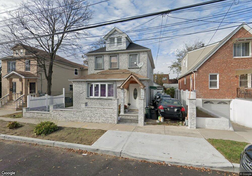
15205 134th Ave Jamaica, NY 11434
Rochdale NeighborhoodEstimated Value: $819,467 - $945,000
--
Bed
--
Bath
1,680
Sq Ft
$521/Sq Ft
Est. Value
About This Home
This home is located at 15205 134th Ave, Jamaica, NY 11434 and is currently estimated at $876,117, approximately $521 per square foot. 15205 134th Ave is a home located in Queens County with nearby schools including P.S. 45 Clarence Witherspoon, J.H.S. 226 Virgil I. Grisson, and Rochdale Early Advantage Charter School.
Ownership History
Date
Name
Owned For
Owner Type
Purchase Details
Closed on
Apr 1, 1999
Sold by
Howard Andrew and Howard Sheryl D
Bought by
Dosunmu Lanray B
Current Estimated Value
Home Financials for this Owner
Home Financials are based on the most recent Mortgage that was taken out on this home.
Original Mortgage
$138,906
Interest Rate
6.88%
Mortgage Type
FHA
Purchase Details
Closed on
Feb 23, 1996
Sold by
Howard Andrew
Bought by
Howard Andrew and Howard Sheryl D
Create a Home Valuation Report for This Property
The Home Valuation Report is an in-depth analysis detailing your home's value as well as a comparison with similar homes in the area
Home Values in the Area
Average Home Value in this Area
Purchase History
| Date | Buyer | Sale Price | Title Company |
|---|---|---|---|
| Dosunmu Lanray B | $139,000 | Stewart Title Insurance Co | |
| Dosunmu Lanray B | $139,000 | Stewart Title Insurance Co | |
| Howard Andrew | -- | -- | |
| Howard Andrew | -- | -- |
Source: Public Records
Mortgage History
| Date | Status | Borrower | Loan Amount |
|---|---|---|---|
| Previous Owner | Dosunmu Lanray B | $138,906 |
Source: Public Records
Tax History Compared to Growth
Tax History
| Year | Tax Paid | Tax Assessment Tax Assessment Total Assessment is a certain percentage of the fair market value that is determined by local assessors to be the total taxable value of land and additions on the property. | Land | Improvement |
|---|---|---|---|---|
| 2025 | $5,571 | $33,428 | $11,113 | $22,315 |
| 2024 | $2,508 | $31,536 | $10,347 | $21,189 |
| 2023 | $2,372 | $31,225 | $11,408 | $19,817 |
| 2022 | $2,281 | $42,360 | $15,060 | $27,300 |
| 2021 | $2,282 | $39,540 | $15,060 | $24,480 |
| 2020 | $2,289 | $40,140 | $15,060 | $25,080 |
| 2019 | $5,205 | $40,920 | $15,060 | $25,860 |
| 2018 | $5,007 | $26,021 | $11,438 | $14,583 |
| 2017 | $2,398 | $24,549 | $11,411 | $13,138 |
| 2016 | $4,346 | $24,549 | $11,411 | $13,138 |
| 2015 | $2,574 | $23,214 | $15,720 | $7,494 |
| 2014 | $2,574 | $21,900 | $16,740 | $5,160 |
Source: Public Records
Map
Nearby Homes
- 15124 134th Ave
- 13426 154th St
- 132-55 154th St
- 134-30 155th St
- 154-20 132nd Ave
- 155-15 134th Ave
- 155-17 134th Ave
- 155-20 132nd Ave
- 132-03 155th St
- 129-44 155th St
- 13437 157th St
- 154-05 129th Ave
- 128-22 149th St
- 130-11 147th St
- 147-03 130th Ave
- 14428 158th St
- 126-27 147th St
- 137-05 159th St
- 14717 N Conduit Ave
- 166-05 144th Ave
- 152-21 134th Ave
- 15209 134th Ave
- 15201 134th Ave
- 152-09 134th Ave Unit 2
- 152-09 134th Ave
- 15201 134th Ave
- 13307 Cranston St
- 15213 134th Ave
- 152-13 134th Ave
- 13305 Cranston St
- 133-05 Cranston St
- 152-17 134th Ave
- 15217 134th Ave
- 133-01 Cranston St Unit 2
- 133-01 Cranston St
- 13301 Cranston St
- 15171 134th Ave
- 15221 134th Ave
- 15154 133rd Ave
- 15206 134th Ave