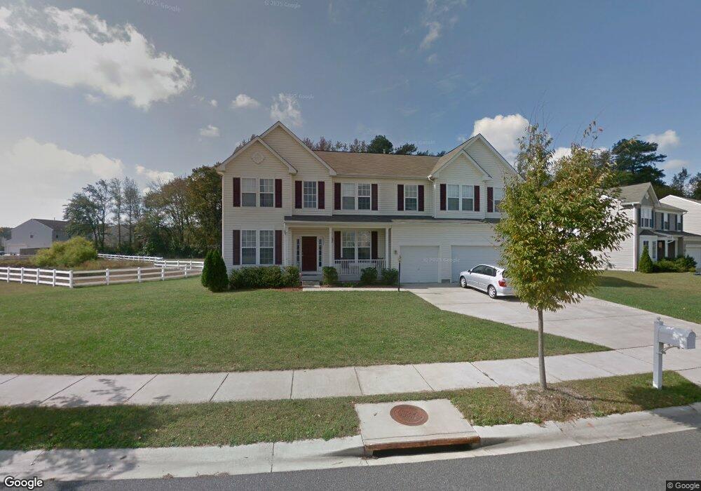
1521 Cattail Commons Way Denton, MD 21629
Estimated Value: $399,127 - $468,000
4
Beds
3
Baths
3,863
Sq Ft
$112/Sq Ft
Est. Value
About This Home
This home is located at 1521 Cattail Commons Way, Denton, MD 21629 and is currently estimated at $433,532, approximately $112 per square foot. 1521 Cattail Commons Way is a home located in Caroline County with nearby schools including Denton Elementary School, Lockerman Middle School, and North Caroline High School.
Ownership History
Date
Name
Owned For
Owner Type
Purchase Details
Closed on
Dec 2, 2010
Sold by
Bunn Rona M
Bought by
Bramble Emerson Thomas
Current Estimated Value
Home Financials for this Owner
Home Financials are based on the most recent Mortgage that was taken out on this home.
Original Mortgage
$191,250
Outstanding Balance
$126,484
Interest Rate
4.24%
Mortgage Type
New Conventional
Estimated Equity
$307,048
Purchase Details
Closed on
Mar 28, 2007
Sold by
Ryl& Group Inc
Bought by
Bunn Rona M
Home Financials for this Owner
Home Financials are based on the most recent Mortgage that was taken out on this home.
Original Mortgage
$362,730
Interest Rate
6.4%
Mortgage Type
Purchase Money Mortgage
Purchase Details
Closed on
Mar 9, 2007
Sold by
Ryl& Group Inc
Bought by
Bunn Rona M
Home Financials for this Owner
Home Financials are based on the most recent Mortgage that was taken out on this home.
Original Mortgage
$362,730
Interest Rate
6.4%
Mortgage Type
Purchase Money Mortgage
Create a Home Valuation Report for This Property
The Home Valuation Report is an in-depth analysis detailing your home's value as well as a comparison with similar homes in the area
Home Values in the Area
Average Home Value in this Area
Purchase History
| Date | Buyer | Sale Price | Title Company |
|---|---|---|---|
| Bramble Emerson Thomas | $225,000 | -- | |
| Bunn Rona M | $453,420 | -- | |
| Bunn Rona M | $453,420 | -- |
Source: Public Records
Mortgage History
| Date | Status | Borrower | Loan Amount |
|---|---|---|---|
| Open | Bramble Emerson Thomas | $191,250 | |
| Previous Owner | Bunn Rona M | $362,730 | |
| Previous Owner | Bunn Rona M | $362,730 |
Source: Public Records
Tax History Compared to Growth
Tax History
| Year | Tax Paid | Tax Assessment Tax Assessment Total Assessment is a certain percentage of the fair market value that is determined by local assessors to be the total taxable value of land and additions on the property. | Land | Improvement |
|---|---|---|---|---|
| 2025 | $5,236 | $360,500 | $45,700 | $314,800 |
| 2024 | $5,093 | $332,533 | $0 | $0 |
| 2023 | $4,953 | $304,567 | $0 | $0 |
| 2022 | $4,790 | $276,600 | $45,700 | $230,900 |
| 2021 | $4,493 | $264,200 | $0 | $0 |
| 2020 | $4,493 | $251,800 | $0 | $0 |
| 2019 | $4,314 | $239,400 | $25,900 | $213,500 |
| 2018 | $4,290 | $239,400 | $25,900 | $213,500 |
| 2017 | $4,242 | $239,400 | $0 | $0 |
| 2016 | -- | $246,300 | $0 | $0 |
| 2015 | $3,943 | $246,300 | $0 | $0 |
| 2014 | $3,943 | $246,300 | $0 | $0 |
Source: Public Records
Map
Nearby Homes
- 1612 Cattail Commons Way
- 1233 Painted Fern Rd
- 1111 Ruddy Duck Ct
- 1626 Blue Heron Dr
- 1403 Blue Heron Dr
- 1202 Blue Heron Dr
- 1105 Market St
- 106 Briarwood Cir
- 1005 Market St
- 804 Gay St
- 800 Gay St
- 406 Morning Glory Dr
- 536 Gay St
- 501 Lincoln St
- 106 S 6th St
- 307 Academy Ave
- 208 S 3rd St
- 121 Edenton Ln
- 311 Kerr Ave
- 318 Carter Ave
- 1601 Cattail Commons Way
- 1524 Cattail Commons Way
- 1522 Cattail Commons Way
- 1600 Cattail Commons Way
- 1520 Cattail Commons Way
- 1602 Cattail Commons Way
- 1518 Cattail Commons Way
- 1605 Cattail Commons Way
- 1604 Cattail Commons Way
- 1516 Cattail Commons Way
- 1103 Daylily Ln
- 1513 Cattail Commons Way
- 1105 Daylily Ln
- 1511 Cattail Commons Way
- 1514 Cattail Commons Way
- 1606 Cattail Commons Way
- 1607 Cattail Commons Way
- 1107 Daylily Ln
- 1509 Cattail Commons Way
- 1512 Cattail Commons Way