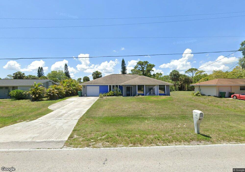
1521 Harbor Blvd Port Charlotte, FL 33952
Estimated Value: $231,000 - $324,000
4
Beds
3
Baths
1,935
Sq Ft
$147/Sq Ft
Est. Value
About This Home
This home is located at 1521 Harbor Blvd, Port Charlotte, FL 33952 and is currently estimated at $284,947, approximately $147 per square foot. 1521 Harbor Blvd is a home located in Charlotte County with nearby schools including Neil Armstrong Elementary School, Port Charlotte Middle School, and Port Charlotte High School.
Ownership History
Date
Name
Owned For
Owner Type
Purchase Details
Closed on
Aug 28, 2015
Sold by
Marshner Gene and Marshner Doris
Bought by
Hayes Christopher M and Hayes Jeanene
Current Estimated Value
Purchase Details
Closed on
Aug 28, 2012
Sold by
Marshner Gene
Bought by
Marshner Dolly J
Purchase Details
Closed on
Dec 28, 2011
Sold by
Austin Timothy
Bought by
Marshner Gene
Purchase Details
Closed on
Dec 16, 2011
Sold by
Entrust Ira Southwest Florida Llc
Bought by
Austin Timothy A
Purchase Details
Closed on
Jul 9, 2002
Sold by
Brown John M and Brown Sharon L
Bought by
Arundel Anne and Gartelman Dolly
Purchase Details
Closed on
Jun 29, 1998
Sold by
Buratti Carmel
Bought by
Brown John M and Brown Sharon L
Home Financials for this Owner
Home Financials are based on the most recent Mortgage that was taken out on this home.
Original Mortgage
$58,000
Interest Rate
7.1%
Create a Home Valuation Report for This Property
The Home Valuation Report is an in-depth analysis detailing your home's value as well as a comparison with similar homes in the area
Home Values in the Area
Average Home Value in this Area
Purchase History
| Date | Buyer | Sale Price | Title Company |
|---|---|---|---|
| Hayes Christopher M | -- | Attorney | |
| Marshner Dolly J | -- | Attorney | |
| Marshner Gene | -- | None Available | |
| Austin Timothy A | $60,000 | Attorney | |
| Arundel Anne | $90,000 | -- | |
| Brown John M | $78,000 | -- |
Source: Public Records
Mortgage History
| Date | Status | Borrower | Loan Amount |
|---|---|---|---|
| Previous Owner | Brown John M | $58,000 |
Source: Public Records
Tax History Compared to Growth
Tax History
| Year | Tax Paid | Tax Assessment Tax Assessment Total Assessment is a certain percentage of the fair market value that is determined by local assessors to be the total taxable value of land and additions on the property. | Land | Improvement |
|---|---|---|---|---|
| 2023 | $4,445 | $209,018 | $0 | $0 |
| 2022 | $3,832 | $209,330 | $20,400 | $188,930 |
| 2021 | $3,532 | $172,742 | $9,138 | $163,604 |
| 2020 | $3,498 | $171,350 | $8,500 | $162,850 |
| 2019 | $2,771 | $169,378 | $8,500 | $160,878 |
| 2018 | $1,450 | $97,458 | $0 | $0 |
| 2017 | $1,430 | $95,453 | $0 | $0 |
| 2016 | $1,415 | $93,490 | $0 | $0 |
| 2015 | $1,400 | $92,840 | $0 | $0 |
| 2014 | $1,375 | $92,103 | $0 | $0 |
Source: Public Records
Map
Nearby Homes
- 21432 Bryn Mawr Ave
- 1505 Harbor Blvd
- 1497 Harbor Blvd
- 21431 Circlewood Ave
- 21460 Dawson Ave
- 1505 Fireside St
- 1529 Fireside St
- 1425 Harbor Blvd
- 1578 Adrian St
- 1586 Scotten St
- 1603 Scotten St
- 1516 Birchcrest Blvd
- 1556 Birchcrest Blvd
- 2116 Hanson St
- 21511 Carleton Ave
- 1050 Birchcrest Blvd
- 1604 Birchcrest Blvd
- 1665 Harmony Dr
- 2144 Harbor Blvd
- 1656 Harmony Dr
- 1513 Harbor Blvd
- 1529 Harbor Blvd
- Bryn Mawr Ave
- Bryn Mawr Ave
- 1537 Boulevard
- 1537 Harbor Blvd
- 1545 Harbor Blvd
- Winlock Ave
- 1542 Forand Cir
- 1550 Forand Cir
- 1534 Forand Cir
- 1558 Forand Cir
- 1496 Harbor Blvd
- 21444 Winlock Ave
- 1489 Harbor Blvd
- 1553 Harbor Blvd
- 21447 Bryn Mawr Ave
- 21452 Winlock Ave
- 1518 Forand Cir
- 1566 Forand Cir