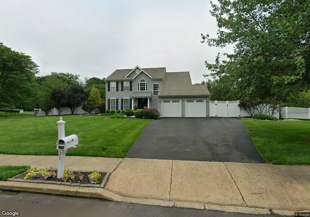
1521 Huntly Dr Warrington, PA 18976
Estimated Value: $796,619 - $885,000
4
Beds
3
Baths
2,568
Sq Ft
$329/Sq Ft
Est. Value
About This Home
This home is located at 1521 Huntly Dr, Warrington, PA 18976 and is currently estimated at $843,655, approximately $328 per square foot. 1521 Huntly Dr is a home located in Bucks County with nearby schools including Barclay Elementary School, Tamanend Middle School, and Central Bucks High School - South.
Ownership History
Date
Name
Owned For
Owner Type
Purchase Details
Closed on
Aug 20, 1999
Sold by
Weber Kenneth P and Weber Katherine M
Bought by
Clancy Daniel and Clancy Andrea L
Current Estimated Value
Home Financials for this Owner
Home Financials are based on the most recent Mortgage that was taken out on this home.
Original Mortgage
$200,000
Outstanding Balance
$56,934
Interest Rate
7.53%
Estimated Equity
$786,721
Purchase Details
Closed on
Aug 11, 1993
Bought by
Weber Kenneth P and Weber Katherine M
Create a Home Valuation Report for This Property
The Home Valuation Report is an in-depth analysis detailing your home's value as well as a comparison with similar homes in the area
Home Values in the Area
Average Home Value in this Area
Purchase History
| Date | Buyer | Sale Price | Title Company |
|---|---|---|---|
| Clancy Daniel | $260,000 | Lawyers Title Insurance Corp | |
| Weber Kenneth P | $202,700 | -- |
Source: Public Records
Mortgage History
| Date | Status | Borrower | Loan Amount |
|---|---|---|---|
| Open | Clancy Daniel | $200,000 |
Source: Public Records
Tax History Compared to Growth
Tax History
| Year | Tax Paid | Tax Assessment Tax Assessment Total Assessment is a certain percentage of the fair market value that is determined by local assessors to be the total taxable value of land and additions on the property. | Land | Improvement |
|---|---|---|---|---|
| 2025 | $7,401 | $42,520 | $12,600 | $29,920 |
| 2024 | $7,401 | $42,520 | $12,600 | $29,920 |
| 2023 | $7,166 | $42,520 | $12,600 | $29,920 |
| 2022 | $7,086 | $42,520 | $12,600 | $29,920 |
| 2021 | $7,007 | $42,520 | $12,600 | $29,920 |
| 2020 | $7,007 | $42,520 | $12,600 | $29,920 |
| 2019 | $6,965 | $42,520 | $12,600 | $29,920 |
| 2018 | $6,965 | $42,520 | $12,600 | $29,920 |
| 2017 | $6,912 | $42,520 | $12,600 | $29,920 |
| 2016 | -- | $42,520 | $12,600 | $29,920 |
| 2015 | -- | $42,520 | $12,600 | $29,920 |
| 2014 | -- | $42,520 | $12,600 | $29,920 |
Source: Public Records
Map
Nearby Homes
- 1656 S Ash Cir
- 1447 Bentley Dr
- 1877 Brook Ln
- 2158 Green Ridge Dr
- 2226 Orchard Hill Cir
- 1917 Brook Ln
- 1402 Valley View
- Kingswood Plan at Breton Hill
- Mayweather Plan at Breton Hill
- Cloverfield Plan at Breton Hill
- Raintree Plan at Breton Hill
- Rollins Plan at Breton Hill
- 1620 Rockcress Dr
- 0 W Bristol Rd
- 1618 Mayfield Cir
- 2018 Buckingham Dr
- 2234 Evin Dr
- 1504 Springfield Ct Unit 37
- 2302 MacIs Cir
- 110 Zircon Ct Unit 14
- 1519 Long Pond Dr
- 1516 Long Pond Dr
- 1519 Huntly Dr
- 1517 Long Pond Dr
- 1520 Huntly Dr
- 1518 Huntly Dr
- 1515 Long Pond Dr
- 1895 Mulberry Ln
- 1522 Huntly Dr
- 1513 Long Pond Dr
- 1516 Huntly Dr
- 1514 Long Pond Dr
- 1597 Huntly Dr
- 1921 Mulberry Ln
- 1517 Huntly Dr
- 1911 Mulberry Ln
- 1931 Mulberry Ln
- 1629 Ramblewood Ln
- 1623 Ramblewood Ln
- 1893 Mulberry Ln