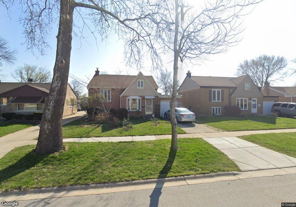
1521 Mandel Ave Westchester, IL 60154
Estimated Value: $227,000 - $337,000
3
Beds
1
Bath
920
Sq Ft
$314/Sq Ft
Est. Value
About This Home
This home is located at 1521 Mandel Ave, Westchester, IL 60154 and is currently estimated at $288,691, approximately $313 per square foot. 1521 Mandel Ave is a home located in Cook County with nearby schools including Westchester Primary School, Westchester Intermediate School, and Westchester Middle School.
Ownership History
Date
Name
Owned For
Owner Type
Purchase Details
Closed on
May 9, 2016
Sold by
Popescu Petre and Benedek Clara
Bought by
Popescu Petre and Petre Popescu Revocable Living Trust
Current Estimated Value
Purchase Details
Closed on
May 31, 1994
Sold by
Jilbert Janice M and Jilbert Peter R
Bought by
Popescu Petre and Benedek Clara
Home Financials for this Owner
Home Financials are based on the most recent Mortgage that was taken out on this home.
Original Mortgage
$104,800
Interest Rate
8.61%
Create a Home Valuation Report for This Property
The Home Valuation Report is an in-depth analysis detailing your home's value as well as a comparison with similar homes in the area
Home Values in the Area
Average Home Value in this Area
Purchase History
| Date | Buyer | Sale Price | Title Company |
|---|---|---|---|
| Popescu Petre | -- | Attorney | |
| Popescu Petre | $131,000 | -- |
Source: Public Records
Mortgage History
| Date | Status | Borrower | Loan Amount |
|---|---|---|---|
| Closed | Popescu Petre | $104,800 |
Source: Public Records
Tax History Compared to Growth
Tax History
| Year | Tax Paid | Tax Assessment Tax Assessment Total Assessment is a certain percentage of the fair market value that is determined by local assessors to be the total taxable value of land and additions on the property. | Land | Improvement |
|---|---|---|---|---|
| 2024 | $4,023 | $21,299 | $4,425 | $16,874 |
| 2023 | $4,087 | $21,299 | $4,425 | $16,874 |
| 2022 | $4,087 | $19,553 | $3,793 | $15,760 |
| 2021 | $4,004 | $19,552 | $3,792 | $15,760 |
| 2020 | $4,417 | $20,893 | $3,792 | $17,101 |
| 2019 | $3,385 | $18,156 | $3,476 | $14,680 |
| 2018 | $3,338 | $18,156 | $3,476 | $14,680 |
| 2017 | $3,304 | $18,156 | $3,476 | $14,680 |
| 2016 | $3,330 | $15,700 | $3,160 | $12,540 |
| 2015 | $3,225 | $15,700 | $3,160 | $12,540 |
| 2014 | $3,177 | $15,700 | $3,160 | $12,540 |
| 2013 | $3,168 | $17,111 | $3,160 | $13,951 |
Source: Public Records
Map
Nearby Homes
- 1413 Highridge Pkwy
- 1326 Heidorn Ave
- 1327 S Wolf Rd
- 1847 Boeger Ave
- 1242 Heidorn Ave
- 1905 S Wolf Rd Unit 302
- 11157 Shaw St
- 1948 Boeger Ave
- 1811 Downing Ave
- 10567 Waterford Dr
- 1860 Buckingham Ave
- 10531 Camelot St
- 10524 Camelot St
- 2130 Mandel Ave
- 2205 Mayfair Ave
- 10630 W Cermak Rd Unit 2E
- 2300 Boeger Ave
- 134 S Maple Ave
- 1245 S Mannheim Rd Unit 2
- 1247 S Mannheim Rd Unit 3
- 1527 Mandel Ave
- 1519 Mandel Ave
- 1531 Mandel Ave
- 1513 Mandel Ave
- 1520 Evers Ave
- 1526 Evers Ave
- 1518 Evers Ave
- 1537 Mandel Ave
- 1507 Mandel Ave
- 1530 Evers Ave
- 1512 Evers Ave
- 1520 Mandel Ave
- 1539 Mandel Ave
- 1536 Evers Ave
- 1526 Mandel Ave
- 1506 Evers Ave
- 1516 Mandel Ave
- 1530 Mandel Ave
- 1501 Mandel Ave
- 1510 Mandel Ave