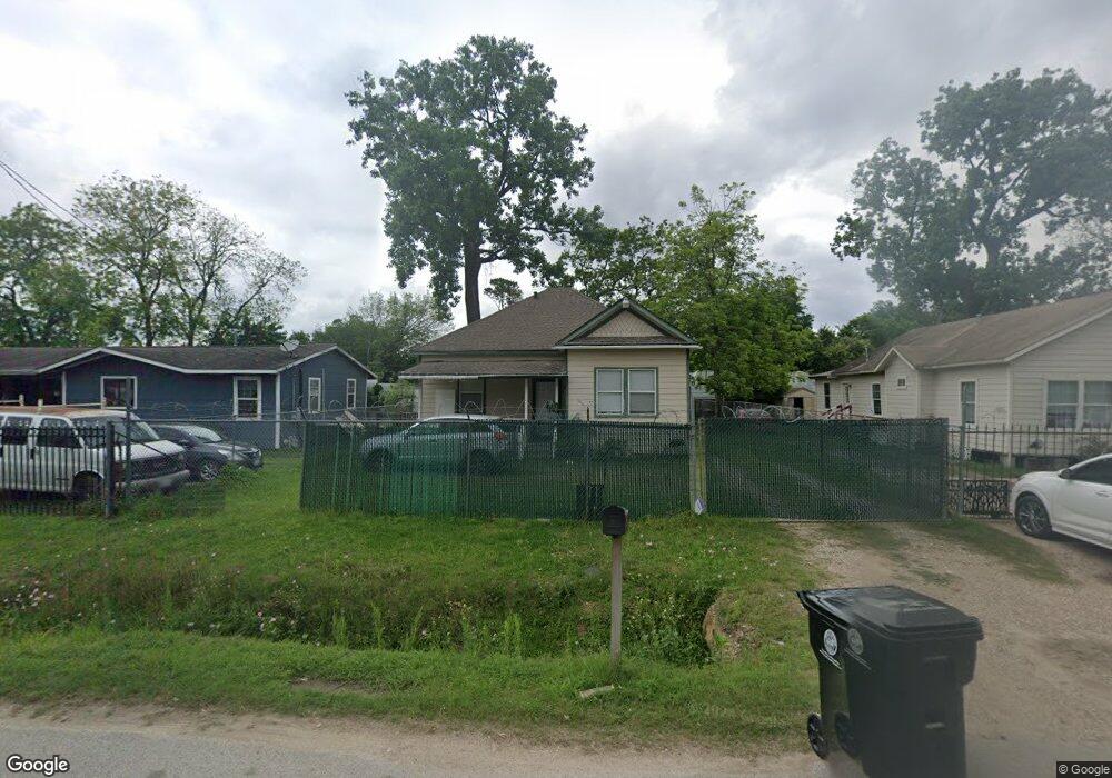
1521 Margaret St Houston, TX 77093
Eastex-Jensen NeighborhoodEstimated Value: $159,763 - $225,000
2
Beds
1
Bath
1,175
Sq Ft
$163/Sq Ft
Est. Value
About This Home
This home is located at 1521 Margaret St, Houston, TX 77093 and is currently estimated at $190,941, approximately $162 per square foot. 1521 Margaret St is a home located in Harris County with nearby schools including Coop Elementary School, Patrick Henry Middle School, and Sam Houston Math, Science & Technology Center.
Ownership History
Date
Name
Owned For
Owner Type
Purchase Details
Closed on
Jan 9, 2007
Sold by
Trejo Noel and Trejo Romualda
Bought by
Barrera Maria
Current Estimated Value
Purchase Details
Closed on
Nov 2, 1998
Sold by
Ayala Sandra and Ayala Amando
Bought by
Trejo Noel
Home Financials for this Owner
Home Financials are based on the most recent Mortgage that was taken out on this home.
Original Mortgage
$31,000
Interest Rate
6.57%
Purchase Details
Closed on
Jul 5, 1995
Sold by
Burns Robert W and Burns Bonnie Jean
Bought by
Ayala Sandra and Ayala Amando
Home Financials for this Owner
Home Financials are based on the most recent Mortgage that was taken out on this home.
Original Mortgage
$27,900
Interest Rate
7.79%
Create a Home Valuation Report for This Property
The Home Valuation Report is an in-depth analysis detailing your home's value as well as a comparison with similar homes in the area
Home Values in the Area
Average Home Value in this Area
Purchase History
| Date | Buyer | Sale Price | Title Company |
|---|---|---|---|
| Barrera Maria | -- | Texas American Title Company | |
| Trejo Noel | -- | Fidelity National Title | |
| Ayala Sandra | -- | Texas American Title Company |
Source: Public Records
Mortgage History
| Date | Status | Borrower | Loan Amount |
|---|---|---|---|
| Previous Owner | Trejo Noel | $31,000 | |
| Previous Owner | Ayala Sandra | $27,900 |
Source: Public Records
Tax History Compared to Growth
Tax History
| Year | Tax Paid | Tax Assessment Tax Assessment Total Assessment is a certain percentage of the fair market value that is determined by local assessors to be the total taxable value of land and additions on the property. | Land | Improvement |
|---|---|---|---|---|
| 2025 | $2,635 | $105,693 | $55,863 | $49,830 |
| 2024 | $2,635 | $126,207 | $52,320 | $73,887 |
| 2023 | $2,635 | $104,942 | $40,875 | $64,067 |
| 2022 | $1,866 | $84,723 | $34,063 | $50,660 |
| 2021 | $1,503 | $64,506 | $24,525 | $39,981 |
| 2020 | $1,470 | $60,700 | $24,525 | $36,175 |
| 2019 | $1,536 | $60,700 | $24,525 | $36,175 |
| 2018 | $1,074 | $42,458 | $18,803 | $23,655 |
| 2017 | $1,074 | $42,458 | $18,803 | $23,655 |
| 2016 | $1,074 | $42,458 | $18,803 | $23,655 |
| 2015 | $1,042 | $40,530 | $14,988 | $25,542 |
| 2014 | $1,042 | $40,530 | $14,988 | $25,542 |
Source: Public Records
Map
Nearby Homes
- 1002 Grenfell Ln
- 9910 E Hardy Rd
- 10514 Exeter St
- 10512 Exeter St
- 1829 Skinner Rd
- 11314 Courtshire Rd
- 11514 Courtshire Rd
- 10022 E Hardy Rd
- 513 Mayford St
- 606 Cresline St
- 11026 Catamore St
- 11018 Catamore St
- 1908 Little York Rd
- 401 Cresline St
- 1105 Soren Ln
- 1802 Kowis St
- 11334 Carla St
- 1731 Schilder Dr
- 2315 Langley Rd
- 2332 Margaret St
- 1525 Margaret St
- 1503 Margaret St
- 1529 Margaret St
- 1533 Margaret St
- 1518 Margaret St
- 1522 Margaret St
- 10514 E Hardy Rd
- 10522 E Hardy Rd
- 10518 E Hardy Rd
- 10427 Michulka Ln
- 1606 Margaret St
- 10524 E Hardy Rd
- 10432 Michulka Ln
- 10448 E Hardy Rd
- 10428 Michulka Ln
- 10536 E Hardy Rd
- 1530 Skinner Rd
- 10554 E Hardy Rd
- 1602 Skinner Rd
- 1518 Skinner Rd