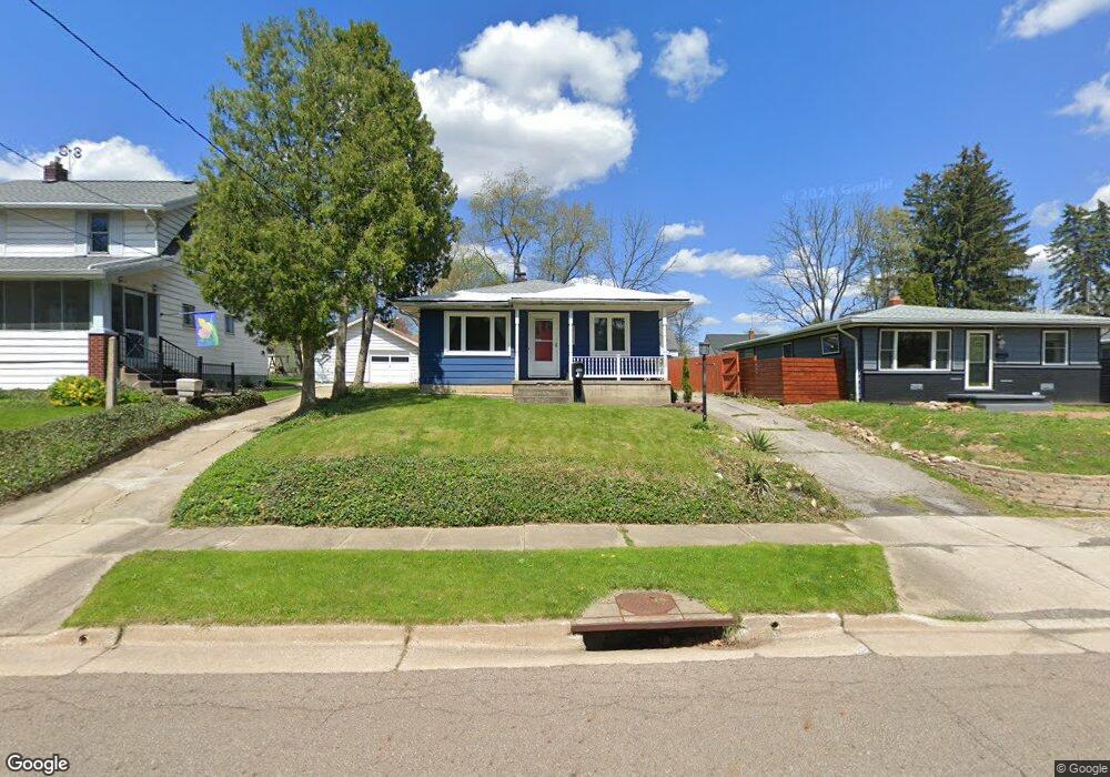
1521 Shatto Ave Akron, OH 44313
Northwest Akron NeighborhoodEstimated Value: $160,000 - $171,000
3
Beds
1
Bath
1,092
Sq Ft
$150/Sq Ft
Est. Value
About This Home
This home is located at 1521 Shatto Ave, Akron, OH 44313 and is currently estimated at $164,217, approximately $150 per square foot. 1521 Shatto Ave is a home located in Summit County with nearby schools including Case Community Learning Center, Summit Academy School, and Our Lady Of The Elms Elementary School.
Ownership History
Date
Name
Owned For
Owner Type
Purchase Details
Closed on
May 6, 2019
Sold by
A Schlueter Llc
Bought by
Freedom Neo Properties Llc
Current Estimated Value
Purchase Details
Closed on
May 3, 2010
Sold by
Em & Em Properties Llc
Bought by
A Schlueter Llc
Purchase Details
Closed on
Mar 2, 2010
Sold by
Pnc Bank National Association
Bought by
Em & Em Properties Llc
Purchase Details
Closed on
Sep 14, 2009
Sold by
Hinson Thomas R
Bought by
National City Bank
Purchase Details
Closed on
Sep 30, 1997
Sold by
Alley Wayne L
Bought by
Hinson Thomas R and Hinson Kathleen E
Home Financials for this Owner
Home Financials are based on the most recent Mortgage that was taken out on this home.
Original Mortgage
$50,000
Interest Rate
7.13%
Mortgage Type
New Conventional
Create a Home Valuation Report for This Property
The Home Valuation Report is an in-depth analysis detailing your home's value as well as a comparison with similar homes in the area
Home Values in the Area
Average Home Value in this Area
Purchase History
| Date | Buyer | Sale Price | Title Company |
|---|---|---|---|
| Freedom Neo Properties Llc | $23,422 | Patriot Title Agency Inc | |
| A Schlueter Llc | $42,000 | Accommodation | |
| Em & Em Properties Llc | $18,500 | Minnesota Title | |
| National City Bank | $45,000 | None Available | |
| Hinson Thomas R | $70,000 | -- |
Source: Public Records
Mortgage History
| Date | Status | Borrower | Loan Amount |
|---|---|---|---|
| Previous Owner | Hinson Thomas R | $50,000 |
Source: Public Records
Tax History Compared to Growth
Tax History
| Year | Tax Paid | Tax Assessment Tax Assessment Total Assessment is a certain percentage of the fair market value that is determined by local assessors to be the total taxable value of land and additions on the property. | Land | Improvement |
|---|---|---|---|---|
| 2025 | $3,707 | $43,107 | $10,637 | $32,470 |
| 2024 | $2,431 | $43,107 | $10,637 | $32,470 |
| 2023 | $3,707 | $43,107 | $10,637 | $32,470 |
| 2022 | $2,209 | $30,566 | $7,438 | $23,128 |
| 2021 | $2,212 | $30,566 | $7,438 | $23,128 |
| 2020 | $2,180 | $30,570 | $7,440 | $23,130 |
| 2019 | $1,838 | $22,660 | $7,070 | $15,590 |
| 2018 | $1,716 | $22,660 | $7,070 | $15,590 |
| 2017 | $1,743 | $22,660 | $7,070 | $15,590 |
| 2016 | $1,744 | $22,660 | $7,070 | $15,590 |
| 2015 | $1,743 | $22,660 | $7,070 | $15,590 |
| 2014 | $1,729 | $22,660 | $7,070 | $15,590 |
| 2013 | $2,236 | $28,860 | $7,070 | $21,790 |
Source: Public Records
Map
Nearby Homes
- 242 N Hawkins Ave
- 1623 Liberty Dr Unit 1625
- 1633-1635 Liberty Dr
- 297 Harcourt Dr
- 1688 Tanglewood Dr Unit 1690
- 101 N Hawkins Ave
- 100 N Hawkins Ave
- 1725 Liberty Dr Unit 1727
- 2040 Thurmont Rd
- 254 Castle Blvd
- 284 Kenilworth Dr
- 423 Foursome Ave
- 590 N Hawkins Ave
- 432 Auburndale Ave
- 1785 Fairlawn Knolls Dr
- 607 Treeside Dr
- 1159 Garman Rd
- 237 Hollywood Ave
- 635 N Hawkins Ave
- 746 Newcastle Dr
- 1515 Shatto Ave
- 1527 Shatto Ave
- 1511 Shatto Ave
- 1531 Shatto Ave
- 1560 Berendo Ave
- 1535 Shatto Ave
- 1564 Berendo Ave
- 1554 Berendo Ave
- 1520 Shatto Ave
- V/L 61 Shatto Ave
- 1570 Berendo Ave
- 1550 Berendo Ave
- 1541 Shatto Ave
- 1574 Berendo Ave
- 1544 Berendo Ave
- 1532 Shatto Ave
- 1580 Berendo Ave
- 1545 Shatto Ave
- 1536 Shatto Ave
- 1584 Berendo Ave