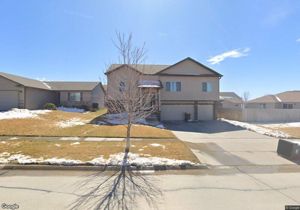
1521 W Silverado Dr Lincoln, NE 68521
Fallbrook NeighborhoodEstimated Value: $384,989 - $425,000
3
Beds
5
Baths
1,496
Sq Ft
$272/Sq Ft
Est. Value
About This Home
This home is located at 1521 W Silverado Dr, Lincoln, NE 68521 and is currently estimated at $406,997, approximately $272 per square foot. 1521 W Silverado Dr is a home located in Lancaster County with nearby schools including Kooser Elementary School, Schoo Middle School, and North Star High School.
Ownership History
Date
Name
Owned For
Owner Type
Purchase Details
Closed on
Jul 21, 2023
Sold by
Byrnes John Michael
Bought by
John Michael Byrnes Revocable Trust and Byrnes
Current Estimated Value
Purchase Details
Closed on
Sep 18, 2020
Sold by
Starostka Lewis Llc
Bought by
Snb Construction Ii Inc
Purchase Details
Closed on
Feb 21, 2014
Sold by
Viktor Derun Construction Inc
Bought by
Byrnes John Michael
Purchase Details
Closed on
Jun 18, 2013
Sold by
Starostka-Lewis Llc
Bought by
Viktor Derun Construction Inc
Create a Home Valuation Report for This Property
The Home Valuation Report is an in-depth analysis detailing your home's value as well as a comparison with similar homes in the area
Home Values in the Area
Average Home Value in this Area
Purchase History
| Date | Buyer | Sale Price | Title Company |
|---|---|---|---|
| John Michael Byrnes Revocable Trust | -- | None Listed On Document | |
| Snb Construction Ii Inc | $72,000 | Charter T&E Svcs Inc | |
| Byrnes John Michael | $204,000 | Charter Title & Escrow Svcs | |
| Viktor Derun Construction Inc | $34,000 | Charter Title & Escrow Servi |
Source: Public Records
Tax History Compared to Growth
Tax History
| Year | Tax Paid | Tax Assessment Tax Assessment Total Assessment is a certain percentage of the fair market value that is determined by local assessors to be the total taxable value of land and additions on the property. | Land | Improvement |
|---|---|---|---|---|
| 2025 | $4,586 | $342,900 | $90,000 | $252,900 |
| 2024 | $4,586 | $338,500 | $77,000 | $261,500 |
| 2023 | $5,265 | $322,300 | $77,000 | $245,300 |
| 2022 | $5,027 | $258,000 | $50,000 | $208,000 |
| 2021 | $4,749 | $258,000 | $50,000 | $208,000 |
| 2020 | $4,486 | $241,500 | $50,000 | $191,500 |
| 2019 | $4,401 | $241,500 | $50,000 | $191,500 |
| 2018 | $4,118 | $227,300 | $50,000 | $177,300 |
| 2017 | $4,168 | $227,300 | $50,000 | $177,300 |
| 2016 | $4,031 | $213,500 | $40,000 | $173,500 |
| 2015 | $4,076 | $213,500 | $40,000 | $173,500 |
| 2014 | $3,538 | $186,400 | $40,000 | $146,400 |
| 2013 | -- | $40,000 | $40,000 | $0 |
Source: Public Records
Map
Nearby Homes
- 1501 W Silverado Dr
- 1319 W Silverado Dr
- 1600 W Avalanche Rd
- 7010 NW 14th St
- 6811 NW 11th St
- 6821 NW 11th St
- 6901 NW 11th St
- 1611 W Trout Dr
- 6840 NW 11th St
- 6830 NW 11th St
- 6900 NW 11th St
- 6910 NW 11th St
- 1050 Pine Grove Ln
- 1621 W Trout Dr
- 6920 NW 11th St
- 6930 NW 11th St
- 6940 NW 11th St
- 1030 Pine Grove Ln
- 7220 NW 19th St
- 1031 Pine Grove Ln
- 1605 W Silverado Dr
- 1521 W Silverado Dr
- 1511 W Silverado Dr
- 1511 W Silverado Dr
- 1560 W Lander Dr
- 1520 W Lander Dr
- 1540 W Lander Dr
- 1510 W Lander Dr
- 1520 W Silverado Dr
- 1530 W Silverado Dr
- 1501 W Dubois St
- 1500 W Lander Dr
- 1530 W Silverado Dr
- 1457 W Silverado Dr
- 1540 W Silverado Dr
- 1540 W Silverado Dr
- 1466 W Lander Dr
- 1550 W Silverado Dr
- 1557 W Lander Dr
- 1449 W Silverado Dr