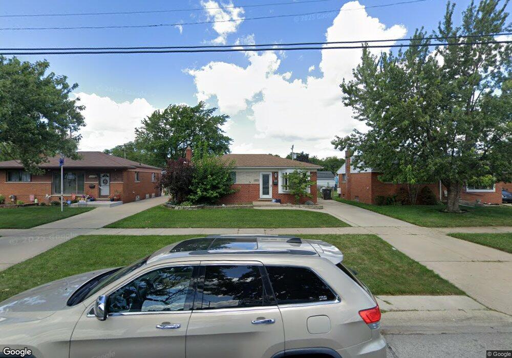
15211 Common Rd Roseville, MI 48066
Estimated Value: $181,000 - $204,000
3
Beds
1
Bath
1,000
Sq Ft
$190/Sq Ft
Est. Value
About This Home
This home is located at 15211 Common Rd, Roseville, MI 48066 and is currently estimated at $190,288, approximately $190 per square foot. 15211 Common Rd is a home located in Macomb County with nearby schools including Mark Twain Elementary School, Richards Middle School, and Fraser High School.
Ownership History
Date
Name
Owned For
Owner Type
Purchase Details
Closed on
Jun 5, 2017
Sold by
Zelenak Anthony M
Bought by
Zelenak Stacy
Current Estimated Value
Purchase Details
Closed on
Nov 17, 2014
Sold by
Zelenak Stacy A
Bought by
Zelenak Anthony M
Purchase Details
Closed on
Sep 28, 2011
Sold by
Secretary Of Housing & Urban Development
Bought by
Zelenak Anthony
Purchase Details
Closed on
Jun 14, 2010
Sold by
Us Bank Na
Bought by
Secretary Of Housing & Urban Development
Purchase Details
Closed on
May 14, 2010
Sold by
Deason John E and Deason Debra Ann
Bought by
Us Bank Na
Purchase Details
Closed on
Apr 17, 2003
Sold by
Lefebvre Michael and Lefebvre Lori
Bought by
Deason John E
Purchase Details
Closed on
May 28, 1999
Sold by
Schmittler Jess D
Bought by
Lefebvre Michael W
Create a Home Valuation Report for This Property
The Home Valuation Report is an in-depth analysis detailing your home's value as well as a comparison with similar homes in the area
Home Values in the Area
Average Home Value in this Area
Purchase History
| Date | Buyer | Sale Price | Title Company |
|---|---|---|---|
| Zelenak Stacy | $85,000 | Greater Macomb Title Agency | |
| Zelenak Anthony M | -- | None Available | |
| Zelenak Anthony | $37,100 | None Available | |
| Secretary Of Housing & Urban Development | -- | None Available | |
| Us Bank Na | $126,859 | None Available | |
| Deason John E | $123,900 | First American Title Se Div | |
| Lefebvre Michael W | $104,000 | -- |
Source: Public Records
Tax History Compared to Growth
Tax History
| Year | Tax Paid | Tax Assessment Tax Assessment Total Assessment is a certain percentage of the fair market value that is determined by local assessors to be the total taxable value of land and additions on the property. | Land | Improvement |
|---|---|---|---|---|
| 2025 | $2,383 | $76,000 | $0 | $0 |
| 2024 | $1,423 | $74,500 | $0 | $0 |
| 2023 | $1,365 | $68,500 | $0 | $0 |
| 2022 | $2,126 | $58,500 | $0 | $0 |
| 2021 | $2,065 | $54,800 | $0 | $0 |
| 2020 | $1,324 | $50,500 | $0 | $0 |
| 2019 | $1,344 | $43,500 | $0 | $0 |
| 2018 | $1,764 | $0 | $0 | $0 |
| 2017 | $1,355 | $32,566 | $6,348 | $26,218 |
| 2016 | $1,344 | $32,566 | $0 | $0 |
| 2015 | $929 | $29,240 | $0 | $0 |
| 2013 | -- | $26,134 | $0 | $0 |
| 2011 | -- | $31,518 | $0 | $0 |
Source: Public Records
Map
Nearby Homes
- 15225 Common Rd
- 30324 Glenwood Cir
- 30464 Hayes Rd
- 30607 Glenwood Cir
- 15102 Raphael Terrace Unit K67
- 29448 El Dorado Plaza
- 30644 Hayes Rd
- 15797 Common Rd
- 29201 Hayes Rd Unit G-1
- 29273 Rd
- 29249 Hayes #74 Rd Unit 74
- 29304 Gloede Dr
- 15867 Loreto St
- 14625 Bade Dr
- 29101 Hayes Rd
- 30214 J Carls St
- 31070 Hayes Rd
- 14219 Harrison Dr
- 31263 Hayes Rd
- 30729 Mayflower St
- 15219 Common Rd
- 15205 Common Rd
- 15240 Rudland St
- 30012 Hayes Rd
- 15228 Rudland St
- 30024 Hayes Rd
- 15231 Common Rd
- 30036 Hayes Rd
- 15264 Rudland St
- 30048 Hayes Rd
- 15276 Rudland St
- 15237 Common Rd
- 15288 Rudland St
- 15243 Common Rd
- 15214 Common Rd
- 15400 Rudland St
- 15241 Rudland St
- 30110 Hayes Rd
- 15253 Rudland St
- 15249 Common Rd