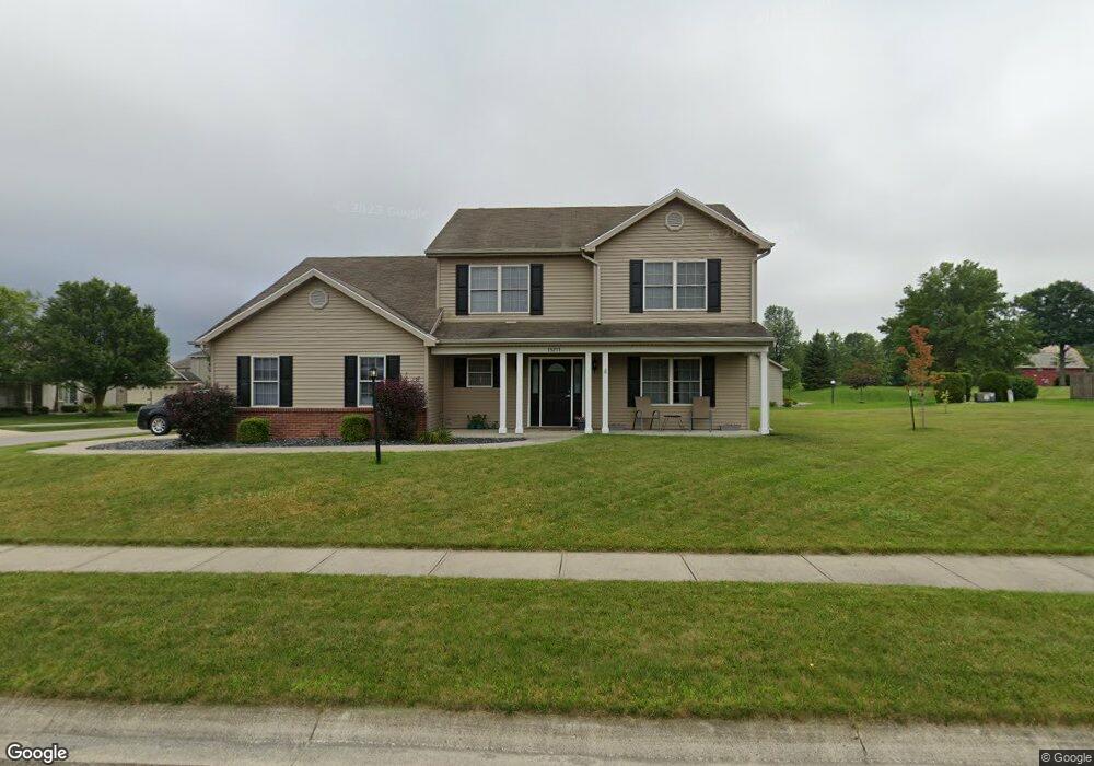
15211 Firethorne Path Fort Wayne, IN 46814
Estimated Value: $321,431 - $346,000
3
Beds
3
Baths
2,140
Sq Ft
$155/Sq Ft
Est. Value
About This Home
This home is located at 15211 Firethorne Path, Fort Wayne, IN 46814 and is currently estimated at $332,608, approximately $155 per square foot. 15211 Firethorne Path is a home located in Allen County with nearby schools including Covington Elementary School, Woodside Middle School, and Homestead Senior High School.
Ownership History
Date
Name
Owned For
Owner Type
Purchase Details
Closed on
Feb 11, 2005
Sold by
First Quality Homes Inc
Bought by
Ball Dennis R and Ball Stephanie K
Current Estimated Value
Home Financials for this Owner
Home Financials are based on the most recent Mortgage that was taken out on this home.
Original Mortgage
$170,000
Outstanding Balance
$99,642
Interest Rate
8.5%
Mortgage Type
Stand Alone First
Estimated Equity
$232,966
Purchase Details
Closed on
Jul 23, 2004
Sold by
Walnut Springs Developers Llc
Bought by
First Quality Homes Inc
Create a Home Valuation Report for This Property
The Home Valuation Report is an in-depth analysis detailing your home's value as well as a comparison with similar homes in the area
Home Values in the Area
Average Home Value in this Area
Purchase History
| Date | Buyer | Sale Price | Title Company |
|---|---|---|---|
| Ball Dennis R | -- | -- | |
| First Quality Homes Inc | -- | -- |
Source: Public Records
Mortgage History
| Date | Status | Borrower | Loan Amount |
|---|---|---|---|
| Open | Ball Dennis R | $170,000 |
Source: Public Records
Tax History
| Year | Tax Paid | Tax Assessment Tax Assessment Total Assessment is a certain percentage of the fair market value that is determined by local assessors to be the total taxable value of land and additions on the property. | Land | Improvement |
|---|---|---|---|---|
| 2025 | $2,207 | $302,500 | $64,900 | $237,600 |
| 2024 | $1,984 | $285,200 | $64,900 | $220,300 |
| 2023 | $1,984 | $276,600 | $38,000 | $238,600 |
| 2022 | $1,600 | $233,400 | $38,000 | $195,400 |
| 2021 | $1,493 | $213,000 | $38,000 | $175,000 |
| 2020 | $1,330 | $192,300 | $38,000 | $154,300 |
| 2019 | $1,243 | $177,900 | $38,000 | $139,900 |
| 2018 | $1,107 | $169,000 | $38,000 | $131,000 |
| 2017 | $1,293 | $179,800 | $38,000 | $141,800 |
| 2016 | $1,258 | $172,900 | $38,000 | $134,900 |
| 2014 | $1,195 | $166,400 | $38,000 | $128,400 |
| 2013 | $1,244 | $165,500 | $38,000 | $127,500 |
Source: Public Records
Map
Nearby Homes
- 15014 Bristlecone Ct
- 15306 Covington Rd
- 3438 Buckeye Run
- 3113 Pinoak Ct
- 3321 Treviso Cove
- 11130 Kola Crossover Unit 98
- 11162 Kola Crossover Unit 97
- 10844 Kola Crossover Unit 26
- 11088 Kola Crossover Unit 145
- 10908 Kola Crossover Unit 28
- 10704 Kola Crossover Unit 21
- 10822 Kola Crossover Unit 25
- 11466 Kola Crossover Unit 88
- 11358 Kola Crossover
- 10736 Kola Crossover Unit 22
- 10758 Kola Crossover Unit 23
- 11444 Kola Crossover Unit 89
- 10672 Kola Crossover Unit 20
- 10790 Kola Crossover Unit 24
- 11422 Kola Crossover Unit 90
- 3112 Shallowbrook Dr
- 3120 Shallowbrook Dr
- 15216 Firethorne Path
- 15208 Firethorne Path
- 3103 Shallowbrook Dr
- 3111 Shallowbrook Dr
- 3003 Weatherstone Ct
- 15224 Firethorne Path
- 3128 Shallowbrook Dr
- 3018 Shallowbrook Dr
- 3127 Shallowbrook Dr
- 15232 Firethorne Path
- 3202 Shallowbrook Dr
- 3015 Weatherstone Ct
- 3002 Shallowbrook Dr
- 15124 Butterbough Ln
- 3204 Shallowbrook Dr
- 15309 Firethorne Path
- 3030 Weatherstone Ct
- 3018 Weatherstone Ct
Your Personal Tour Guide
Ask me questions while you tour the home.