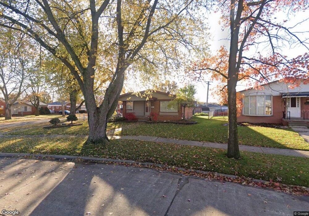
15211 Travis St Southgate, MI 48195
Estimated Value: $228,000 - $235,000
3
Beds
1
Bath
1,073
Sq Ft
$215/Sq Ft
Est. Value
About This Home
This home is located at 15211 Travis St, Southgate, MI 48195 and is currently estimated at $230,706, approximately $215 per square foot. 15211 Travis St is a home located in Wayne County with nearby schools including Allen Elementary School, Davidson Middle School, and Southgate Anderson High School.
Ownership History
Date
Name
Owned For
Owner Type
Purchase Details
Closed on
Jul 22, 2005
Sold by
Wuerker Richard Carl
Bought by
Wuerker Richard Carl
Current Estimated Value
Home Financials for this Owner
Home Financials are based on the most recent Mortgage that was taken out on this home.
Original Mortgage
$133,600
Interest Rate
5.71%
Mortgage Type
New Conventional
Create a Home Valuation Report for This Property
The Home Valuation Report is an in-depth analysis detailing your home's value as well as a comparison with similar homes in the area
Home Values in the Area
Average Home Value in this Area
Purchase History
| Date | Buyer | Sale Price | Title Company |
|---|---|---|---|
| Wuerker Richard Carl | -- | Metropolitan Title Company |
Source: Public Records
Mortgage History
| Date | Status | Borrower | Loan Amount |
|---|---|---|---|
| Closed | Wuerker Richard Carl | $133,600 |
Source: Public Records
Tax History
| Year | Tax Paid | Tax Assessment Tax Assessment Total Assessment is a certain percentage of the fair market value that is determined by local assessors to be the total taxable value of land and additions on the property. | Land | Improvement |
|---|---|---|---|---|
| 2025 | $3,663 | $104,200 | $0 | $0 |
| 2024 | $3,494 | $95,700 | $0 | $0 |
| 2023 | $3,250 | $88,100 | $0 | $0 |
| 2022 | $3,516 | $80,000 | $0 | $0 |
| 2021 | $3,315 | $72,900 | $0 | $0 |
| 2020 | $3,263 | $66,200 | $0 | $0 |
| 2019 | $3,164 | $61,900 | $0 | $0 |
| 2018 | $2,525 | $58,400 | $0 | $0 |
| 2017 | $1,205 | $55,100 | $0 | $0 |
| 2016 | $2,861 | $48,700 | $0 | $0 |
| 2015 | $4,273 | $45,700 | $0 | $0 |
| 2013 | $4,140 | $42,400 | $0 | $0 |
| 2012 | $1,783 | $40,400 | $8,000 | $32,400 |
Source: Public Records
Map
Nearby Homes
- 14801 Pennsylvania Rd
- 16047 Mccann St
- 17486 Poplar St
- 15742 Kennebec St
- 15470 Windemere St
- 15435 Cameron St
- 16959 Anderson Dr
- 15464 Mulberry St
- 15795 Lakeside Dr Unit 6
- 14851 Williamsburg Dr
- 14749 Williamsburg Dr
- 15426 Poplar St
- 15231 Windemere St
- 15110 Drake St
- 16829 Club Dr Unit 41
- 14559 Balsam St
- 15335 Dumay St
- 15142 Fordline St
- 14716 Eureka Rd
- 14706 Eureka Rd
- 15221 Travis St
- 16832 Cameron St
- 15233 Travis St
- 16846 Cameron St
- 16811 Cameron St
- 16819 Cameron St
- 16805 Cameron St
- 15234 Travis St
- 15247 Travis St
- 16755 Cameron St Unit Bldg-Unit
- 16755 Cameron St
- 16827 Cameron St
- 16902 Cameron St
- 16866 Windermere Cir
- 16741 Cameron St
- 15246 Travis St
- 16914 Cameron St
- 15259 Travis St
- 16854 Windermere Cir
- 16640 Drake St
Your Personal Tour Guide
Ask me questions while you tour the home.