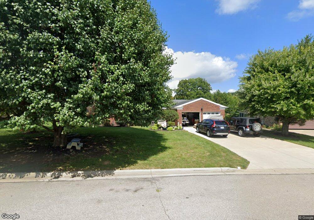
1522 Brindley Dr Greendale, IN 47025
Estimated Value: $302,000 - $348,000
3
Beds
2
Baths
2,171
Sq Ft
$153/Sq Ft
Est. Value
About This Home
This home is located at 1522 Brindley Dr, Greendale, IN 47025 and is currently estimated at $332,085, approximately $152 per square foot. 1522 Brindley Dr is a home located in Dearborn County with nearby schools including Lawrenceburg Primary School, Central Elementary School, and Greendale Middle School.
Ownership History
Date
Name
Owned For
Owner Type
Purchase Details
Closed on
Sep 9, 2016
Sold by
Karg Shirley A
Bought by
Moorman Robert E and Moorman Erin N
Current Estimated Value
Home Financials for this Owner
Home Financials are based on the most recent Mortgage that was taken out on this home.
Original Mortgage
$140,800
Outstanding Balance
$112,248
Interest Rate
3.37%
Mortgage Type
New Conventional
Estimated Equity
$219,837
Purchase Details
Closed on
May 15, 2006
Sold by
Karg William A and Karg Shirley A
Bought by
Karg Shirley A
Create a Home Valuation Report for This Property
The Home Valuation Report is an in-depth analysis detailing your home's value as well as a comparison with similar homes in the area
Home Values in the Area
Average Home Value in this Area
Purchase History
| Date | Buyer | Sale Price | Title Company |
|---|---|---|---|
| Moorman Robert E | -- | Attorney | |
| Karg Shirley A | -- | -- |
Source: Public Records
Mortgage History
| Date | Status | Borrower | Loan Amount |
|---|---|---|---|
| Open | Moorman Robert E | $140,800 |
Source: Public Records
Tax History Compared to Growth
Tax History
| Year | Tax Paid | Tax Assessment Tax Assessment Total Assessment is a certain percentage of the fair market value that is determined by local assessors to be the total taxable value of land and additions on the property. | Land | Improvement |
|---|---|---|---|---|
| 2024 | $2,601 | $260,100 | $28,900 | $231,200 |
| 2023 | $2,407 | $240,700 | $28,900 | $211,800 |
| 2022 | $2,328 | $232,800 | $28,900 | $203,900 |
| 2021 | $2,094 | $209,400 | $28,900 | $180,500 |
| 2020 | $2,094 | $209,400 | $28,900 | $180,500 |
| 2019 | $2,025 | $202,500 | $28,900 | $173,600 |
| 2018 | $1,858 | $185,800 | $28,900 | $156,900 |
| 2017 | $1,575 | $157,500 | $28,900 | $128,600 |
| 2016 | $1,498 | $149,800 | $28,900 | $120,900 |
| 2014 | $1,498 | $149,800 | $28,900 | $120,900 |
Source: Public Records
Map
Nearby Homes
- 1530 Nowlin Ave Unit 104
- 1530 Nowlin Ave
- 1009 Nowlin Ave
- 1005 Nowlin Ave
- 219 Parkgrove Ave
- 952 Miller Ave
- 939 Nowlin Ave
- 130 Parkside Ave
- 1015 Ridge Ave
- 887 Nowlin Ave
- 0 Sunset Dr Unit 204596
- 0 Sunset Dr Unit 1856832
- 0 Sunset Dr Unit MBR22065196
- 10 Dearborn Ct
- 18815 Rileys Ridge
- 18826 Casey's Trail
- Drexel Plan at The Crossing at Tanners Creek
- Rockford Plan at The Crossing at Tanners Creek
- Sanibel Plan at The Crossing at Tanners Creek
- Somerset Plan at The Crossing at Tanners Creek
- 1602 Ritzmann Dr
- 1520 Brindley Dr
- 1518 Ritzmann Dr
- 1517 Brindley Dr
- 1516 Ritzmann Dr
- 1604 Ritzmann Dr
- 1519 Ritzmann Dr
- 1514 Ritzmann Dr
- 1515 Brindley Dr
- 1605 Ritzmann Dr
- 1517 Ritzmann Dr
- 1513 Brindley Dr
- 1514 Brindley Dr
- 1515 Ritzmann Dr
- 1513 Ritzmann Dr
- 1510 Ritzmann Dr
- 1511 Brindley Dr
- 0 Brindley Dr Unit 1352374
- 0 Brindley Dr Unit 1522305