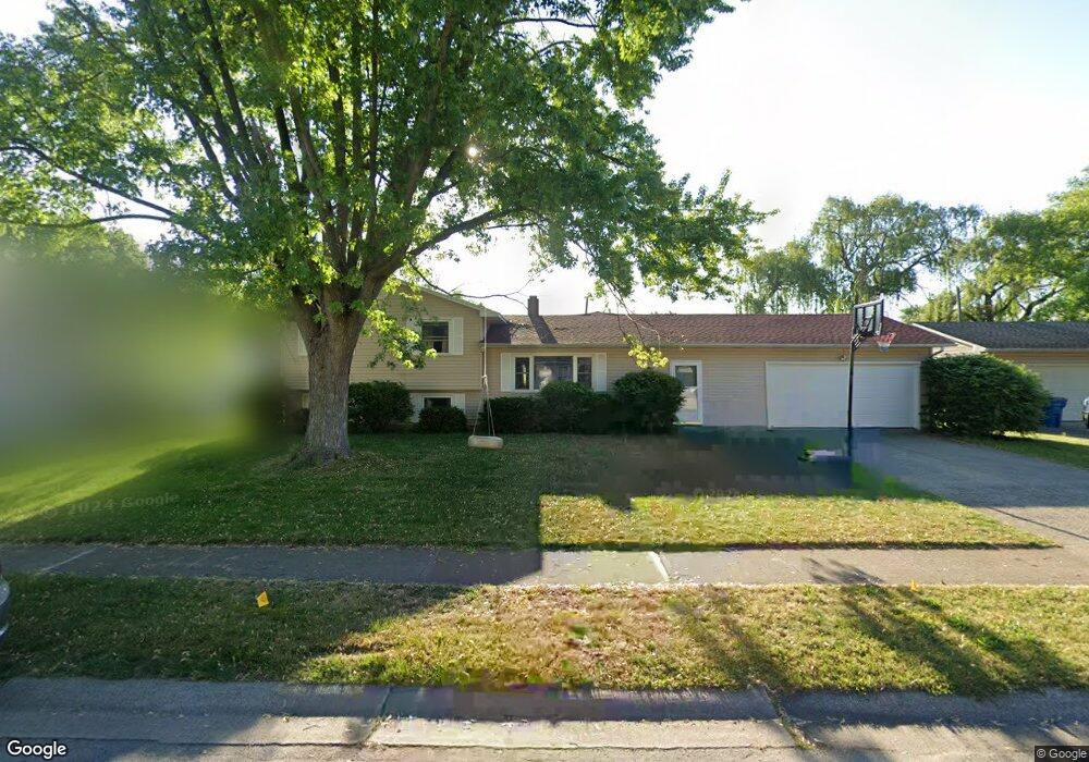
1522 Cantondale Ln Mishawaka, IN 46544
Estimated Value: $261,000 - $290,000
4
Beds
2
Baths
1,942
Sq Ft
$142/Sq Ft
Est. Value
About This Home
This home is located at 1522 Cantondale Ln, Mishawaka, IN 46544 and is currently estimated at $275,695, approximately $141 per square foot. 1522 Cantondale Ln is a home located in St. Joseph County with nearby schools including Fred J. Hums Elementary School, John J. Young Middle School, and Mishawaka High School.
Ownership History
Date
Name
Owned For
Owner Type
Purchase Details
Closed on
Oct 30, 2009
Sold by
Butterfield John M and Butterfield Dorothy
Bought by
Bowen Robert and Bowen Anita
Current Estimated Value
Home Financials for this Owner
Home Financials are based on the most recent Mortgage that was taken out on this home.
Original Mortgage
$106,400
Outstanding Balance
$69,865
Interest Rate
5.11%
Mortgage Type
New Conventional
Estimated Equity
$205,830
Purchase Details
Closed on
May 1, 2006
Sold by
Klodzinski Susan E and Leazenby Susan E
Bought by
Leazenby Susan E and Leazenby Paul A
Create a Home Valuation Report for This Property
The Home Valuation Report is an in-depth analysis detailing your home's value as well as a comparison with similar homes in the area
Home Values in the Area
Average Home Value in this Area
Purchase History
| Date | Buyer | Sale Price | Title Company |
|---|---|---|---|
| Bowen Robert | -- | Metropolitan Title In Llc | |
| Leazenby Susan E | -- | None Available |
Source: Public Records
Mortgage History
| Date | Status | Borrower | Loan Amount |
|---|---|---|---|
| Open | Bowen Robert | $106,400 |
Source: Public Records
Tax History Compared to Growth
Tax History
| Year | Tax Paid | Tax Assessment Tax Assessment Total Assessment is a certain percentage of the fair market value that is determined by local assessors to be the total taxable value of land and additions on the property. | Land | Improvement |
|---|---|---|---|---|
| 2024 | $3,037 | $295,800 | $63,600 | $232,200 |
| 2023 | $3,082 | $256,400 | $63,600 | $192,800 |
| 2022 | $3,082 | $261,500 | $63,600 | $197,900 |
| 2021 | $2,437 | $206,600 | $27,400 | $179,200 |
| 2020 | $2,254 | $191,200 | $25,900 | $165,300 |
| 2019 | $2,072 | $175,700 | $23,800 | $151,900 |
| 2018 | $2,102 | $146,200 | $19,600 | $126,600 |
| 2017 | $2,244 | $145,900 | $19,600 | $126,300 |
| 2016 | $2,158 | $146,100 | $19,600 | $126,500 |
| 2014 | $1,506 | $119,400 | $19,600 | $99,800 |
Source: Public Records
Map
Nearby Homes
- 1529 Hampton Ct
- 1350 Providence Ct
- 1507 Kensington Place
- 1427 Princeton Ct
- 2982 Princeton Dr
- 1503 Blanchard Dr
- 2730 Lexington Blvd
- 2610 Lexington Blvd
- 1568 Blanchard Dr
- 2933 Colonial Dr
- 2732 Prescott Dr
- 14332 Harrison Rd
- 1101 Wellsley Ct
- 3127 Brunswick Square Dr
- 2406 E 9th St
- 1109 Sunrise Cir
- 1815 Bennington Dr
- Lot 608A Rosemont Place Unit 608A
- Lot 607A Rosemont Place Unit 607A
- Lot 677A Rosemont Place Unit 677A
- 1518 Cantondale Ln
- 1526 Cantondale Ln
- 1535 Hampton Ct
- 1541 Hampton Ct
- 1514 Cantondale Ln
- 1532 Cantondale Ln
- 1547 Hampton Ct
- 1523 Cantondale Ln
- 1529 Cantondale Ln
- 1523 Hampton Ct
- 1517 Cantondale Ln
- 1553 Hampton Ct
- 1535 Cantondale Ln
- 1510 Cantondale Ln
- 1538 Cantondale Ln
- 1517 Hampton Ct
- 1511 Cantondale Ln
- 1559 Hampton Ct
- 1541 Cantondale Ln
- 1507 Cantondale Ln