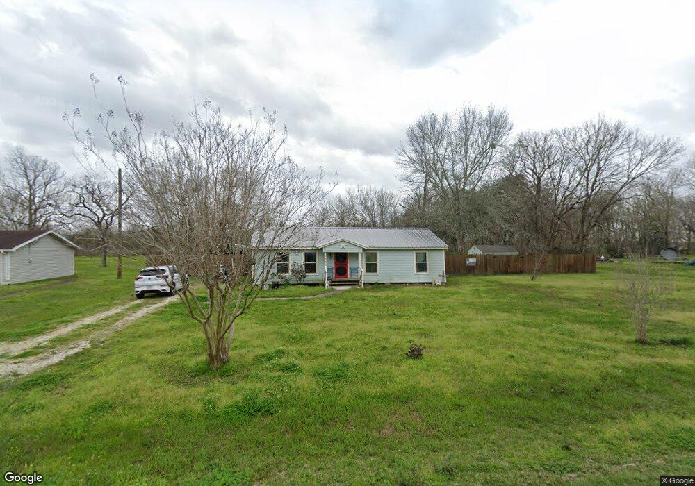
1522 County Road 597 Unit FIG Angleton, TX 77515
Estimated Value: $169,497 - $187,000
--
Bed
1
Bath
1,144
Sq Ft
$157/Sq Ft
Est. Value
About This Home
This home is located at 1522 County Road 597 Unit FIG, Angleton, TX 77515 and is currently estimated at $179,124, approximately $156 per square foot. 1522 County Road 597 Unit FIG is a home located in Brazoria County with nearby schools including Southside Elementary School, Angleton Junior High School, and Angleton High School.
Ownership History
Date
Name
Owned For
Owner Type
Purchase Details
Closed on
Feb 19, 2025
Sold by
Brooks Jeanine D
Bought by
Stephens Rylee Mae
Current Estimated Value
Home Financials for this Owner
Home Financials are based on the most recent Mortgage that was taken out on this home.
Original Mortgage
$6,854
Outstanding Balance
$6,813
Interest Rate
6.93%
Estimated Equity
$172,311
Purchase Details
Closed on
Aug 19, 2005
Sold by
Brooks Inez M
Bought by
Brooks Jeanine D
Create a Home Valuation Report for This Property
The Home Valuation Report is an in-depth analysis detailing your home's value as well as a comparison with similar homes in the area
Home Values in the Area
Average Home Value in this Area
Purchase History
| Date | Buyer | Sale Price | Title Company |
|---|---|---|---|
| Stephens Rylee Mae | -- | Great American Title | |
| Brooks Jeanine D | -- | -- |
Source: Public Records
Mortgage History
| Date | Status | Borrower | Loan Amount |
|---|---|---|---|
| Open | Stephens Rylee Mae | $6,854 | |
| Open | Stephens Rylee Mae | $171,338 |
Source: Public Records
Tax History Compared to Growth
Tax History
| Year | Tax Paid | Tax Assessment Tax Assessment Total Assessment is a certain percentage of the fair market value that is determined by local assessors to be the total taxable value of land and additions on the property. | Land | Improvement |
|---|---|---|---|---|
| 2025 | $46 | $109,840 | $22,500 | $87,340 |
| 2023 | $46 | $63,481 | $12,750 | $89,570 |
| 2022 | $1,116 | $57,710 | $11,900 | $45,810 |
| 2021 | $1,211 | $55,580 | $11,050 | $44,530 |
| 2020 | $1,286 | $55,580 | $11,050 | $44,530 |
| 2019 | $1,411 | $58,480 | $11,050 | $47,430 |
| 2018 | $1,436 | $58,480 | $11,050 | $47,430 |
| 2017 | $1,468 | $58,480 | $11,050 | $47,430 |
| 2016 | $1,284 | $51,140 | $10,200 | $40,940 |
| 2015 | $1,149 | $45,850 | $8,500 | $37,350 |
| 2014 | $1,149 | $43,860 | $8,500 | $35,360 |
Source: Public Records
Map
Nearby Homes
- 2111 County Road 428
- 14515 Farm To Market Road 523
- 1349 Fair Dr
- 1324 Fair Dr
- 1200 Gifford Ln
- 217 Laura Leigh Ln
- 2217 Shanks Rd
- 238 E Phillips Rd
- 199 Gulf St
- 2025 Shanks Rd
- 0 Shanks Rd
- 00 Shanks Rd
- 2213 Shanks Rd
- 2313 Shanks Rd
- 2849 Shanks Rd
- 0 County Road 220 Airport Rd at 288 B Unit 30510688
- 1040 S Anderson St
- 1007 S Anderson St
- 15.79 AC County Road 220
- 1003 S Anderson St
- 1522 County Road 597
- 1526 County Road 597 Unit FIG
- 1526 County Road 597
- 1526 Fig Ln
- 1523 County Road 597 Unit FIG
- 1523 County Road 597
- 1527 County Road 597 Unit FIG
- 1527 County Road 597
- 1527 County Road 597
- 1527 County Road 597
- 1531 Fig Ln
- 1519 County Road 597
- 1510 County Road 597 Unit FIG
- 1513 Fig Ln
- 1531 County Road 597 Unit FIG
- 1530 County Road 597 Unit FIG
- 1501 County Road 597
- 1537 County Road 597 Unit FIG
- 1510 Fig Ln
- 1540 County Road 597 Unit FIG