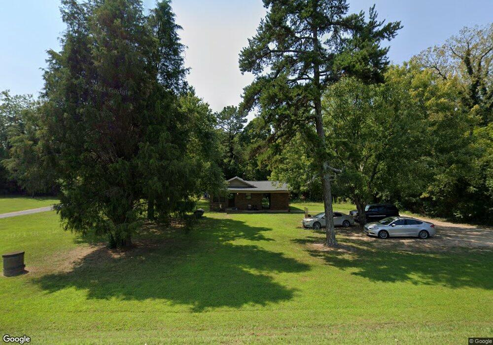
1522 Longbranch Rd Grover, NC 28073
Estimated Value: $115,000 - $228,000
--
Bed
--
Bath
1,056
Sq Ft
$177/Sq Ft
Est. Value
About This Home
This home is located at 1522 Longbranch Rd, Grover, NC 28073 and is currently estimated at $186,405, approximately $176 per square foot. 1522 Longbranch Rd is a home located in Cleveland County with nearby schools including Grover Elementary School, Kings Mountain Middle, and Kings Mountain Intermediate School.
Ownership History
Date
Name
Owned For
Owner Type
Purchase Details
Closed on
Sep 30, 2021
Sold by
Byers Eric and Walker Crystal
Bought by
Byers Erica C
Current Estimated Value
Home Financials for this Owner
Home Financials are based on the most recent Mortgage that was taken out on this home.
Original Mortgage
$118,181
Outstanding Balance
$107,770
Interest Rate
2.8%
Mortgage Type
USDA
Estimated Equity
$78,635
Purchase Details
Closed on
Apr 29, 2010
Sold by
Byers Dorothy G
Bought by
Byers Eric R
Create a Home Valuation Report for This Property
The Home Valuation Report is an in-depth analysis detailing your home's value as well as a comparison with similar homes in the area
Home Values in the Area
Average Home Value in this Area
Purchase History
| Date | Buyer | Sale Price | Title Company |
|---|---|---|---|
| Byers Erica C | $117,000 | None Available | |
| Byers Eric R | -- | None Available |
Source: Public Records
Mortgage History
| Date | Status | Borrower | Loan Amount |
|---|---|---|---|
| Open | Byers Erica C | $118,181 |
Source: Public Records
Tax History Compared to Growth
Tax History
| Year | Tax Paid | Tax Assessment Tax Assessment Total Assessment is a certain percentage of the fair market value that is determined by local assessors to be the total taxable value of land and additions on the property. | Land | Improvement |
|---|---|---|---|---|
| 2025 | $880 | $138,646 | $18,500 | $120,146 |
| 2024 | $701 | $78,056 | $16,000 | $62,056 |
| 2023 | $697 | $78,056 | $16,000 | $62,056 |
| 2022 | $697 | $78,056 | $16,000 | $62,056 |
| 2021 | $699 | $78,056 | $16,000 | $62,056 |
| 2020 | $729 | $79,170 | $14,632 | $64,538 |
| 2019 | $729 | $79,170 | $14,632 | $64,538 |
| 2018 | $725 | $79,170 | $14,632 | $64,538 |
| 2017 | $721 | $79,170 | $14,632 | $64,538 |
| 2016 | $687 | $79,170 | $14,632 | $64,538 |
| 2015 | $597 | $67,680 | $12,400 | $55,280 |
| 2014 | $597 | $67,680 | $12,400 | $55,280 |
Source: Public Records
Map
Nearby Homes
- 101 Melvin Ct
- 132 Hicks Rd Unit 1
- 210 Roy Bell Rd
- 111 Hicks Rd Unit 9
- 764 S Battleground Ave
- 105 Elm Rd
- 203 Bethlehem Church Rd
- 00 Bethlehem Church Rd
- 308 M H Camp Hwy
- 811 Cleveland Ave
- 101 Park Ln
- 219 Watterson Rd
- 129 Lakeview Dr
- 238 Lakeview Dr
- 114 Brenda Ct
- 131 Sam Smith Dr
- 716 Mcdaniel Rd
- 00 Mill Creek Rd
- 107 Tara Terrace
- 907 Bethlehem Rd
- 1520 Longbranch Rd
- 105 Twin Ln
- 1515 Longbranch Rd
- 1515 Longbranch Rd Unit 3
- 111 Twin Ln
- 1524 Longbranch Rd
- 1514 Longbranch Rd
- 1527 Longbranch Rd
- 1513 Longbranch Rd
- 1517 Longbranch Rd Unit 1
- 1517 Longbranch Rd Unit 2
- 1517 Longbranch Rd
- 113 Twin Ln
- 1535 Longbranch Rd Unit 55L
- 1535 Longbranch Rd
- 1535 Longbranch Rd
- 1536 Longbranch Rd
- 1510 Longbranch Rd
- 117 Twin Ln
- 1511 Longbranch Rd