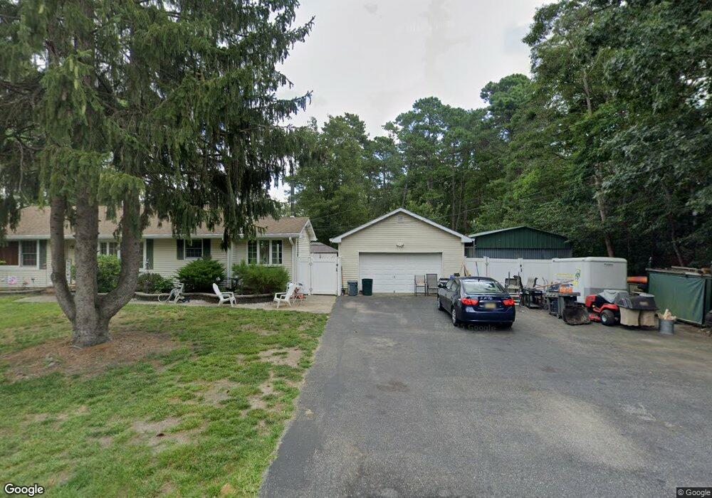
1522 Pershing Ave Forked River, NJ 08731
Estimated Value: $437,975 - $482,000
3
Beds
2
Baths
1,674
Sq Ft
$272/Sq Ft
Est. Value
About This Home
This home is located at 1522 Pershing Ave, Forked River, NJ 08731 and is currently estimated at $455,994, approximately $272 per square foot. 1522 Pershing Ave is a home located in Ocean County with nearby schools including Lacey Township High School.
Ownership History
Date
Name
Owned For
Owner Type
Purchase Details
Closed on
Mar 1, 2021
Sold by
Meyh George M and Meyh Lois J
Bought by
Cort Joseph D
Current Estimated Value
Purchase Details
Closed on
Dec 13, 1995
Sold by
Mcfarland Linda
Bought by
Cort Joseph and Cort Anna Marie
Home Financials for this Owner
Home Financials are based on the most recent Mortgage that was taken out on this home.
Original Mortgage
$64,000
Interest Rate
7.33%
Create a Home Valuation Report for This Property
The Home Valuation Report is an in-depth analysis detailing your home's value as well as a comparison with similar homes in the area
Home Values in the Area
Average Home Value in this Area
Purchase History
| Date | Buyer | Sale Price | Title Company |
|---|---|---|---|
| Cort Joseph D | $35,000 | Counsellors Title Agency | |
| Cort Joseph | $80,000 | -- |
Source: Public Records
Mortgage History
| Date | Status | Borrower | Loan Amount |
|---|---|---|---|
| Previous Owner | Cort Joseph | $64,000 |
Source: Public Records
Tax History
| Year | Tax Paid | Tax Assessment Tax Assessment Total Assessment is a certain percentage of the fair market value that is determined by local assessors to be the total taxable value of land and additions on the property. | Land | Improvement |
|---|---|---|---|---|
| 2025 | $5,949 | $217,500 | $90,000 | $127,500 |
| 2024 | $5,153 | $217,500 | $90,000 | $127,500 |
| 2023 | $4,922 | $217,500 | $90,000 | $127,500 |
| 2022 | $4,922 | $217,500 | $90,000 | $127,500 |
| 2021 | $4,839 | $217,500 | $90,000 | $127,500 |
| 2020 | $4,685 | $217,500 | $90,000 | $127,500 |
| 2019 | $4,602 | $217,500 | $90,000 | $127,500 |
| 2018 | $4,548 | $217,500 | $90,000 | $127,500 |
| 2017 | $4,444 | $217,500 | $90,000 | $127,500 |
| 2016 | $4,426 | $217,500 | $90,000 | $127,500 |
| 2015 | $4,141 | $213,000 | $85,500 | $127,500 |
| 2014 | $4,329 | $251,700 | $125,500 | $126,200 |
Source: Public Records
Map
Nearby Homes
- 0000 Earie Way
- 1440 Leguene Ave
- 1660 Joffre Rd
- 1988 Brookdale Dr
- 1326 Leguene Ave
- 4 Kent Ct
- 38 Sheffield Dr
- 1223 Sylvania Place
- 0 Lakeside Dr S Unit 22601319
- 1972 Glen Oak Dr
- 576 Vaughn Ave
- 1303 Cypress St
- 1216 Taylor Ln
- 321 Letts Ave
- 000 Elwood St
- 304 Shepard Ave
- 882 Harrison Ave
- 00 Lacey Rd
- 105 Shodda St
- 102 Maria Loretta Ln
- 4 Pershing Ave
- 3 Pershing Ave
- 0 Pershing Ave Unit 22327829
- 0 Pershing Ave Unit 21939491
- 0 Pershing Ave Unit NJOC360918
- 0 Pershing Ave Unit NJOC140338
- 0 Pershing Ave
- 1523 Pershing Ave
- 1519 Pershing Ave
- 1512 Pershing Ave
- 1539 Bee Way
- 1547 Bee Way
- 1511 Pershing Ave
- 1550 Dee Rd
- 0 - B Bee Way
- 1548 Bee Way
- 1546 Dee Rd
- 1560 Dee Rd
- 1555 Dee Rd
- 1540 Bee Way
Your Personal Tour Guide
Ask me questions while you tour the home.